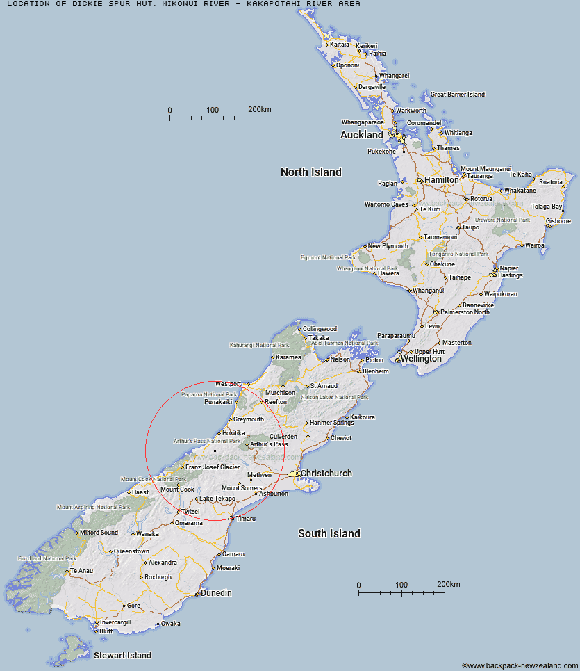
Topo Map showing location of Dickie Spur Hut
This information is sourced from DoC, LINZ and Openstreetmap. Some of the hut photos are mine and the rest are from DoC. I will be adding an upload feature soon so people can photos of .Dickie Spur Hut.
Basic info: basic four-bunk hut in the Hokitika area.
Latitude: -43.0589071278
Longitude: 170.869601065
Location: Mikonui River - Kakapotahi River area
Area: West Coast
Type of Hut: Basic/bivvies
Tracks: Mikonui Catchment - Dickie Ridge/Upper Tuke River Route
Map: BV18 Topo Map | Road Map
Does this hut still exist? Have any more information? Contact
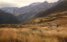
Image: DoC
Scroll down to see a topographical map and road map showing the location of Dickie Spur Hut
[ A ] [ B ] [ C ] [ D ] [ E ] [ F ] [ G ] [ H ] [ I ] [ J ] [ K ] [ L ] [ M ] [ N ] [ O ] [ P ] [ Q ] [ R ] [ S ] [ T ] [ U ] [ V ] [ W ] [ Y ] [ Z ]
Closest 20 Huts to Dickie Spur Hut
These are as the crow fliesHealey Creek Hut 3.51km Top Tuke Hut 3.78km Polluck Creek Hut 3.92km Mikonui Flat Hut 3.97km Mikonui Spur Bivouac 6.37km Top Waitaha Hut 8.08km Explorer Hut 8.12km Ivory Lake Hut 9.21km Black Hut 9.47km Moonbeam Hut 10.35km Price Basin Hut 11.07km County Stream Hut 11.15km Price Flat Hut 12.36km Price Flat Hut 12.55km Rapid Creek Hut 12.65km Kiwi Flat Hut 13.13km Frew Hut 14.16km Wilkinson Hut 14.62km Scamper Torrent Hut 15.04km Neave Hut 16.34km Smyth Hut 16.77km Serpentine Hut 17.78km Frew Saddle Bivouac 18.15km Frisco Hut 19.84km Gerhardt Spur Bivouac 20.76km Hunters Hut 20.95km Bluff Hut 20.95km West Mathias Bivouac 21.5km Mullins Hut 21.76km Poet Hut 23.12km Sir Robert Hut 23.21km Top Toaroha Hut 23.65km Canyon Creek Bivouac 23.78km Crystal Bivouac 24.04km Yeats Ridge Hut 24.17km Toaroha Saddle Bivouac 24.3km Lauper Bivouac 24.57km Cedar Flat Hut 24.74km Centennial Cabin 24.79km Mathias Hut 25.59km