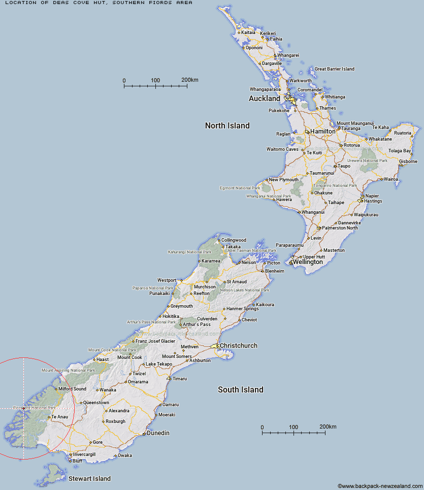
Topo Map showing location of Deas Cove Hut
This information is sourced from DoC, LINZ and Openstreetmap. Some of the hut photos are mine and the rest are from DoC. I will be adding an upload feature soon so people can photos of .Deas Cove Hut.
Basic info: standard ten-bunk hut in western Fiordland.
Latitude: -45.193091015
Longitude: 166.9747001
Location: Southern fiords area
Area: Fiordland
Type of Hut: Standard
Map: CC05 Topo Map | Road Map
Does this hut still exist? Have any more information? Contact
Basic info: standard ten-bunk hut in western Fiordland.
Latitude: -45.193091015
Longitude: 166.9747001
Location: Southern fiords area
Area: Fiordland
Type of Hut: Standard
Map: CC05 Topo Map | Road Map
Does this hut still exist? Have any more information? Contact
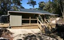
Image: DoC
Scroll down to see a topographical map and road map showing the location of Deas Cove Hut
[ A ] [ B ] [ C ] [ D ] [ E ] [ F ] [ G ] [ H ] [ I ] [ J ] [ K ] [ L ] [ M ] [ N ] [ O ] [ P ] [ Q ] [ R ] [ S ] [ T ] [ U ] [ V ] [ W ] [ Y ] [ Z ]
Closest 20 Huts to Deas Cove Hut
These are as the crow fliesRocky Point Hut 5.22km Stantley Burn Hut 7.7km The Gut Hut 11.49km Robin Saddle Hut 29.59km Caswell Sound Hut 30.78km Junction Burn Hut 41.29km Freeman Burn Hut 42.03km West Arm Hut 43.3km George Sound Hut 43.31km Upper Spey Hut 45.5km Iris Burn Hut 47.69km Lake Thomson Hut 47.9km Kintail Hut 48.15km Hanging Valley Shelter 48.73km Lake Hankinson Hut 49.14km Forest Burn Shelter 51.56km Percy Shelter 51.79km Luxmore Hut 54.76km Loch Maree Hut 55.14km Supper Cove Hut 56.66km Lake Roe Hut 58.27km Moturau Hut 59.17km Brod Bay Shelter and Campsite 59.58km Shallow Bay Hut 60km Glaisnock Hut 60.68km Hope Arm Hut 62.49km Halfway Hut 64.37km Back Valley Hut 65.55km North Borland Hut 67.78km Borland Bivouac 68.22km Historic Clark Hut 71.02km Hauroko Burn Hut 72.13km Clark Hut - A Frame 72.2km Worsley Hut 72.97km Green Lake Hut 73.75km Quintin Lodge 75.79km Pompolona Lodge 76.03km Bus Stop Shelter 76.06km Prairie Shelter 76.39km Mintaro Hut 76.43km