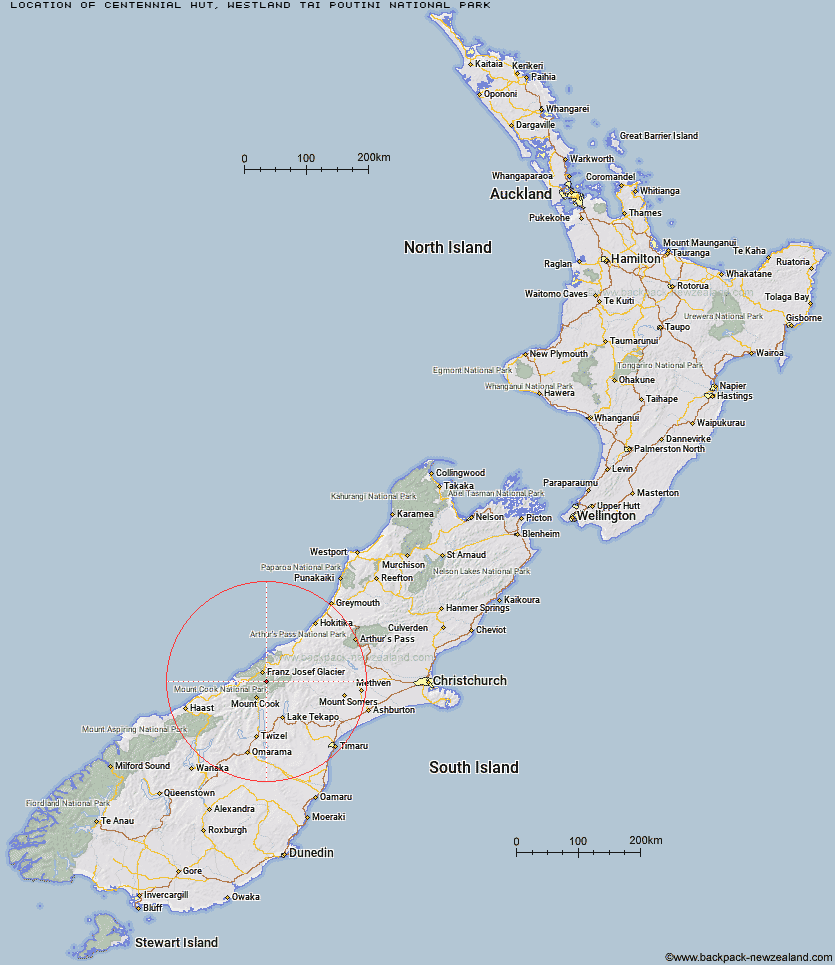
Topo Map showing location of Centennial Hut
This information is sourced from DoC, LINZ and Openstreetmap. Some of the hut photos are mine and the rest are from DoC. I will be adding an upload feature soon so people can photos of .Centennial Hut.
Basic info: This is an alpine serviced 20-bunk hut in the Glaciers area.
Latitude: -43.5081304506
Longitude: 170.233938866
Location: Westland Tai Poutini National Park
Area: West Coast
Type of Hut: Serviced Alpine
Map: BX16 Topo Map | Road Map
Does this hut still exist? Have any more information? Contact
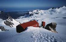
Image: DoC
Scroll down to see a topographical map and road map showing the location of Centennial Hut
[ A ] [ B ] [ C ] [ D ] [ E ] [ F ] [ G ] [ H ] [ I ] [ J ] [ K ] [ L ] [ M ] [ N ] [ O ] [ P ] [ Q ] [ R ] [ S ] [ T ] [ U ] [ V ] [ W ] [ Y ] [ Z ]
Closest 20 Huts to Centennial Hut
These are as the crow fliesCentennial Hut 0km Almer Hut 4.27km Pioneer Hut 4.85km Castle Rocks Hut 8.17km Spencer Rock Bivouac 8.45km Tasman Saddle Hut 8.73km Haast Hut 8.83km Plateau Hut 9.31km Hende's Hut 9.51km Chancellor Hut 10.12km Kelman Hut 10.32km Onslow Hut (Steffan Memorial Hut) 12.71km Murchison Hut 12.99km Empress Hut 13.2km Whymper Hut 13.32km Ball Hut 13.42km Liebig Hut 14.77km Caroline Hut 15.07km Butler Junction Hut 18.35km Top Butler Hut 19.31km Copland Shelter 19.64km Eade Memorial Hut 20.03km Stan's Hut 21.77km Red Stag Hut 21.94km Rankin Hut 22.12km Memorial Hut 22.41km Godley Hut 22.52km Birdcage Hut 23km Douglas Rock Hut 23.67km Sefton Bivvy 23.7km Stocking Stream Shelter 23.86km Angus Hut 25.32km Littles Hut 26.14km Nolans Hut 26.77km Welcome Flat Campsite 26.85km Welcome Flat Hut 26.87km Mueller Hut 27.28km Tin Hut 28.84km Harpers Rock Bivouac 30.12km Architect Creek Hut 30.26km