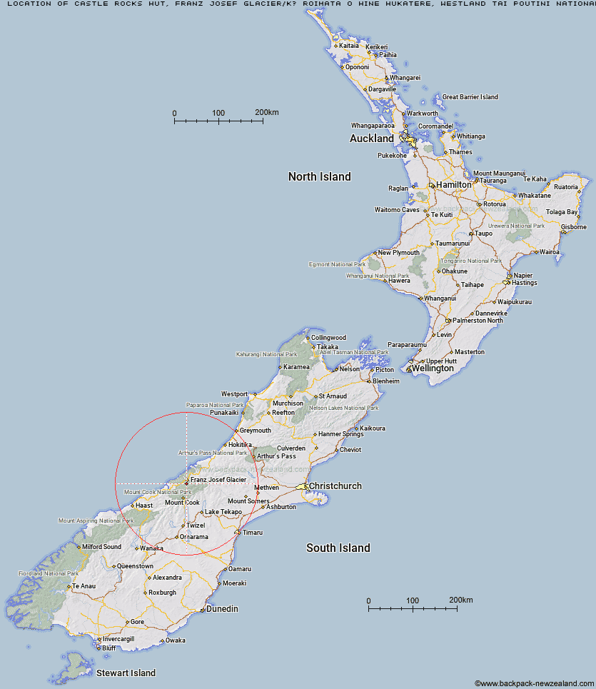
Topo Map showing location of Castle Rocks Hut
This information is sourced from DoC, LINZ and Openstreetmap. Some of the hut photos are mine and the rest are from DoC. I will be adding an upload feature soon so people can photos of .Castle Rocks Hut.
Basic info: standard four-bunk hut in the Glaciers area.
Latitude: -43.4530689174
Longitude: 170.166968629
Location: Franz Josef Glacier/Kā Roimata o Hine Hukatere, Westland Tai Poutini National Park
Area: West Coast
Type of Hut: Standard
Map: BX15 Topo Map | Road Map
Does this hut still exist? Have any more information? Contact
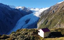
Image: DoC
Scroll down to see a topographical map and road map showing the location of Castle Rocks Hut
[ A ] [ B ] [ C ] [ D ] [ E ] [ F ] [ G ] [ H ] [ I ] [ J ] [ K ] [ L ] [ M ] [ N ] [ O ] [ P ] [ Q ] [ R ] [ S ] [ T ] [ U ] [ V ] [ W ] [ Y ] [ Z ]
Closest 20 Huts to Castle Rocks Hut
These are as the crow fliesCastle Rocks Hut 0km Hende's Hut 2.4km Almer Hut 4.11km Chancellor Hut 7.92km Centennial Hut 8.17km Spencer Rock Bivouac 8.5km Pioneer Hut 8.81km Plateau Hut 14.58km Haast Hut 14.62km Tasman Saddle Hut 15.65km Empress Hut 16.16km Whymper Hut 16.56km Kelman Hut 17.3km Ball Hut 19.19km Murchison Hut 19.74km Caroline Hut 20.32km Butler Junction Hut 20.6km Onslow Hut (Steffan Memorial Hut) 20.73km Stan's Hut 21.92km Top Butler Hut 22.37km Liebig Hut 22.71km Copland Shelter 23.13km Douglas Rock Hut 25.25km Eade Memorial Hut 26.46km Welcome Flat Campsite 26.54km Welcome Flat Hut 26.56km Sefton Bivvy 27.12km Stocking Stream Shelter 27.86km Godley Hut 27.88km Nolans Hut 27.99km Architect Creek Hut 28.65km Red Stag Hut 28.74km Rankin Hut 29.92km Memorial Hut 30.51km Mueller Hut 30.89km Birdcage Hut 31.1km Harpers Rock Bivouac 31.97km Horace Walker Hut 32.79km Littles Hut 33.13km Angus Hut 33.42km