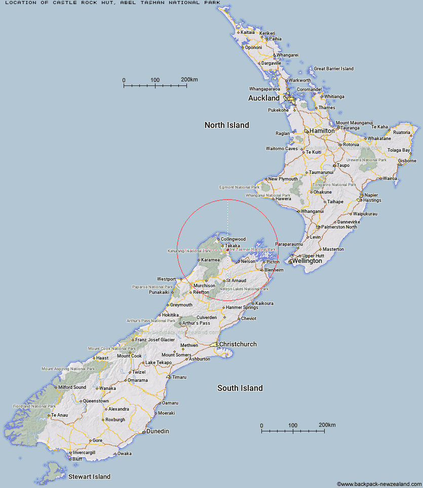
Topo Map showing location of Castle Rock Hut
This information is sourced from DoC, LINZ and Openstreetmap. Some of the hut photos are mine and the rest are from DoC. I will be adding an upload feature soon so people can photos of .Castle Rock Hut.
Basic info: standard 8-bunk hut in the Motueka area.
Latitude: -40.9616692735
Longitude: 172.953804884
Location: Abel Tasman National Park
Area: Nelson/Tasman
Type of Hut: Standard
Tracks: Inland Track
Map: BP25 Topo Map | Road Map
Does this hut still exist? Have any more information? Contact
Basic info: standard 8-bunk hut in the Motueka area.
Latitude: -40.9616692735
Longitude: 172.953804884
Location: Abel Tasman National Park
Area: Nelson/Tasman
Type of Hut: Standard
Tracks: Inland Track
Map: BP25 Topo Map | Road Map
Does this hut still exist? Have any more information? Contact
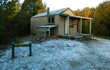
Image: DoC
Scroll down to see a topographical map and road map showing the location of Castle Rock Hut
[ A ] [ B ] [ C ] [ D ] [ E ] [ F ] [ G ] [ H ] [ I ] [ J ] [ K ] [ L ] [ M ] [ N ] [ O ] [ P ] [ Q ] [ R ] [ S ] [ T ] [ U ] [ V ] [ W ] [ Y ] [ Z ]
Closest 20 Huts to Castle Rock Hut
These are as the crow fliesMoa Park Shelter 3km Holyoake Clearing Shelter 4.03km Wainui Hut 5.97km Anchorage Hut 8.74km Bark Bay Hut 9.44km Awapoto Hut 11.06km Awaroa Hut 11.98km Tin Hut Shelter 17.34km Whariwharangi Hut 19.28km Riordans Hut 20.01km Waingaro Forks Hut 25.25km Asbestos Cottage 28.83km Anatoki Forks Hut 29.12km Soper Shelter 30.37km Sylvester Hut 30.52km Flora Hut 30.91km Upper Gridiron Hut and Rock Shelters 31.7km Boulder Lake Hut 32.24km Growler Rock Shelter 32.68km Mt Arthur Hut 32.98km Lonely Lake Hut 33.31km Myttons Hut 33.92km Dry Rock Shelter 34.39km Trilobite Hut 34.45km Adelaide Tarn Hut 34.53km Chaffey Hut 35.38km Balloon Hut 36.11km Tent Camp 36.9km Fenella Hut 37.27km Cobb Hut 37.47km Ellis Hut 38.04km Splugeons Rock Shelter 39.64km Brown Hut 44.33km Flanagans Hut 45.96km Perry Saddle Hut 46.77km Karamea Bend Hut 47.83km Roaring Lion Hut 50.9km Third House Shelter 50.98km Gouland Downs Hut 51.07km Crow Hut 54.88km