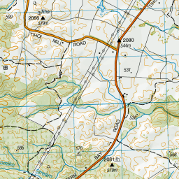
Topo Map showing location of Bog Inn Hut
This information is sourced from DoC, LINZ and Openstreetmap. Some of the hut photos are mine and the rest are from DoC. I will be adding an upload feature soon so people can photos of .Bog Inn Hut.
Basic info: standard four-bunk hut in the Waitomo/Pureora area. This small historic hut provides trampers and hunters with a rustic overnight stay in the Pureora Forest Park.
Latitude: -38.5831653578
Longitude: 175.628806549
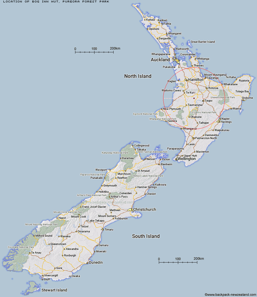
Location: Pureora Forest Park
Area: Waikato
Type of Hut: Standard
Tracks: Pureora Forest Park tramping tracks
Map: BG35 Topo Map | Road Map
Does this hut still exist? Have any more information? Contact
Basic info: standard four-bunk hut in the Waitomo/Pureora area. This small historic hut provides trampers and hunters with a rustic overnight stay in the Pureora Forest Park.
Latitude: -38.5831653578
Longitude: 175.628806549
Location: Pureora Forest Park
Area: Waikato
Type of Hut: Standard
Tracks: Pureora Forest Park tramping tracks
Map: BG35 Topo Map | Road Map
Does this hut still exist? Have any more information? Contact
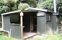
Image: DoC
Scroll down to see a topographical map and road map showing the location of Bog Inn Hut
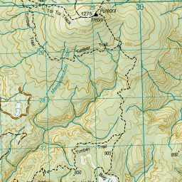
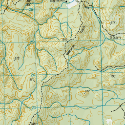
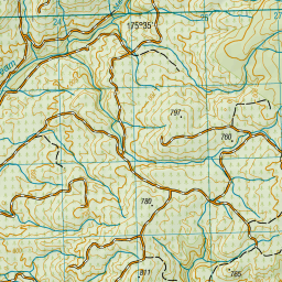
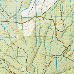
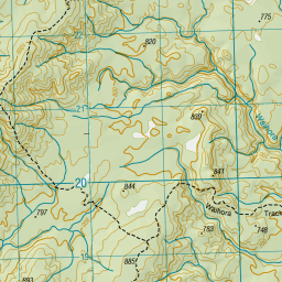
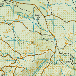
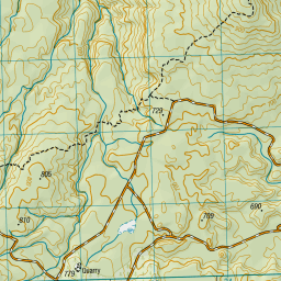
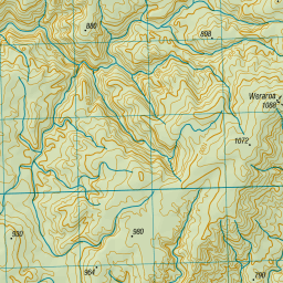
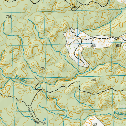
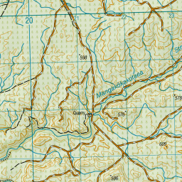
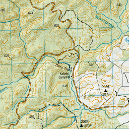
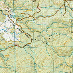
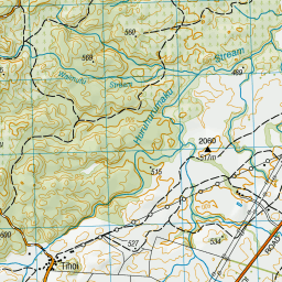
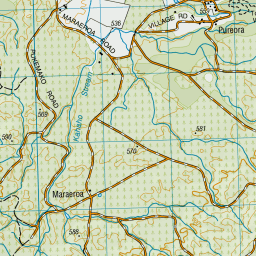
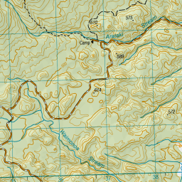
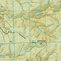

Leaflet | Sourced from LINZ. CC BY 4.0


Leaflet | Map data © OpenStreetMap contributors
[ A ] [ B ] [ C ] [ D ] [ E ] [ F ] [ G ] [ H ] [ I ] [ J ] [ K ] [ L ] [ M ] [ N ] [ O ] [ P ] [ Q ] [ R ] [ S ] [ T ] [ U ] [ V ] [ W ] [ Y ] [ Z ]
Closest 20 Huts to Bog Inn Hut
These are as the crow fliesBog Inn Hut 0km Waihaha Hut 12.68km Hauhungaroa Hut 20.84km Wildlife Hut 27.67km Ten Man Hut 50.7km Ketetahi Shelter 58.4km Hamilton Tomo Group Hut 58.97km Mangatepopo Hut 62.5km Oturere Hut 64.21km Waipakihi Hut 66.56km Cascade Hut 67.36km Old Waihohonu Hut 69.73km Waihohonu Hut 69.78km Ohuraiti Hut 73.39km Whakapapaiti Hut 73.41km WTFRW Hut 74.44km Leitchs Hut 75.97km Oamaru Hut 77.66km Whangaehu Hut 77.84km Poronui Hut 78.27km Wairua Hut 79.06km Rangipo Hut 79.72km Red Hut 79.88km Mangaturuturu Hut 80.12km East Creek Hut 80.39km Pahautea Hut 80.59km Tussock Hut 82.29km Te Apunga Hut 82.31km Blyth Hut 83.73km Lupton Hut 83.86km Golden Hills Hut 84.25km Mangaehuehu Hut 84.78km Mangatainoka Hut 84.91km Harkness Hut 86.17km Rerekapa Hut 87.86km Te Puke (Te Pukeohikarua) Hut 88.03km Tevers Hut 88.92km Hurunui Hut 89.07km Ernie's Creek Hut 89.15km Halfway Hut 89.45km