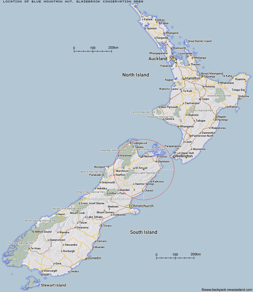
Topo Map showing location of Blue Mountain Hut
This information is sourced from DoC, LINZ and Openstreetmap. Some of the hut photos are mine and the rest are from DoC. I will be adding an upload feature soon so people can photos of .Blue Mountain Hut.
Basic info: standard 4-bunk hut in the South Marlborough area.
Latitude: -41.8627128678
Longitude: 173.324024231
Location: Glazebrook Conservation Area
Area: Marlborough
Type of Hut: Standard
Map: BR27 Topo Map | Road Map
Does this hut still exist? Have any more information? Contact
Basic info: standard 4-bunk hut in the South Marlborough area.
Latitude: -41.8627128678
Longitude: 173.324024231
Location: Glazebrook Conservation Area
Area: Marlborough
Type of Hut: Standard
Map: BR27 Topo Map | Road Map
Does this hut still exist? Have any more information? Contact
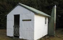
Image: DoC
Scroll down to see a topographical map and road map showing the location of Blue Mountain Hut
[ A ] [ B ] [ C ] [ D ] [ E ] [ F ] [ G ] [ H ] [ I ] [ J ] [ K ] [ L ] [ M ] [ N ] [ O ] [ P ] [ Q ] [ R ] [ S ] [ T ] [ U ] [ V ] [ W ] [ Y ] [ Z ]
Closest 20 Huts to Blue Mountain Hut
These are as the crow fliesTop Whare 8.91km Boulder Forks Hut 9.93km Gosling Hut 10.57km Burnt Yards Hut 11.48km Caves Hut 12.74km Barbers Hut 12.84km Turkeys Nest Bivouac 12.85km Top Gordon Hut 13.13km Hidden Hut 13.87km Bottom Gordons Hut 16.88km Munroe Hut 18.33km Greigs Hut 18.35km Old Middlehurst Hut 20.18km Siberia Hut 20.7km Junction Hut 21.46km Team Hut 21.78km Mid Silverstream Hut 23.25km Bottom Misery Hut 23.35km Top Leatham Hut 23.49km Silverstream Bivouac 24.58km Lost Stream Bivouac 24.79km Carters Yards Hut 25.28km Saxton Hut 25.71km Branch Bivouac 26.26km Bull Paddock Creek Hut 27.37km Top Misery Hut 27.41km Lees Creek Hut 30.26km Lower Goulter Hut 30.4km Lake Alexander Hut 30.71km Penk Hut 30.97km Red Hills Hut 31.2km Cam Hut 31.53km Mid Goulter Hut 32.23km Severn Hut 32.47km Lake Chalice Hut 32.79km Acheron Hut 33.19km Top Wairoa Hut 34.79km Porters Creek Hut 35.71km Lake McRae Hut 36.13km Ravine Hut 36.23km