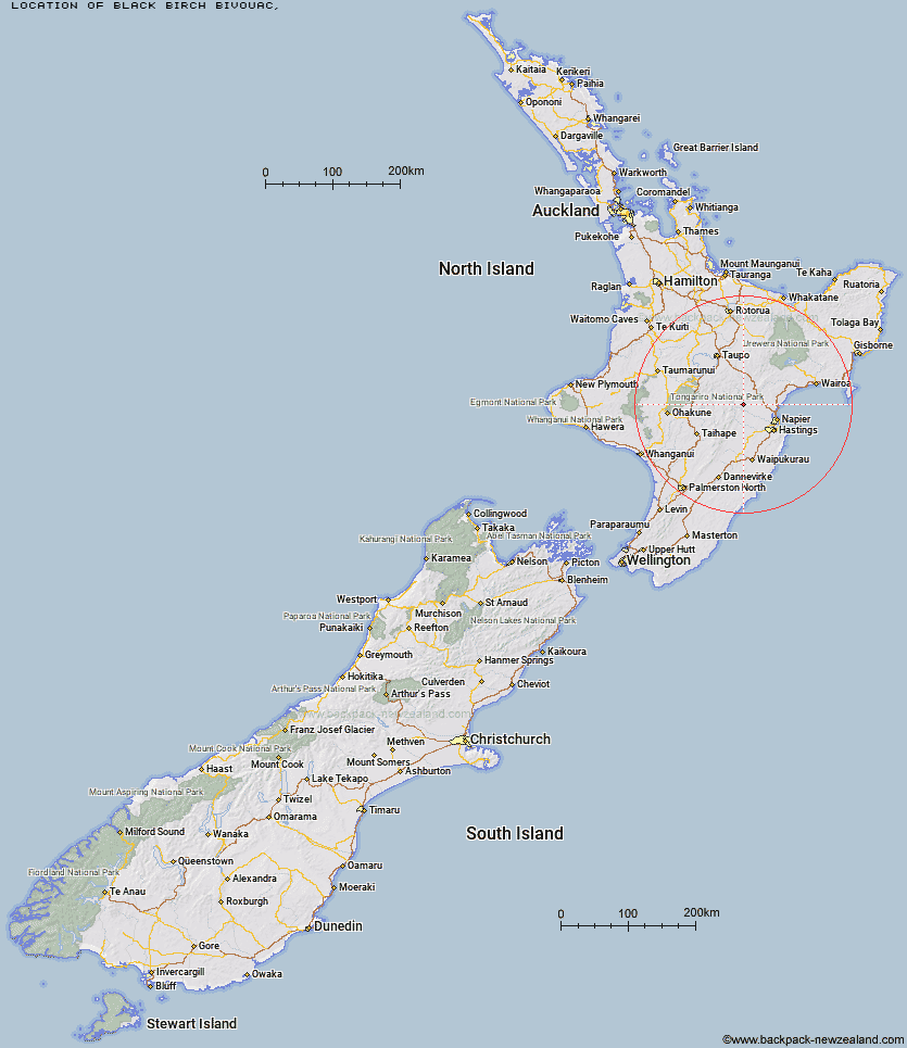
Topo Map showing location of Black Birch Bivouac
This information is sourced from DoC, LINZ and Openstreetmap. Some of the hut photos are mine and the rest are from DoC. I will be adding an upload feature soon so people can photos of .Black Birch Bivouac.
Latitude: -39.3018036546
Longitude: 176.438282404
Location:
Type of Hut:
Map: Topo Map | Road Map
Does this hut still exist? Have any more information? Contact
Latitude: -39.3018036546
Longitude: 176.438282404
Location:
Type of Hut:
Map: Topo Map | Road Map
Does this hut still exist? Have any more information? Contact
Scroll down to see a topographical map and road map showing the location of Black Birch Bivouac
[ A ] [ B ] [ C ] [ D ] [ E ] [ F ] [ G ] [ H ] [ I ] [ J ] [ K ] [ L ] [ M ] [ N ] [ O ] [ P ] [ Q ] [ R ] [ S ] [ T ] [ U ] [ V ] [ W ] [ Y ] [ Z ]
Closest 20 Huts to Black Birch Bivouac
These are as the crow fliesMakahu Saddle Hut 3.11km Dominie Hut 4.49km Mackintosh Hut 4.52km Kaweka Flats Bivouac 4.79km Iron Whare 5.11km Studholme Saddle Hut 6.36km Studholme Saddle Bivouac 6.43km Back Ridge Hut 7.57km Middle Hill Hut 8.35km Ballard Hut 9.23km Back Ridge Bivouac 9.31km Kiwi Saddle Hut 10.67km Venison Tops Hut (Tira Lodge) 11.73km Lowry Shelter 12.08km Rocks Ahead Hut 12.53km Rocks Ahead Bivouac 12.65km Makino Hut 12.75km Manson Bivouac 12.89km Mangaturutu Hut 13.1km Omarukokere Bivouac 13.86km Kiwi Mouth Hut 13.91km Cameron Hut 14.23km Old Manson Hut 15.1km Manson Hut 15.36km Ngaawapurua Hut 17.94km Otutu Hut 17.94km Rock Camp Bivouac 18.04km Te Puke (Te Pukeohikarua) Hut 18.41km Lower Ripia Hut 19.28km Otutu Island Hut 19.64km Te Matai Hut 20.51km Harkness Hut 20.83km Upper Ripia Hut 21.16km Mangatainoka Hut 21.46km Tevers Hut 21.79km Ernie's Creek Hut 22.28km Comet Hut 22.5km Tussock Hut 24.46km Upper Toropapa Hut 25.37km Golden Hills Hut 25.91km