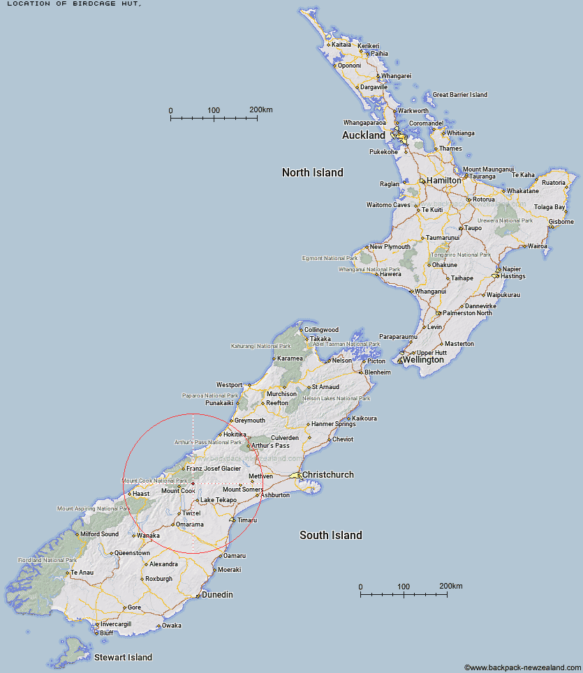
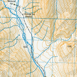
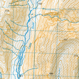
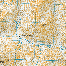
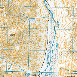
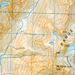
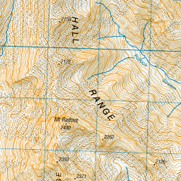
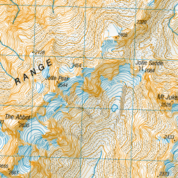
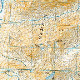
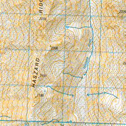
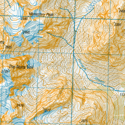
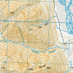
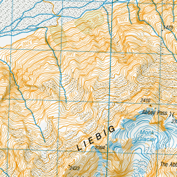
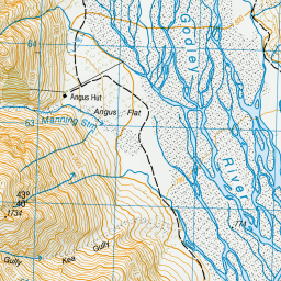
Topo Map showing location of Birdcage Hut
This information is sourced from DoC, LINZ and Openstreetmap. Some of the hut photos are mine and the rest are from DoC. I will be adding an upload feature soon so people can photos of .Birdcage Hut.
Latitude: -43.6816827927
Longitude: 170.389337493
Location:
Type of Hut:
Map: Topo Map | Road Map
Does this hut still exist? Have any more information? Contact
Latitude: -43.6816827927
Longitude: 170.389337493
Location:
Type of Hut:
Map: Topo Map | Road Map
Does this hut still exist? Have any more information? Contact
Scroll down to see a topographical map and road map showing the location of Birdcage Hut

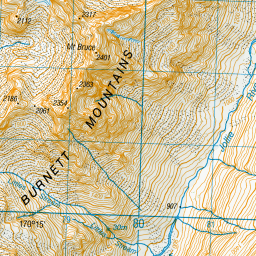

Leaflet | Sourced from LINZ. CC BY 4.0


Leaflet | Map data © OpenStreetMap contributors
[ A ] [ B ] [ C ] [ D ] [ E ] [ F ] [ G ] [ H ] [ I ] [ J ] [ K ] [ L ] [ M ] [ N ] [ O ] [ P ] [ Q ] [ R ] [ S ] [ T ] [ U ] [ V ] [ W ] [ Y ] [ Z ]
Closest 20 Huts to Birdcage Hut
These are as the crow fliesMemorial Hut 0.6km Tin Hut 6.38km Angus Hut 7.5km Liebig Hut 8.64km Ryders Hut 9.36km Ribbonwood Hut 9.98km Onslow Hut (Steffan Memorial Hut) 10.42km Middle Gorge Hut 10.96km Rankin Hut 11.23km Littles Hut 11.86km Waterfall Hut 12.65km Green Point Hut 17.03km Ball Hut 17.18km Murchison Hut 18.15km Red Stag Hut 18.18km Kelman Hut 18.21km Stony Stream Hut 18.22km Caroline Hut 18.3km Haast Hut 19.01km Tasman Saddle Hut 19.05km Eade Memorial Hut 19.53km Plateau Hut 19.8km Macaulay Hut 20.58km Rex Simpson Hut 21.73km Centennial Hut 23km Pioneer Hut 23.55km Stocking Stream Shelter 23.56km Copland Shelter 23.57km Empress Hut 23.61km Camp Stream Hut 24.31km Godley Hut 24.42km Jollie Hut 24.43km Sefton Bivvy 25.22km Mueller Hut 26.42km Whymper Hut 26.69km Almer Hut 27.26km Royal Hut 28.16km Spencer Rock Bivouac 28.89km Top Butler Hut 29.34km Chancellor Hut 29.57km