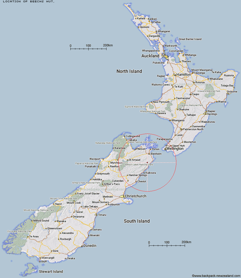
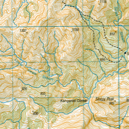
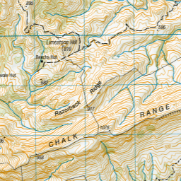
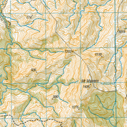
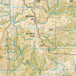
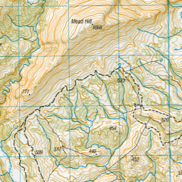
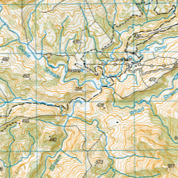
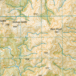
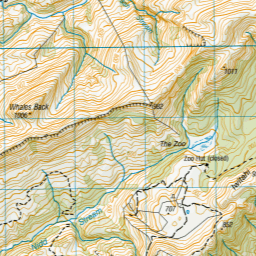
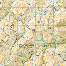
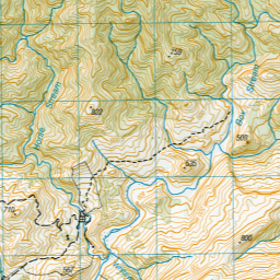
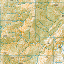
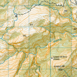
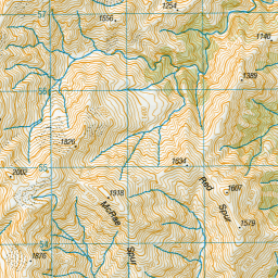
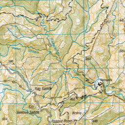
Topo Map showing location of Beechs Hut
This information is sourced from DoC, LINZ and Openstreetmap. Some of the hut photos are mine and the rest are from DoC. I will be adding an upload feature soon so people can photos of .Beechs Hut.
Latitude: -41.9134617851
Longitude: 173.857967008
Location:
Type of Hut:
Map: Topo Map | Road Map
Does this hut still exist? Have any more information? Contact
Latitude: -41.9134617851
Longitude: 173.857967008
Location:
Type of Hut:
Map: Topo Map | Road Map
Does this hut still exist? Have any more information? Contact
Scroll down to see a topographical map and road map showing the location of Beechs Hut
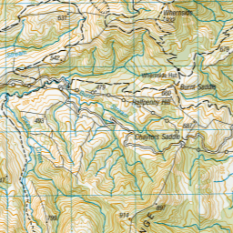
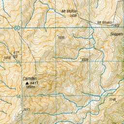
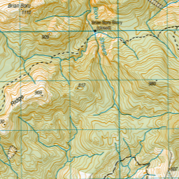
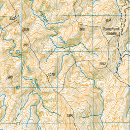

Leaflet | Sourced from LINZ. CC BY 4.0


Leaflet | Map data © OpenStreetMap contributors
[ A ] [ B ] [ C ] [ D ] [ E ] [ F ] [ G ] [ H ] [ I ] [ J ] [ K ] [ L ] [ M ] [ N ] [ O ] [ P ] [ Q ] [ R ] [ S ] [ T ] [ U ] [ V ] [ W ] [ Y ] [ Z ]
Closest 20 Huts to Beechs Hut
These are as the crow fliesSwale Hut 0.98km Zoo Hut 5.84km Whernside Hut 6.56km Flynns 6.71km Mead Hut 7.75km Cabbage Tree Hut 8.87km Isolation Hut 10.63km Gibson Hut 11.11km Cam Hut 13.09km Dee Hut 13.12km Snowgrass Hut 18.25km Hornby Bivvy 19.4km Penk Hut 20.15km Black Birch Bivouac 21.97km Jam Hut 23.43km Omaka Bivouac 24.1km Lake Alexander Hut 24.43km Ravine Hut 25.29km Dillon Hut 25.32km Haycocks Bivouac 26.59km Beehive Hut 27.43km Old Middlehurst Hut 28.34km McNaughts Hut 28.81km Ramshead Hut 29.75km Tinpot Hut 30.34km Fidgit Bivouac 34.81km Top Whare 36.38km Goose Flat Hut 36.63km Barratts Bivouac 39.79km Barratts Hut 39.89km Dubious Bivouac 41.63km Hapuku Hut 43.41km Blue Mountain Hut 44.56km Gosling Hut 45.64km Limestone Hut 46.49km Burnt Yards Hut 46.5km Kowhai Hut 47.98km Turkeys Nest Bivouac 48.11km Hidden Hut 50.43km Mt Fyffe Hut 50.6km