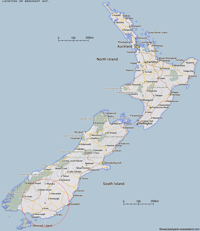
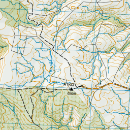
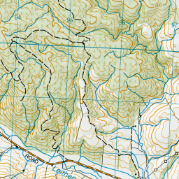
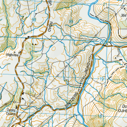
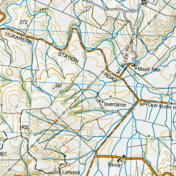
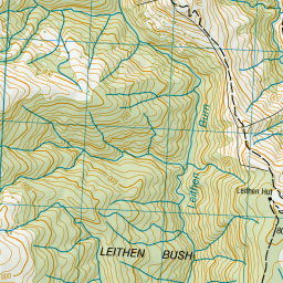
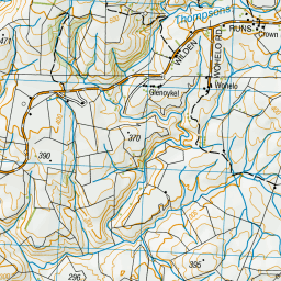
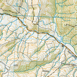
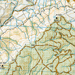
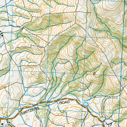
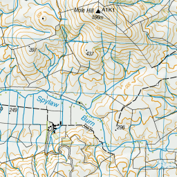
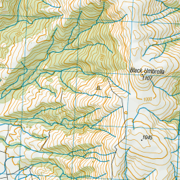
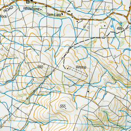
Topo Map showing location of Beaumont Hut
This information is sourced from DoC, LINZ and Openstreetmap. Some of the hut photos are mine and the rest are from DoC. I will be adding an upload feature soon so people can photos of .Beaumont Hut.
Latitude: -45.7873148704
Longitude: 169.09185932
Location:
Type of Hut:
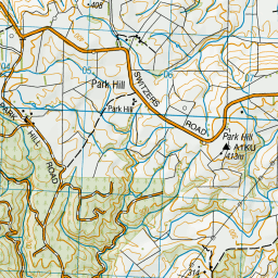
Map: Topo Map | Road Map
Does this hut still exist? Have any more information? Contact
Latitude: -45.7873148704
Longitude: 169.09185932
Location:
Type of Hut:
Map: Topo Map | Road Map
Does this hut still exist? Have any more information? Contact
Scroll down to see a topographical map and road map showing the location of Beaumont Hut
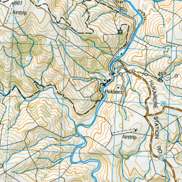

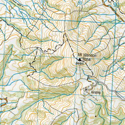

Leaflet | Sourced from LINZ. CC BY 4.0


Leaflet | Map data © OpenStreetMap contributors
[ A ] [ B ] [ C ] [ D ] [ E ] [ F ] [ G ] [ H ] [ I ] [ J ] [ K ] [ L ] [ M ] [ N ] [ O ] [ P ] [ Q ] [ R ] [ S ] [ T ] [ U ] [ V ] [ W ] [ Y ] [ Z ]
Closest 20 Huts to Beaumont Hut
These are as the crow fliesBeaumont Hut 0km Leithen Hut 4.24km Stronach Hut 17.45km Black Hut 20km Hyde Home Hut 27.65km Titan Huts 28.5km Sullivan Hut 28.65km Flaxy Hut 28.88km Junction Hut 29.47km Jim Baird Hut 30.73km Junction Hut 31.59km Christies Hut 32.59km Bush Huts 33.62km Dome Hut 34.61km Blue Lake Huts 36.22km Potters Huts 40.28km Andrew Rees Hut 40.38km Mud Hut 43.46km McCrimmons Hut 43.85km Slate Hut 44.12km Diggers Hut 44.94km Garston Ski Hut 45.7km Nicholsons Hut 48.85km Boundary Hut 51.03km Iron Hut 53.73km Baileys Hut 55.71km Whites Hut 58.26km Mansion Hut 60.96km Tent Hut 61.92km Canadian Hut 62.07km The Swamp Hut 62.73km Mt Bee Bunkrooms 63.05km Mitchells Hut 63.43km Cromel Base Hut 63.68km Old Woman Hut 64.43km Shepherd Creek Hut 66.71km Cromel Branch Hut 66.76km Cowshed Hut 66.82km Ross Hut 67.11km Irthing Hut 67.91km