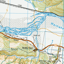
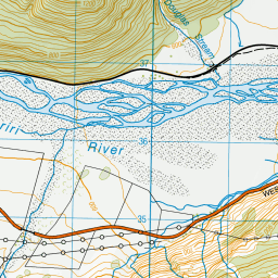
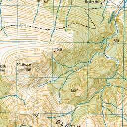
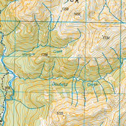
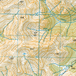
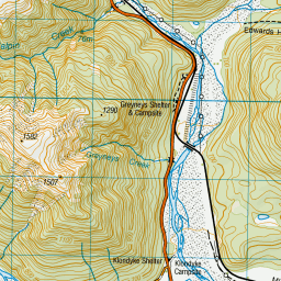
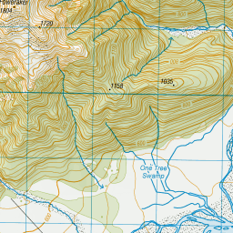
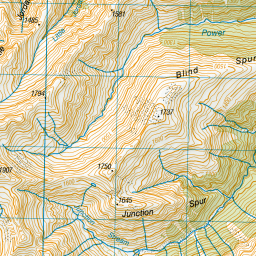
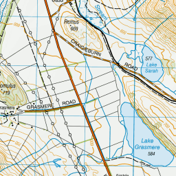
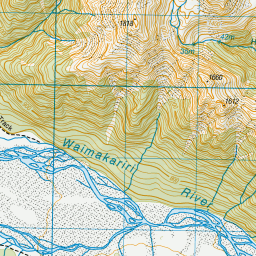
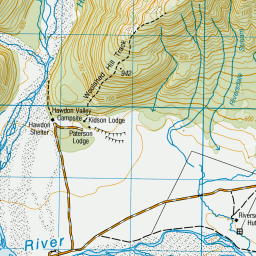
Topo Map showing location of Bealey Hut
This information is sourced from DoC, LINZ and Openstreetmap. Some of the hut photos are mine and the rest are from DoC. I will be adding an upload feature soon so people can photos of .Bealey Hut.
Basic info: basic six-bunk hut in the North Canterbury and Arthur's Pass area.
Latitude: -43.0377481614
Longitude: 171.641676559
Location: Craigieburn Forest Park
Area: Canterbury
Type of Hut: Basic/bivvies
Tracks: Cass-Lagoon Saddle Track
Map: BV20 Topo Map | Road Map
Does this hut still exist? Have any more information? Contact
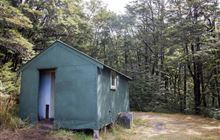
Image: DoC
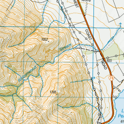
Scroll down to see a topographical map and road map showing the location of Bealey Hut
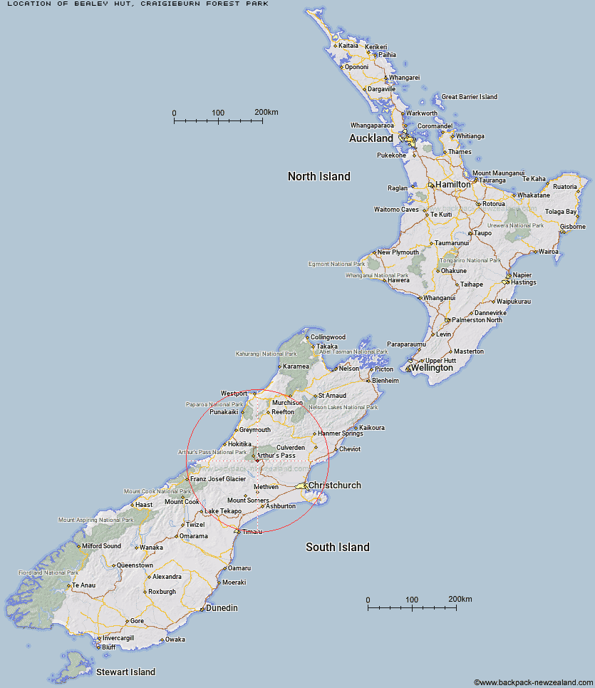
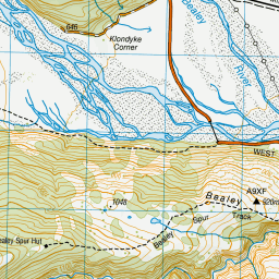
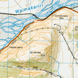
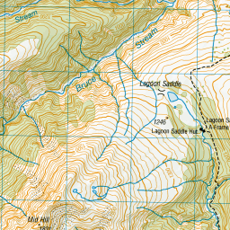
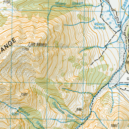
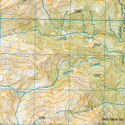
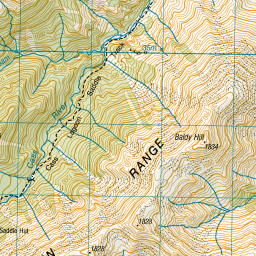
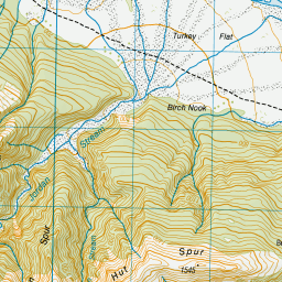
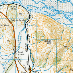
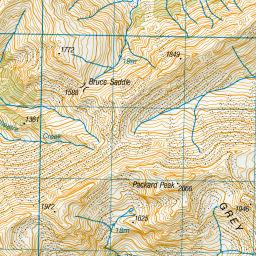

Leaflet | Sourced from LINZ. CC BY 4.0


Leaflet | Map data © OpenStreetMap contributors
[ A ] [ B ] [ C ] [ D ] [ E ] [ F ] [ G ] [ H ] [ I ] [ J ] [ K ] [ L ] [ M ] [ N ] [ O ] [ P ] [ Q ] [ R ] [ S ] [ T ] [ U ] [ V ] [ W ] [ Y ] [ Z ]
Closest 20 Huts to Bealey Hut
These are as the crow fliesLagoon Saddle A Frame Hut 3.78km Lagoon Saddle Hut 3.81km Klondyke Shelter 5.81km Bealey Spur Hut 5.86km Greyneys Shelter 7.27km West Harper Hut 7.45km Cass Saddle Hut 7.75km Hamilton Hut 10.23km Hawdon Shelter 10.24km Edwards Hut 10.68km Sudden Valley Bivouac 11.05km Anti Crow Hut 11.41km Riversdale Hut 11.93km Mingha Bivouac 12.82km Andrews Shelter 13.23km Crow Hut 14.58km Jacks Hut 14.77km Old Basins Hut 14.82km Basins Hut 15.02km Goat Pass Hut 15.21km Hawdon Hut 15.91km Upper Deception Hut 17.2km Avoca Hut 17.27km Back Basin Hide 17.79km Carrington Hut 17.95km Waimakariri Falls Hut 18.31km East Hawdon Bivouac 18.83km Barker Hut 20.57km Otehake Hut 20.81km Broken River Hut 23.13km Old Julia Hut 23.48km Turnbull Bivouac 23.52km Julia Hut 23.55km Worsley Bivouac 23.69km Fanghill Hut 24.18km Hunts Creek Hut 24.69km Weka Burnet Bivouac 24.73km Poulter Hut 25.02km Park Morpeth Hut 25.46km Rosa Hut 25.52km