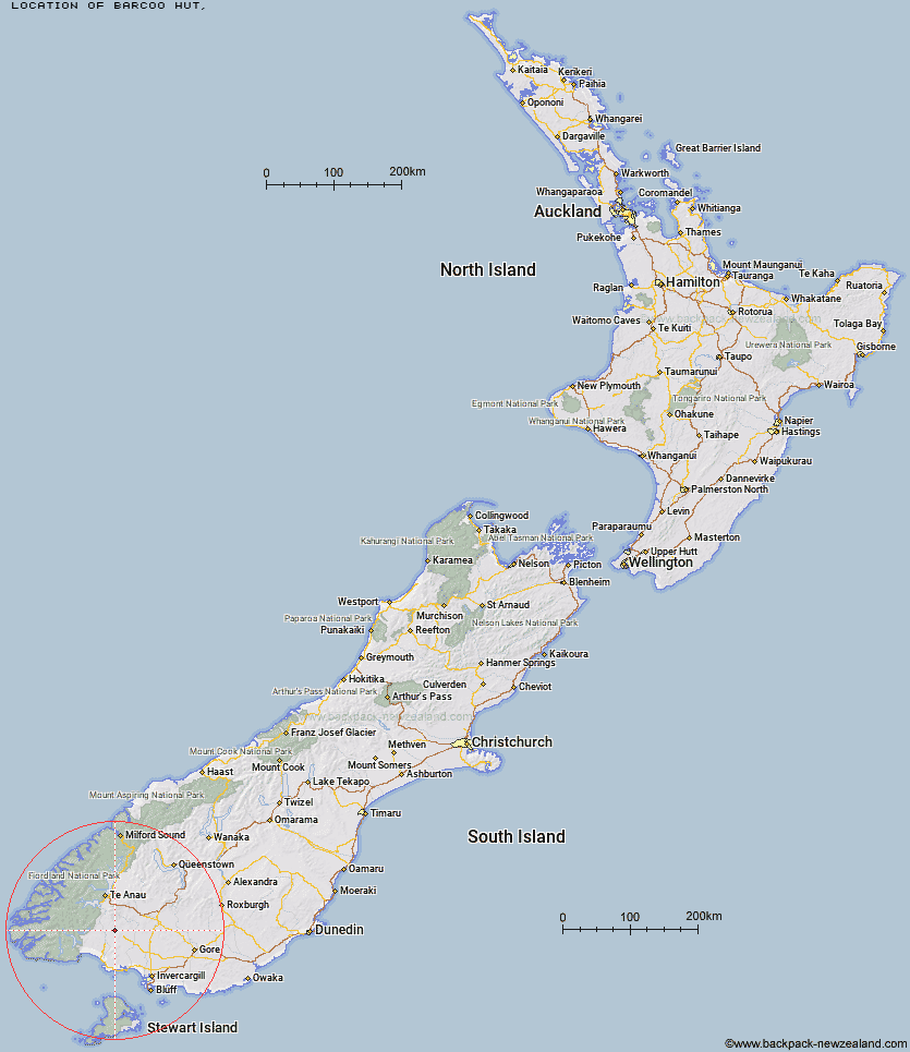
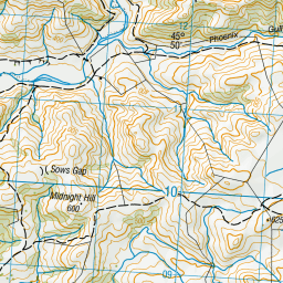
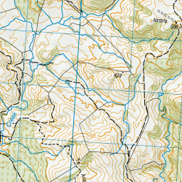
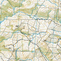
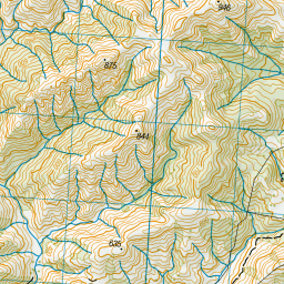
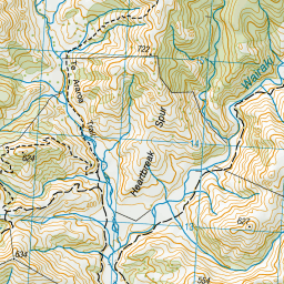
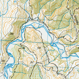
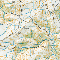
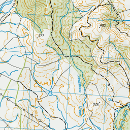
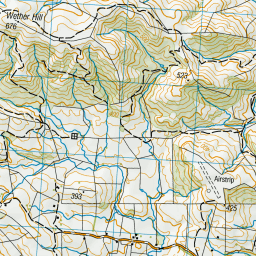
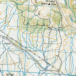
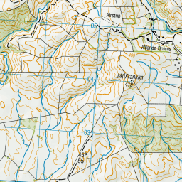
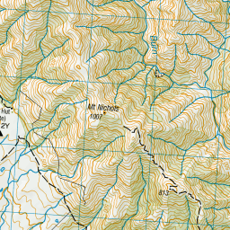
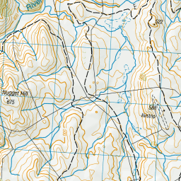
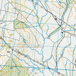
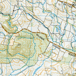
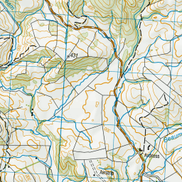
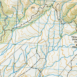
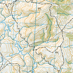
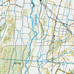
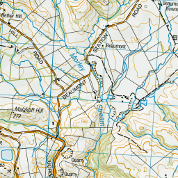
Topo Map showing location of Barcoo Hut
This information is sourced from DoC, LINZ and Openstreetmap. Some of the hut photos are mine and the rest are from DoC. I will be adding an upload feature soon so people can photos of .Barcoo Hut.
Latitude: -45.8585366463
Longitude: 167.857781225
Location:
Type of Hut:
Map: Topo Map | Road Map
Does this hut still exist? Have any more information? Contact
Latitude: -45.8585366463
Longitude: 167.857781225
Location:
Type of Hut:
Map: Topo Map | Road Map
Does this hut still exist? Have any more information? Contact
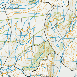
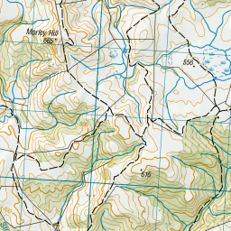
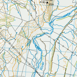
Scroll down to see a topographical map and road map showing the location of Barcoo Hut
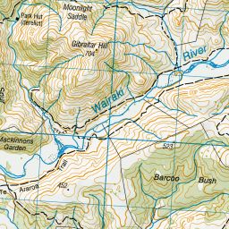

Leaflet | Sourced from LINZ. CC BY 4.0


Leaflet | Map data © OpenStreetMap contributors
[ A ] [ B ] [ C ] [ D ] [ E ] [ F ] [ G ] [ H ] [ I ] [ J ] [ K ] [ L ] [ M ] [ N ] [ O ] [ P ] [ Q ] [ R ] [ S ] [ T ] [ U ] [ V ] [ W ] [ Y ] [ Z ]
Closest 20 Huts to Barcoo Hut
These are as the crow fliesRock Hut 3.28km Lower Wairaki Hut 10.88km Telford Hut 11.85km Upper Wairaki Hut 13.96km Redcliff Hut 15.5km Spence Hut 17.09km Aparima Huts 20.09km Whare Creek Hut 21.32km Aparima Forks Hut 21.56km Becketts Hut 25.26km Cheviot Downs Hut 25.8km Upper Princhester Hut 26.63km Lower Princhester Hut 30.34km Rodger Inlet Huts 32.11km North Borland Hut 34.63km Back Valley Hut 35.82km Green Lake Hut 36.39km Eel Creek Hut 38.51km Hope Arm Hut 38.67km Monowai Hut 39.47km Borland Bivouac 39.95km Clark Hut - A Frame 41.45km Historic Clark Hut 42.58km Shallow Bay Hut 44.85km Martin's Hut 44.97km Caroline Hut 45.4km Moturau Hut 46.09km Oreti Hut 46.82km Lower Windley Hut 47.12km Turnbull's (Big Dam) Hut 48.16km Teal Bay Hut 49.28km Percy Shelter 51.15km Brod Bay Shelter and Campsite 52.44km Cromel Base Hut 52.49km Okaka Lodge 53.89km Mt Bee Bunkrooms 54.51km Islands Hut 54.85km Hauroko Burn Hut 55.26km Upper Windley Hut 55.63km Port Craig Lodge 55.66km