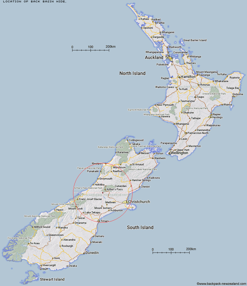
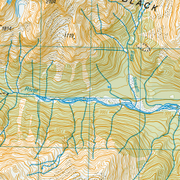
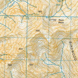
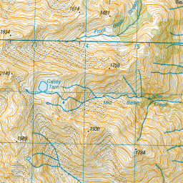
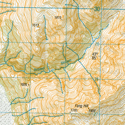
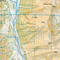
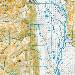
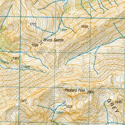
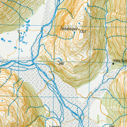
Topo Map showing location of Back Basin Hide
This information is sourced from DoC, LINZ and Openstreetmap. Some of the hut photos are mine and the rest are from DoC. I will be adding an upload feature soon so people can photos of .Back Basin Hide.
Latitude: -43.0870479791
Longitude: 171.433404515
Location:
Type of Hut:
Map: Topo Map | Road Map
Does this hut still exist? Have any more information? Contact
Latitude: -43.0870479791
Longitude: 171.433404515
Location:
Type of Hut:
Map: Topo Map | Road Map
Does this hut still exist? Have any more information? Contact
Scroll down to see a topographical map and road map showing the location of Back Basin Hide
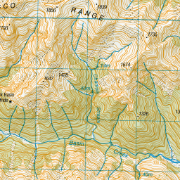
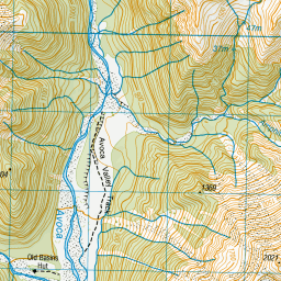
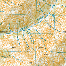
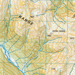
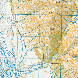
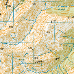
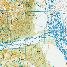
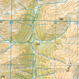

Leaflet | Sourced from LINZ. CC BY 4.0


Leaflet | Map data © OpenStreetMap contributors
[ A ] [ B ] [ C ] [ D ] [ E ] [ F ] [ G ] [ H ] [ I ] [ J ] [ K ] [ L ] [ M ] [ N ] [ O ] [ P ] [ Q ] [ R ] [ S ] [ T ] [ U ] [ V ] [ W ] [ Y ] [ Z ]
Closest 20 Huts to Back Basin Hide
These are as the crow fliesAvoca Hut 3.77km Basins Hut 4.01km Old Basins Hut 4.06km Fanghill Hut 6.82km Weka Burnet Bivouac 8.61km Moa Hut 9.35km Urquhart's Hut 11.14km Manuels Hut 11.27km Barker Hut 11.29km Anti Crow Hut 11.6km Bealey Spur Hut 12.61km Unknown Stream Hut 13.19km Lagoon Saddle Hut 14.08km Lagoon Saddle A Frame Hut 14.13km West Harper Hut 14.17km Carrington Hut 14.19km Moa Stream Hut 14.78km Park Morpeth Hut 14.82km Klondyke Shelter 15.78km Hamilton Hut 16.63km Greyneys Shelter 17.12km Crow Hut 17.35km Bealey Hut 17.79km Waimakariri Falls Hut 19.35km Mungo Hut 20.34km Harman Hut 20.72km Cass Saddle Hut 21.04km Top Crawford Hut 21.04km Old Julia Hut 21.04km Julia Hut 21.07km Jacks Hut 21.24km Crawford Junction Hut 21.44km Campbell Bivouac 21.9km Canyon Creek Bivouac 22.75km Sir Robert Hut 22.82km Toaroha Saddle Bivouac 22.93km Top Kokatahi Hut 22.98km Poet Hut 23.53km Edwards Hut 23.77km Browning Range Bivouac 23.96km