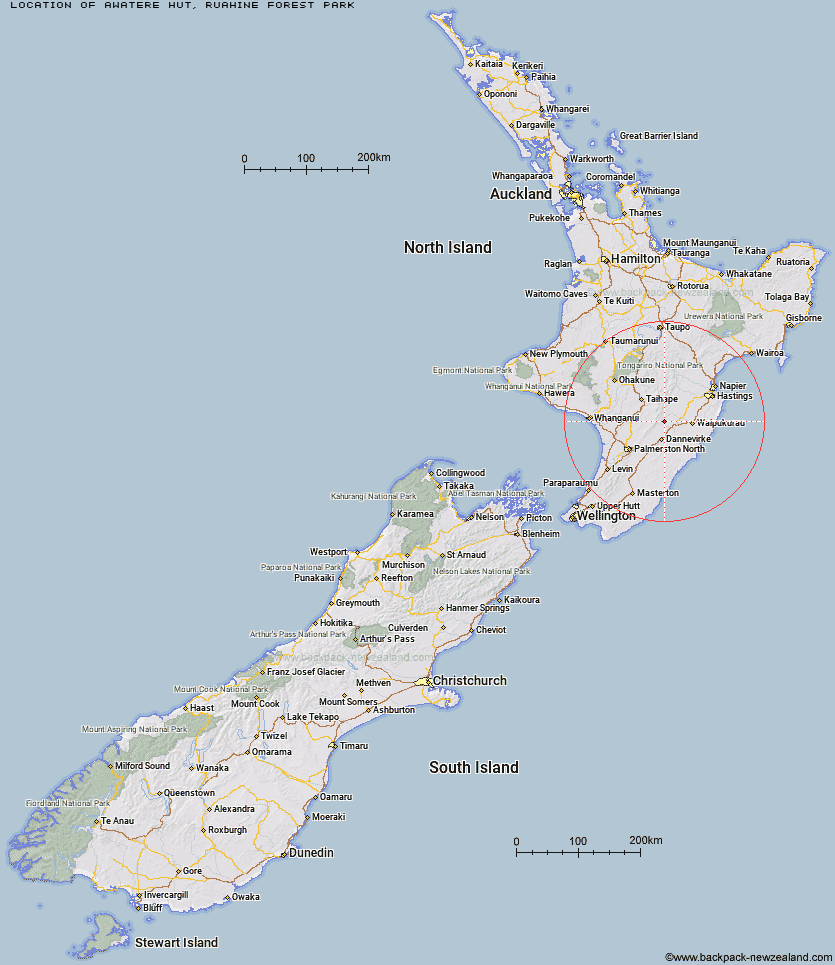
Topo Map showing location of Awatere Hut
This information is sourced from DoC, LINZ and Openstreetmap. Some of the hut photos are mine and the rest are from DoC. I will be adding an upload feature soon so people can photos of .Awatere Hut.
Basic info: basic three-bunk hut in the Hawke's Bay region.
Latitude: -39.9708456829
Longitude: 176.138712454
Location: Ruahine Forest Park
Area: Hawke's Bay
Type of Hut: Basic/bivvies
Tracks: Kashmir Road tramping tracks
Map: BL36 Topo Map | Road Map
Does this hut still exist? Have any more information? Contact
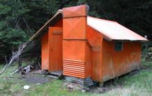
Image: DoC
Scroll down to see a topographical map and road map showing the location of Awatere Hut
[ A ] [ B ] [ C ] [ D ] [ E ] [ F ] [ G ] [ H ] [ I ] [ J ] [ K ] [ L ] [ M ] [ N ] [ O ] [ P ] [ Q ] [ R ] [ S ] [ T ] [ U ] [ V ] [ W ] [ Y ] [ Z ]
Closest 20 Huts to Awatere Hut
These are as the crow fliesLongview Hut 2.58km Top Gorge Hut 2.92km Happy Daze Hut 2.93km Makaretu Hut 4.06km Toka Bivouac 5.82km Daphne Hut 6.43km Leon Kinvig Hut 6.49km Howletts Hut 7.47km Iron Gate Hut 8.5km Triangle Hut 9.14km Tarn Bivouac 9.71km Ngamoko Hut 10.24km Alice Nash Memorial Heritage Lodge 10.48km Cattle Creek Hut 12.36km Hinerua Hut 12.41km Mid Pohangina Hut 12.75km Piripiri Hut 12.86km Pourangaki Hut 13.42km Rangiwahia Hut 13.58km Smiths Stream Hut 13.8km Stanfield Hut 15.13km Kelly Knight Hut 15.28km Waterfall Hut 15.92km Waikamaka Hut 17.71km Purity Hut 18.16km Traverse (A Frame) Hut 18.5km Waipawa Forks Hut 19.39km Triplex Hut 20.37km Sunrise Hut 20.54km Diggers Hut 21.25km McKinnon Hut 21.37km Top Maropea Hut 21.9km Crow Hut 23.13km Forks Hut 23.22km Te Ekaou Hut 23.77km Gold Creek Hut 23.77km Norris Hut 24.03km Wakelings Hut 24.06km Kawhatau Base 24.82km Sparrowhawk Bivouac 26.12km