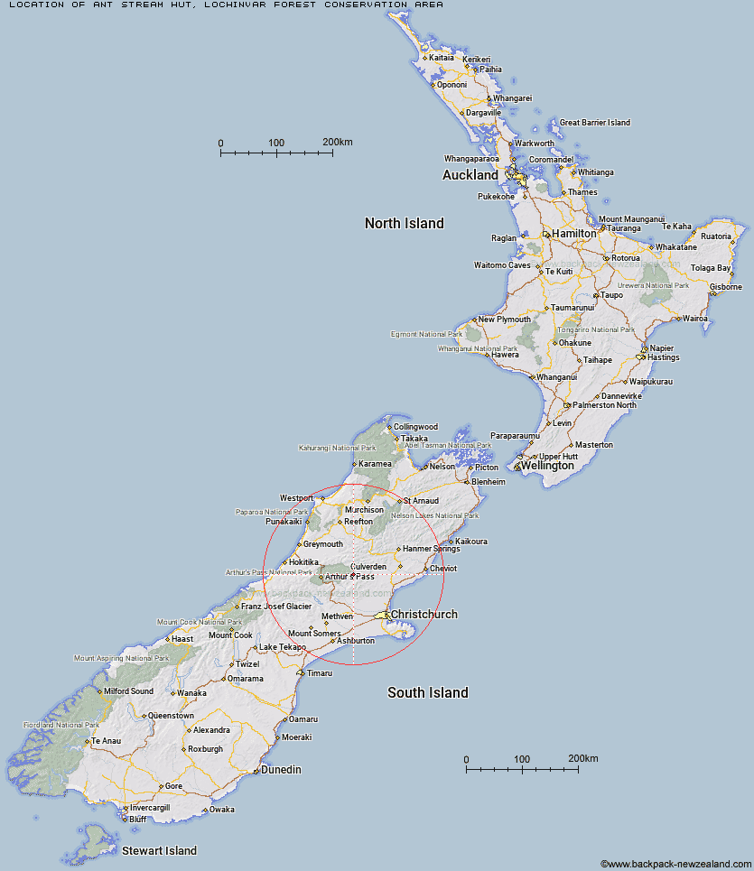
Topo Map showing location of Ant Stream Hut
This information is sourced from DoC, LINZ and Openstreetmap. Some of the hut photos are mine and the rest are from DoC. I will be adding an upload feature soon so people can photos of .Ant Stream Hut.
Basic info: basic two-bunk hut in the North Canterbury and Arthur's Pass area.
Latitude: -42.8969357577
Longitude: 172.088955535
Location: Lochinvar Forest Conservation Area
Area: Canterbury
Type of Hut: Basic/bivvies
Map: BV22 Topo Map | Road Map
Does this hut still exist? Have any more information? Contact
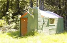
Image: DoC
Scroll down to see a topographical map and road map showing the location of Ant Stream Hut
[ A ] [ B ] [ C ] [ D ] [ E ] [ F ] [ G ] [ H ] [ I ] [ J ] [ K ] [ L ] [ M ] [ N ] [ O ] [ P ] [ Q ] [ R ] [ S ] [ T ] [ U ] [ V ] [ W ] [ Y ] [ Z ]
Closest 20 Huts to Ant Stream Hut
These are as the crow fliesAnt Stream Bivouac 3.34km Anna Hut 4.67km Anderson's Hut 5.54km Lochinvar Hut 7.84km Candlesticks Bivouac 9.24km Bull Creek Hut 9.84km Cattle Creek Hut 10.33km North Esk Hut 10.85km Esk Bivouac 10.87km Bush Camp Hut 11.33km Deep Creek Hut 12.31km Stony Stream Hut 15.5km Turnbull Bivouac 16.1km Youngman Stream Hut 16.2km Ranger Bivouac 16.34km Tarn Hut 16.52km South Branch Research Hut 16.83km Seldom Inn Hut 16.93km Upper South Branch Hurunui Hut 16.96km Lake Mason Hut 18.65km Lilburne Hut 20.38km Trust/Poulter Hut 20.6km Hurunui Hut 21.49km Lake Sumner Hut 21.58km Hurunui No 3 Hut 23.31km Poulter Hut 23.35km Camerons Hut 23.52km Harper Pass Bivouac 24.73km Minchin Bivouac 25.41km Worsley Bivouac 25.43km East Hawdon Bivouac 25.48km Gabriel Hut 25.5km Puketeraki Bivouac 25.71km Andrews Shelter 26.4km Hamilton Hut 26.56km Three Mile Stream Hut 27.22km Locke Stream Hut 27.39km Poulter Bivouac 27.47km Mackenzie Bivouac 27.71km Riversdale Hut 27.71km