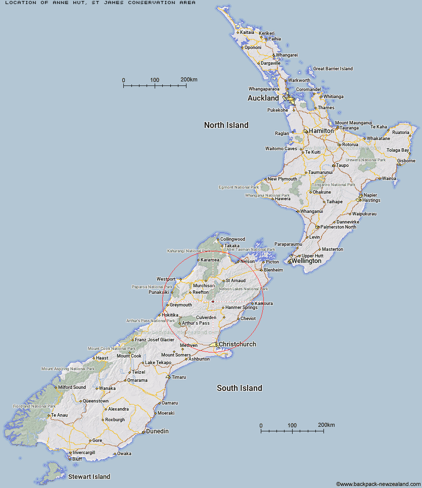
Topo Map showing location of Anne Hut
This information is sourced from DoC, LINZ and Openstreetmap. Some of the hut photos are mine and the rest are from DoC. I will be adding an upload feature soon so people can photos of .Anne Hut.
Basic info: serviced 20-bunk hut in the St James Conservation Area.
Latitude: -42.3511301522
Longitude: 172.528943688
Location: St James Conservation Area
Area: Canterbury
Type of Hut: Serviced
Tracks: St James Walkway
Map: BT23 Topo Map | Road Map
Does this hut still exist? Have any more information? Contact
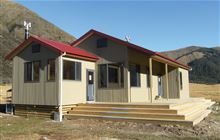
Image: DoC
Scroll down to see a topographical map and road map showing the location of Anne Hut
[ A ] [ B ] [ C ] [ D ] [ E ] [ F ] [ G ] [ H ] [ I ] [ J ] [ K ] [ L ] [ M ] [ N ] [ O ] [ P ] [ Q ] [ R ] [ S ] [ T ] [ U ] [ V ] [ W ] [ Y ] [ Z ]
Closest 20 Huts to Anne Hut
These are as the crow fliesAnne Cullers Hut 1.14km Christopher Hut 7.57km Ada Pass Hut 7.84km Christopher Cullers Hut 7.92km Jervois Hut 8.22km Cannibal Gorge Hut 8.58km Pool Hut 8.68km Old Bridge Hut 9.06km Rokeby Hut 10.64km Stanley Vale Hut 11.48km Lake Guyon Hut 12.14km Scotties Hut 12.63km Tin Jug Hut 13.29km Steyning Hut 13.36km Boyle Flat Hut 13.9km Bobs Hut 14.6km Stony Stream Bivouac 14.93km Pell Stream Hut 15.97km Magdalen Hut 16.84km Lucretia Hut 17.05km East Matakitaki Hut 17.69km Brass Monkey Bivouac 19.06km Fowlers Hut 19.85km Manson-Nicholls Memorial Hut 20.34km Nina Hut 21.23km Carlyle Hut 22.31km Burn Creek Hut 22.6km Tutu Hut 23.05km Downie Hut 24.23km Lake Christabel Hut 24.43km Caroline Creek Bivouac 24.47km Devils Den Bivouac 24.53km Upper Nina Bivouac 24.86km Upper D'Urville Hut 27.73km Doubtful Hut 28.41km Bus Shelter 28.86km Nardoo Hut 29.41km Doubtless Hut 31.29km Top Robinson Hut 31.99km Paske Hut 32.47km