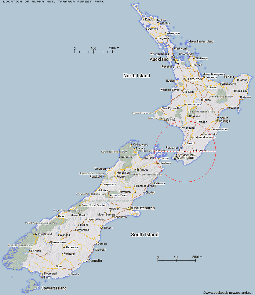
Topo Map showing location of Alpha Hut
This information is sourced from DoC, LINZ and Openstreetmap. Some of the hut photos are mine and the rest are from DoC. I will be adding an upload feature soon so people can photos of .Alpha Hut.
Basic info: standard 20-bunk hut in the Wairarapa region.
Latitude: -40.9857506326
Longitude: 175.281915239
Location: Tararua Forest Park
Area: Wairarapa
Type of Hut: Standard
Tracks: Tararua Southern Crossing
Map: BP33 Topo Map | Road Map
Does this hut still exist? Have any more information? Contact
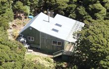
Image: DoC
Scroll down to see a topographical map and road map showing the location of Alpha Hut
[ A ] [ B ] [ C ] [ D ] [ E ] [ F ] [ G ] [ H ] [ I ] [ J ] [ K ] [ L ] [ M ] [ N ] [ O ] [ P ] [ Q ] [ R ] [ S ] [ T ] [ U ] [ V ] [ W ] [ Y ] [ Z ]
Closest 20 Huts to Alpha Hut
These are as the crow fliesEastern Hutt Hut 3.78km Elder Hut 4.43km Tutuwai Hut 4.52km Kime Hut 4.85km Cone Hut 5.28km Smith Creek Shelter 7.62km Neill Forks Hut 8.57km Field Hut 8.93km Maungahuka Hut 9.27km Penn Creek Hut 9.37km Renata Hut 9.38km Waiohine Shelter 9.48km Waiotauru Hut 9.64km Sayer Hut 10.39km Totara Flats Hut 11.77km Aokaparangi Hut 12.35km Kapakapanui Hut 13.09km Mid Waiohine Hut 14.98km Mountain House Shelter 16.15km Powell Hut 16.39km Anderson Memorial Hut 16.69km Waitewaewae Hut 17.33km Atiwhakatu Hut 19.5km Jumbo Hut 19.73km McGregor Bivouac 20.18km Nichols Hut 21.06km Mid King Bivouac 22.49km Dorset Ridge Hut 23.07km Carkeek Hut 23.77km Mitre Flats Hut 23.9km Tarn Ridge Hut 25.25km Dracophyllum Hut 25.67km Arete Forks Hut 28.54km Cow Creek Hut 29.14km Blue Range Hut 29.22km Te Matawai Hut 29.29km Arete Hut 29.42km Waiopehu Hut 29.53km Waikawa Shelter 29.6km South Ohau Hut 31.13km