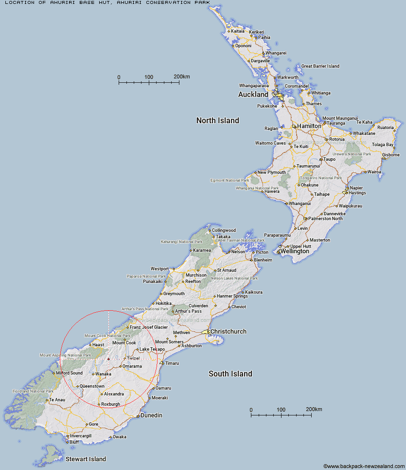
Topo Map showing location of Ahuriri Base Hut
This information is sourced from DoC, LINZ and Openstreetmap. Some of the hut photos are mine and the rest are from DoC. I will be adding an upload feature soon so people can photos of .Ahuriri Base Hut.
Basic info: standard six-bunk hut in the Mackenzie Country and Waitaki area.
Latitude: -44.2719999978
Longitude: 169.599307855
Location: Ahuriri Conservation Park
Area: Canterbury
Type of Hut: Standard
Map: BZ14 Topo Map | Road Map
Does this hut still exist? Have any more information? Contact
Basic info: standard six-bunk hut in the Mackenzie Country and Waitaki area.
Latitude: -44.2719999978
Longitude: 169.599307855
Location: Ahuriri Conservation Park
Area: Canterbury
Type of Hut: Standard
Map: BZ14 Topo Map | Road Map
Does this hut still exist? Have any more information? Contact
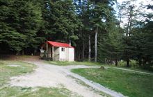
Image: DoC
Scroll down to see a topographical map and road map showing the location of Ahuriri Base Hut
[ A ] [ B ] [ C ] [ D ] [ E ] [ F ] [ G ] [ H ] [ I ] [ J ] [ K ] [ L ] [ M ] [ N ] [ O ] [ P ] [ Q ] [ R ] [ S ] [ T ] [ U ] [ V ] [ W ] [ Y ] [ Z ]
Closest 20 Huts to Ahuriri Base Hut
These are as the crow fliesTop Dingle Hut 3.56km Shamrock Hut 7.46km Snowy Gorge Hut 7.93km Ben Avon Hut 8.96km Green Bush Hut 10.25km Hideaway Hut 10.48km Boundary Hut 11.12km Little Boundary Hut 11.34km Cotters Hut 11.95km Scrubby Hut 12.45km Maitland Hut 12.99km Hagens Hut 13.35km Bull Flat Hut 13.59km High Burn Hut 14.2km Ferguson Hut 17.4km Top Hut 17.47km Bush Hut 18.72km South Temple Hut 19.62km Makarora Hut 20.3km Big Hopwood Burn Hut 22.16km Mae West Bivouac 22.79km Top Timaru Hut 23.4km Cameron Hut 23.99km Forbes Hut 24.86km Brewster Hut 25.34km Burnt Bush Hut 25.38km South Huxley Bivouac 27.52km Wills Hut 28.18km Moonlight & Roses Hut 29.31km Sawyer Burn Hut 31.57km Main Huxley Forks Hut 31.59km Monument Hut 32.38km Stodys Hut 32.94km Junction Hut 33.84km Brodrick Hut 34.61km Craigie Burn Hut 35.19km Red Hut 35.69km Le Crens Hut 38.55km Creswicke Flat Hut 39.46km Pakituhi Hut 39.5km