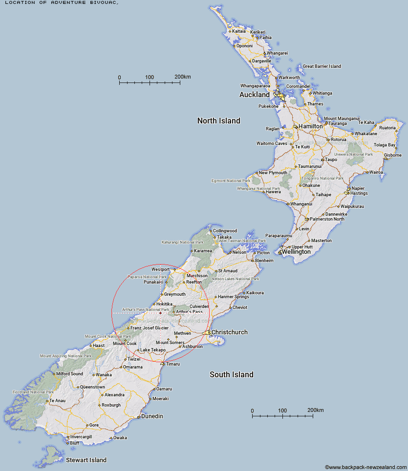
Topo Map showing location of Adventure Bivouac
This information is sourced from DoC, LINZ and Openstreetmap. Some of the hut photos are mine and the rest are from DoC. I will be adding an upload feature soon so people can photos of .Adventure Bivouac.
Latitude: -42.9717605724
Longitude: 171.165485345
Location:
Type of Hut:
Map: Topo Map | Road Map
Does this hut still exist? Have any more information? Contact
Latitude: -42.9717605724
Longitude: 171.165485345
Location:
Type of Hut:
Map: Topo Map | Road Map
Does this hut still exist? Have any more information? Contact
Scroll down to see a topographical map and road map showing the location of Adventure Bivouac
[ A ] [ B ] [ C ] [ D ] [ E ] [ F ] [ G ] [ H ] [ I ] [ J ] [ K ] [ L ] [ M ] [ N ] [ O ] [ P ] [ Q ] [ R ] [ S ] [ T ] [ U ] [ V ] [ W ] [ Y ] [ Z ]
Closest 20 Huts to Adventure Bivouac
These are as the crow fliesYeats Ridge Hut 1.94km Cedar Flat Hut 1.99km Top Kokatahi Hut 2.29km Crystal Bivouac 2.93km Pinnacle Bivouac 3.91km Mullins Hut 4.41km Top Toaroha Hut 4.72km Boo Boo Hut 5.53km Gerhardt Spur Bivouac 5.63km Crawford Junction Hut 5.75km Toaroha Saddle Bivouac 5.81km Mungo Hut 6.57km Poet Hut 7.22km Frisco Hut 8.01km Serpentine Hut 8.4km Bluff Hut 8.91km Sir Robert Hut 9.7km Top Crawford Hut 10.07km Mid Styx Hut 10.67km Browning Range Bivouac 11.57km Mt Brown Hut 11.76km Frew Saddle Bivouac 13.14km Frew Hut 13.16km Rapid Creek Hut 13.32km Newton Range Bivouac 13.45km Grassy Flat Hut 13.58km Unknown Stream Hut 13.67km Harman Hut 13.97km Urquhart's Hut 14.14km Park Morpeth Hut 14.35km Canyon Creek Bivouac 15.15km Weka Burnet Bivouac 16.7km Lower Arahura Hut 16.92km Campbell Bivouac 17.52km Lower Olderog Bivouac 18.76km Barker Hut 18.98km Explorer Hut 19.1km Moa Stream Hut 19.13km Mikonui Spur Bivouac 19.67km Mudflats Hut 19.75km