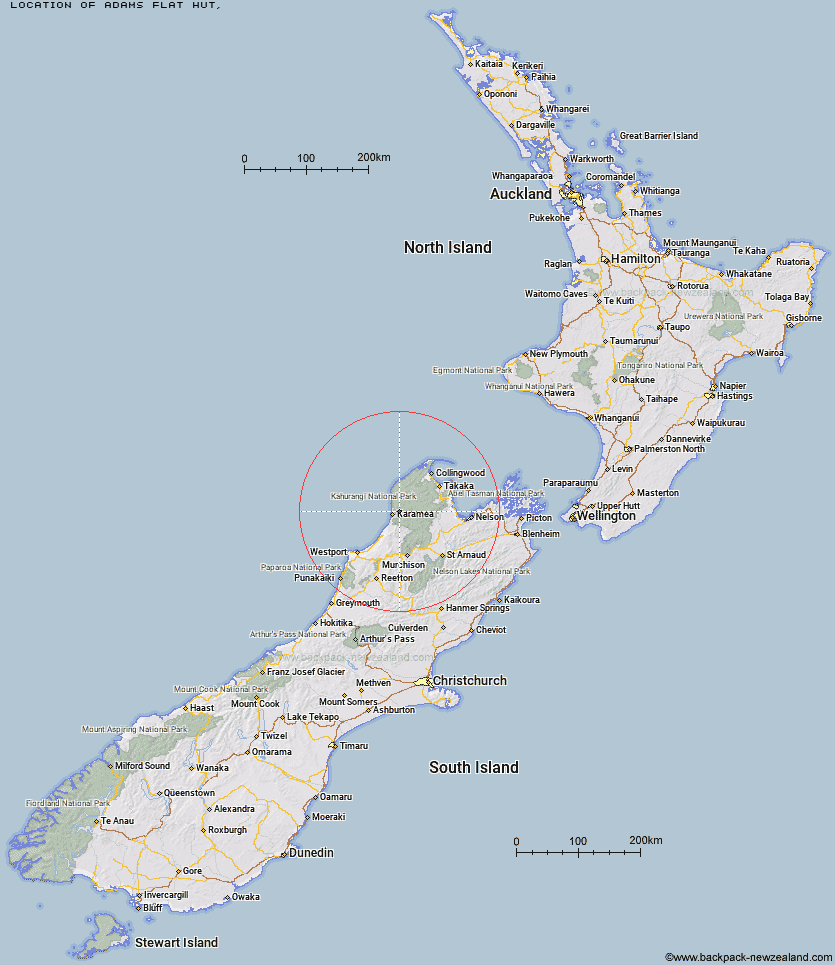
Topo Map showing location of Adams Flat Hut
This information is sourced from DoC, LINZ and Openstreetmap. Some of the hut photos are mine and the rest are from DoC. I will be adding an upload feature soon so people can photos of .Adams Flat Hut.
Latitude: -41.1974944866
Longitude: 172.212605768
Location:
Type of Hut:
Map: Topo Map | Road Map
Does this hut still exist? Have any more information? Contact
Latitude: -41.1974944866
Longitude: 172.212605768
Location:
Type of Hut:
Map: Topo Map | Road Map
Does this hut still exist? Have any more information? Contact
Scroll down to see a topographical map and road map showing the location of Adams Flat Hut
[ A ] [ B ] [ C ] [ D ] [ E ] [ F ] [ G ] [ H ] [ I ] [ J ] [ K ] [ L ] [ M ] [ N ] [ O ] [ P ] [ Q ] [ R ] [ S ] [ T ] [ U ] [ V ] [ W ] [ Y ] [ Z ]
Closest 20 Huts to Adams Flat Hut
These are as the crow fliesAdams Flat Hut 0km Sunshine Flat Shelter 2.96km Greys Hut 7.02km Kohaihai Shelter 13.45km Kākāpō Hut 16.83km Belltown Manunui Hut 17.06km Roaring Lion Hut 18.49km Katipo Creek Shelter 19.2km Wangapeka Bivouac 20.97km Venus Hut 23.15km Stag Flat Shelter 23.18km Taipo Hut 23.84km Crow Hut 23.92km Heaphy Hut 24.95km Karamea Bend Hut 25.27km Thor Hut 25.55km Trevor Carter Hut 26.79km Helicopter Flat Hut 27.28km Lewis Hut 29.14km Johnson Hut 30.48km Cobb Hut 30.54km Tent Camp 30.8km Fenella Hut 30.92km Stone Hut 31.21km Chaffey Hut 32.09km Flanagans Hut 32.71km Kiwi Saddle Hut 33.13km Splugeons Rock Shelter 33.14km Trilobite Hut 34.03km Balloon Hut 34.44km James Mackay Hut 34.63km Myttons Hut 34.92km Saxon Hut 35.52km Gouland Downs Hut 36.11km John Reid Hut 36.2km Perry Saddle Hut 36.61km Hurricane Hut 37.2km Kings Creek Hut 37.3km Cecil Kings Hut 37.34km Dry Rock Shelter 37.52km