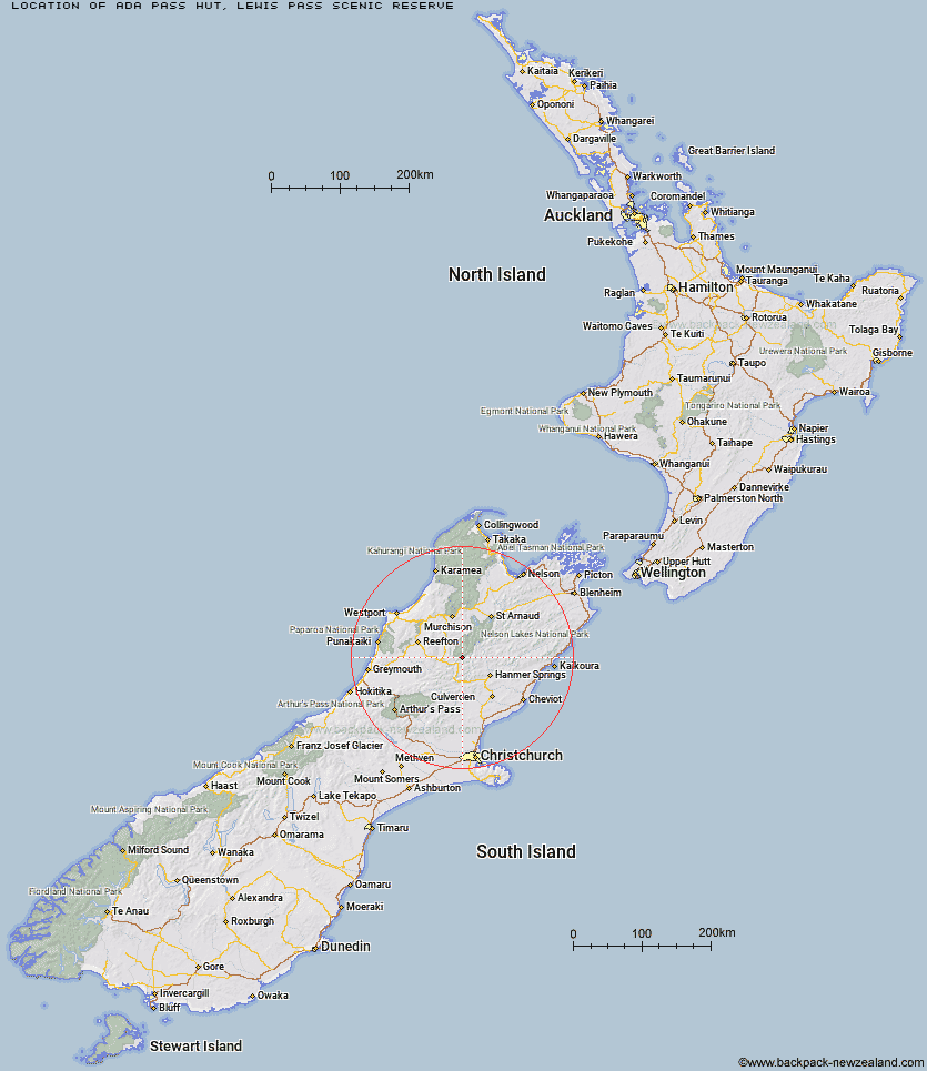
Topo Map showing location of Ada Pass Hut
This information is sourced from DoC, LINZ and Openstreetmap. Some of the hut photos are mine and the rest are from DoC. I will be adding an upload feature soon so people can photos of .Ada Pass Hut.
Basic info: serviced 14-bunk hut in the Greymouth area.
Latitude: -42.3045488526
Longitude: 172.457320788
Location: Lewis Pass Scenic Reserve
Area: West Coast
Type of Hut: Serviced
Tracks: St James Walkway
Map: BT23 Topo Map | Road Map
Does this hut still exist? Have any more information? Contact
Basic info: serviced 14-bunk hut in the Greymouth area.
Latitude: -42.3045488526
Longitude: 172.457320788
Location: Lewis Pass Scenic Reserve
Area: West Coast
Type of Hut: Serviced
Tracks: St James Walkway
Map: BT23 Topo Map | Road Map
Does this hut still exist? Have any more information? Contact
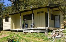
Image: DoC
Scroll down to see a topographical map and road map showing the location of Ada Pass Hut
[ A ] [ B ] [ C ] [ D ] [ E ] [ F ] [ G ] [ H ] [ I ] [ J ] [ K ] [ L ] [ M ] [ N ] [ O ] [ P ] [ Q ] [ R ] [ S ] [ T ] [ U ] [ V ] [ W ] [ Y ] [ Z ]
Closest 20 Huts to Ada Pass Hut
These are as the crow fliesCannibal Gorge Hut 3.33km Anne Cullers Hut 7.45km Anne Hut 7.84km Christopher Cullers Hut 8.6km Christopher Hut 9.04km Bobs Hut 9.29km Pell Stream Hut 10.07km Manson-Nicholls Memorial Hut 13.79km Rokeby Hut 14.37km East Matakitaki Hut 14.86km Jervois Hut 15.83km Lake Guyon Hut 15.84km Lucretia Hut 16.3km Burn Creek Hut 16.46km Pool Hut 16.5km Stanley Vale Hut 16.74km Old Bridge Hut 16.88km Brass Monkey Bivouac 17.26km Boyle Flat Hut 17.9km Downie Hut 19.84km Steyning Hut 20.1km Tin Jug Hut 20.34km Scotties Hut 20.47km Nina Hut 21.09km Magdalen Hut 21.48km Lake Christabel Hut 22.2km Stony Stream Bivouac 22.59km Nardoo Hut 23.2km Caroline Creek Bivouac 23.67km Upper Nina Bivouac 23.84km Devils Den Bivouac 24.38km Upper D'Urville Hut 25.01km Fowlers Hut 25.31km Lake Stream Hut 27.49km Carlyle Hut 27.51km Doubtful Hut 28.96km Top Robinson Hut 29.9km Tutu Hut 29.95km Doubtless Hut 30.75km Top Waitahu Bivouac 30.83km