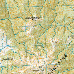
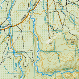
Topo Map showing location of Waipakihi Hut
This information is sourced from DoC, LINZ and Openstreetmap. Some of the hut photos are mine and the rest are from DoC. I will be adding an upload feature soon so people can photos of .Waipakihi Hut.
Basic info: This 12-bunk hut sits in the Waipakihi River Valley, part of the Kaimanawa Forest Park.
Latitude: -39.1239298032
Longitude: 175.958282941
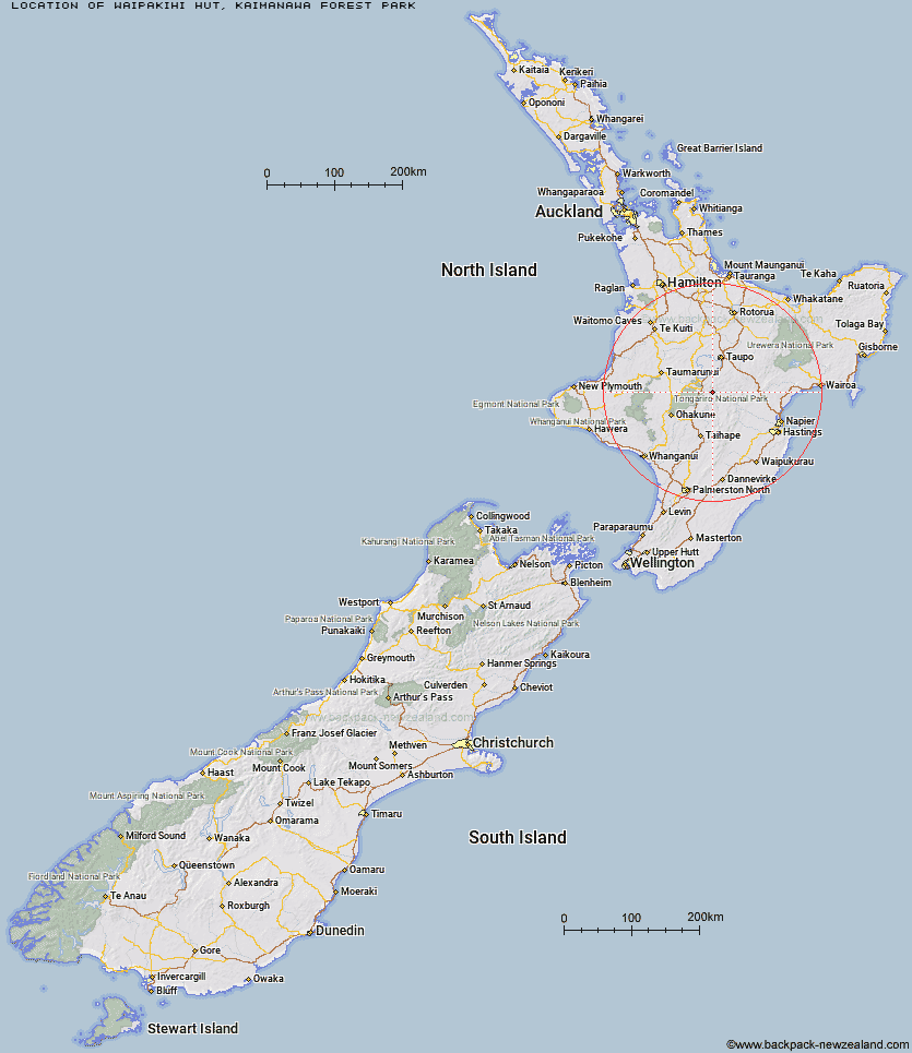
Location: Kaimanawa Forest Park
Area: Central North Island
Type of Hut: Standard
Tracks: Urchin and Umukarikari tracks|Waipakihi River tracks
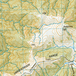
Map: BH36 Topo Map | Road Map
Does this hut still exist? Have any more information? Contact
Basic info: This 12-bunk hut sits in the Waipakihi River Valley, part of the Kaimanawa Forest Park.
Latitude: -39.1239298032
Longitude: 175.958282941
Location: Kaimanawa Forest Park
Area: Central North Island
Type of Hut: Standard
Tracks: Urchin and Umukarikari tracks|Waipakihi River tracks
Map: BH36 Topo Map | Road Map
Does this hut still exist? Have any more information? Contact
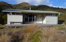
Image: DoC
Scroll down to see a topographical map and road map showing the location of Waipakihi Hut
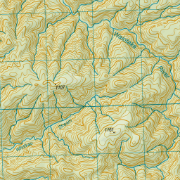
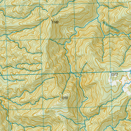
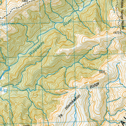
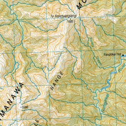
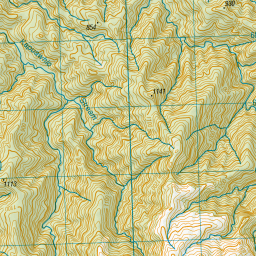
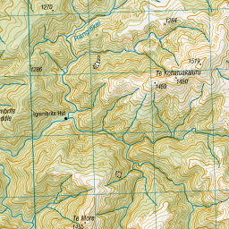
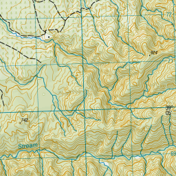
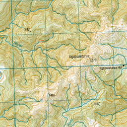
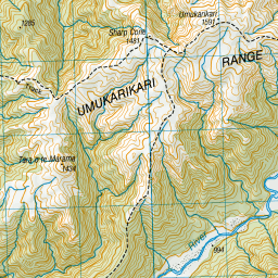
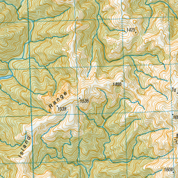
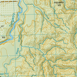
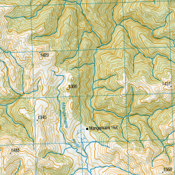
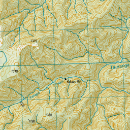
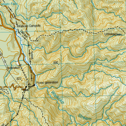
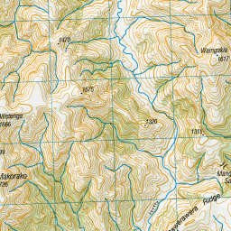

Leaflet | Sourced from LINZ. CC BY 4.0


Leaflet | Map data © OpenStreetMap contributors
[ A ] [ B ] [ C ] [ D ] [ E ] [ F ] [ G ] [ H ] [ I ] [ J ] [ K ] [ L ] [ M ] [ N ] [ O ] [ P ] [ Q ] [ R ] [ S ] [ T ] [ U ] [ V ] [ W ] [ Y ] [ Z ]
Closest 20 Huts to Waipakihi Hut
These are as the crow fliesWTFRW Hut 14.7km Cascade Hut 15.24km Te Apunga Hut 16.21km Golden Hills Hut 20.15km Tussock Hut 22.65km Oturere Hut 23.52km Harkness Hut 25.49km Waihohonu Hut 25.82km Old Waihohonu Hut 26.39km Ketetahi Shelter 26.4km Bob's Hut 26.77km Oamaru Hut 26.99km Otutu Island Hut 27.36km Ngaawapurua Hut 27.9km Poronui Hut 28.24km Te Puke (Te Pukeohikarua) Hut 28.51km Otutu Hut 28.94km Mangatainoka Hut 28.98km East Creek Hut 29.06km Red Hut 30.2km Mangatepopo Hut 31.27km Omarukokere Bivouac 31.99km Manson Hut 32.29km Old Manson Hut 32.55km Rocks Ahead Bivouac 33.58km Rock Camp Bivouac 33.68km Rocks Ahead Hut 33.68km Mangaturutu Hut 33.74km Venison Tops Hut (Tira Lodge) 34.19km Manson Bivouac 34.36km Rangipo Hut 34.84km Kiwi Mouth Hut 35.61km Whangaehu Hut 36.41km Back Ridge Bivouac 37.03km Westlawn Hut 37.5km Ballard Hut 37.67km Back Ridge Hut 38.29km Tevers Hut 38.48km Kiwi Saddle Hut 38.94km Cameron Hut 39.06km