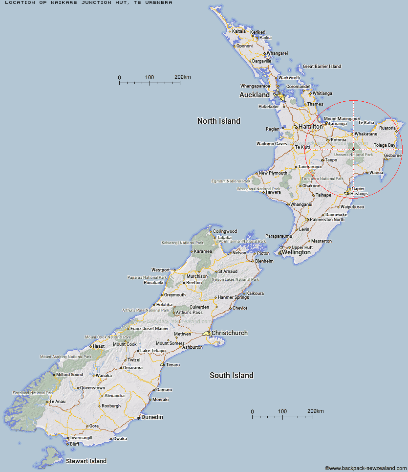
Topo Map showing location of Waikare Junction Hut
This information is sourced from DoC, LINZ and Openstreetmap. Some of the hut photos are mine and the rest are from DoC. I will be adding an upload feature soon so people can photos of .Waikare Junction Hut.
Basic info: standard 10-bunk hut in the Te Urewera area.
Latitude: -38.3910667356
Longitude: 177.002898807
Location: Te Urewera
Area: East Coast
Type of Hut: Standard
Map: BF40 Topo Map | Road Map
Does this hut still exist? Have any more information? Contact
Basic info: standard 10-bunk hut in the Te Urewera area.
Latitude: -38.3910667356
Longitude: 177.002898807
Location: Te Urewera
Area: East Coast
Type of Hut: Standard
Map: BF40 Topo Map | Road Map
Does this hut still exist? Have any more information? Contact
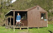
Image: DoC
Scroll down to see a topographical map and road map showing the location of Waikare Junction Hut
[ A ] [ B ] [ C ] [ D ] [ E ] [ F ] [ G ] [ H ] [ I ] [ J ] [ K ] [ L ] [ M ] [ N ] [ O ] [ P ] [ Q ] [ R ] [ S ] [ T ] [ U ] [ V ] [ W ] [ Y ] [ Z ]
Closest 20 Huts to Waikare Junction Hut
These are as the crow fliesOhane Hut 2.83km Hanamahihi Hut 5.77km Manaohou Right Branch Hut 7.81km Ohora Hut 8.65km Onepu Hut 9.35km Te Pourewa Hut 9.78km Takurua Hut 9.95km Duckville Hut 11.26km Te Panaa Hut 11.42km Ngahiramai Hut 11.47km Casino Hut 11.85km Otanetea Hut 11.91km Apiti Hut 12.66km Otapukawa Hut 12.73km Tawhiwhi Hut 13.53km Saddle (Mangaawai) Hut 14.06km Mangamako Hut 14.12km Te Pua Hut 14.32km Horomanga Base Camp 15.45km Taurawharona Hut 15.77km Otane Hut 15.83km Wharekahika Hut 16.01km Waihua Hut 16.11km Koaunui Hut 16.33km Twain (Waipotiki) Hut 16.46km Makomako Hut 19.51km Waiawa Hut 19.73km Tataweka Hut 20.21km Mangatoatoa Hut 20.89km Mangapouri Hut 21.98km Te Rangaakapua Hut 22.73km Tawa Hut 23.12km Makakoere Hut 23.5km Kanohirua Hut 23.57km Okui Hut 23.97km Koranga Forks Hut 24.82km Nikau Flat Hut 25.37km Kahunui Hut 25.82km Kotepato Hut 29.01km Manuoha Hut 31.2km