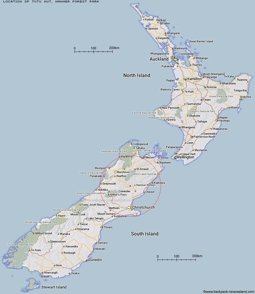
Topo Map showing location of Tutu Hut
This information is sourced from DoC, LINZ and Openstreetmap. Some of the hut photos are mine and the rest are from DoC. I will be adding an upload feature soon so people can photos of .Tutu Hut.
Basic info: basic four-bunk hut in the North Canterbury area.
Latitude: -42.5504081332
Longitude: 172.606418697
Location: Hanmer Forest Park
Area: Canterbury
Type of Hut: Basic/bivvies
Map: BU24 Topo Map | Road Map
Does this hut still exist? Have any more information? Contact
Basic info: basic four-bunk hut in the North Canterbury area.
Latitude: -42.5504081332
Longitude: 172.606418697
Location: Hanmer Forest Park
Area: Canterbury
Type of Hut: Basic/bivvies
Map: BU24 Topo Map | Road Map
Does this hut still exist? Have any more information? Contact
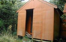
Image: DoC
Scroll down to see a topographical map and road map showing the location of Tutu Hut
[ A ] [ B ] [ C ] [ D ] [ E ] [ F ] [ G ] [ H ] [ I ] [ J ] [ K ] [ L ] [ M ] [ N ] [ O ] [ P ] [ Q ] [ R ] [ S ] [ T ] [ U ] [ V ] [ W ] [ Y ] [ Z ]
Closest 20 Huts to Tutu Hut
These are as the crow fliesCarlyle Hut 9.06km Tin Jug Hut 9.77km Stony Stream Bivouac 9.83km Steyning Hut 9.85km Magdalen Hut 12.29km Scotties Hut 13.69km Valley Camp Hut 14.69km Jervois Hut 15.18km Boyle Flat Hut 15.23km Old Bridge Hut 16.89km Pool Hut 17.2km Rokeby Hut 17.48km Bus Shelter 19.15km Bush Hut 19.76km Glenrae Bivouac 20.91km Anne Cullers Hut 22.91km Anne Hut 23.05km Nina Hut 25.13km Lucretia Hut 25.19km Hope Halfway Hut 26.28km Stanley Vale Hut 26.43km Devils Den Bivouac 26.51km Doubtful Hut 26.56km Glenrae Hut 27.68km Brass Monkey Bivouac 27.91km Cold Stream Hut 28.28km Cannibal Gorge Hut 28.79km Upper Nina Bivouac 28.84km Jollie Brook Hut 29.2km Christopher Hut 29.32km Fowlers Hut 29.39km Lake Guyon Hut 29.48km Ada Pass Hut 29.95km Christopher Cullers Hut 29.98km Museum Hut 30.03km Evangeline Bivouac 30.57km Saint Jacob's Hut 30.91km Lake Man Bivouac 31.24km Doubtless Hut 31.32km Lake Christabel Hut 31.43km