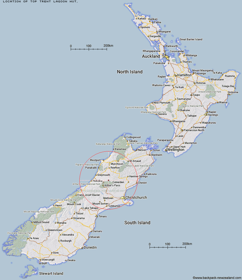
Topo Map showing location of Top Trent / Lagoon Hut
This information is sourced from DoC, LINZ and Openstreetmap. Some of the hut photos are mine and the rest are from DoC. I will be adding an upload feature soon so people can photos of .Top Trent / Lagoon Hut.
Latitude: -42.6997641353
Longitude: 171.832927984
Location:
Type of Hut:
Map: Topo Map | Road Map
Does this hut still exist? Have any more information? Contact
Latitude: -42.6997641353
Longitude: 171.832927984
Location:
Type of Hut:
Map: Topo Map | Road Map
Does this hut still exist? Have any more information? Contact
Scroll down to see a topographical map and road map showing the location of Top Trent / Lagoon Hut
[ A ] [ B ] [ C ] [ D ] [ E ] [ F ] [ G ] [ H ] [ I ] [ J ] [ K ] [ L ] [ M ] [ N ] [ O ] [ P ] [ Q ] [ R ] [ S ] [ T ] [ U ] [ V ] [ W ] [ Y ] [ Z ]
Closest 20 Huts to Top Trent / Lagoon Hut
These are as the crow fliesElizabeth Hut 4.23km Locke Stream Hut 4.46km Mid Trent Hut 5.15km Harper Pass Bivouac 5.91km Cone Creek Hut 8.38km Townsend Hut 9.44km Waikiti Hut 9.64km Kiwi Hut 9.7km Camerons Hut 9.82km Minchin Bivouac 10.72km Lake Morgan Hut 10.89km Top Crooked Hut 11.6km Hurunui No 3 Hut 12.67km Poulter Bivouac 13.8km Upper South Branch Hurunui Hut 14.47km Tutaekuri Hut 14.81km Koropuku Hut 14.84km Mackenzie Hut 16.21km Jacko Flat Hut 16.54km Poulter Hut 16.75km Trust/Poulter Hut 17.25km Worsley Bivouac 17.35km Pfeifer Bivouac 17.88km Ranger Bivouac 18.09km Mackenzie Bivouac 19.86km Otehake Hut 20.19km South Branch Research Hut 20.81km Candlesticks Bivouac 21.19km Hurunui Hut 21.51km Camp Creek Hut 22.21km North Esk Hut 22.34km East Hawdon Bivouac 22.74km Stony Stream Hut 23.34km Bull Creek Hut 24.17km Hawdon Hut 24.88km Carroll Hut 25.05km Lake Sumner Hut 25.69km Three Mile Stream Hut 26.8km Slaty Creek Hut 26.83km Upper Deception Hut 27.03km