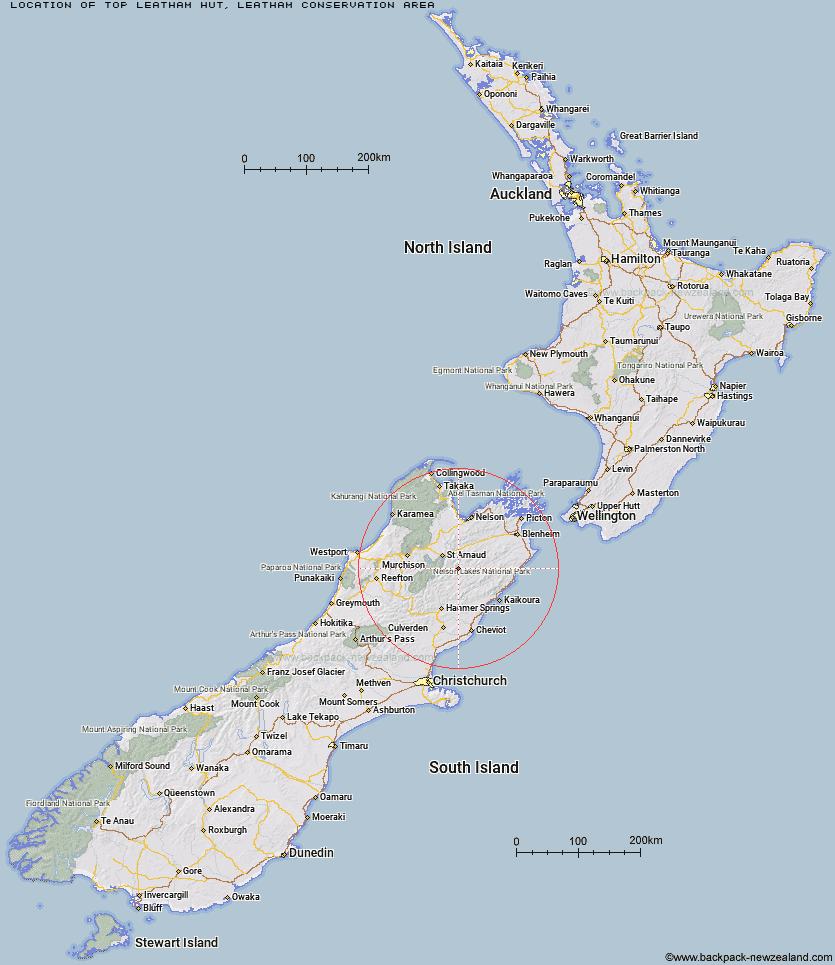
Topo Map showing location of Top Leatham Hut
This information is sourced from DoC, LINZ and Openstreetmap. Some of the hut photos are mine and the rest are from DoC. I will be adding an upload feature soon so people can photos of .Top Leatham Hut.
Basic info: standard 6 bunk hut in the South Marlborough area.
Latitude: -41.9731618366
Longitude: 173.082059666
Location: Leatham Conservation Area
Area: Marlborough
Type of Hut: Standard
Tracks: Leatham Molesworth Route
Map: BS25 Topo Map | Road Map
Does this hut still exist? Have any more information? Contact
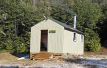
Image: DoC
Scroll down to see a topographical map and road map showing the location of Top Leatham Hut
[ A ] [ B ] [ C ] [ D ] [ E ] [ F ] [ G ] [ H ] [ I ] [ J ] [ K ] [ L ] [ M ] [ N ] [ O ] [ P ] [ Q ] [ R ] [ S ] [ T ] [ U ] [ V ] [ W ] [ Y ] [ Z ]
Closest 20 Huts to Top Leatham Hut
These are as the crow fliesTop Leatham Hut 0km Branch Bivouac 3.87km Bottom Gordons Hut 6.98km Bottom Misery Hut 7.37km Team Hut 8.91km Lees Creek Hut 9.48km Top Gordon Hut 10.43km Siberia Hut 10.45km Severn Hut 10.55km Saxton Hut 10.84km Junction Hut 12.17km Top Misery Hut 12.28km Lost Stream Bivouac 12.88km Carters Yards Hut 13.95km Barbers Hut 14.16km Munroe Hut 14.91km Greigs Hut 15.3km Acheron Hut 16.46km Connors Creek Hut 16.66km Mid Silverstream Hut 16.7km Bull Paddock Creek Hut 17.18km Red Gate Hut 17.88km Burnt Yards Hut 18.04km Silverstream Bivouac 20.21km Caves Hut 20.58km Blue Mountain Hut 23.49km Sedgemere Sleepout 23.5km Lakehead Hut 24.09km Begley Hut 24.35km Coldwater Hut 24.72km Boulder Forks Hut 24.86km John Tait Hut 25.91km Bushline Hut 26.25km Relax Shelter 27.31km Hopeless Hut 27.33km Bushedge Shelter 27.43km Red Hills Hut 27.93km Upper Travers Hut 27.95km Island Gully Hut 28.59km Cupola Hut 28.87km