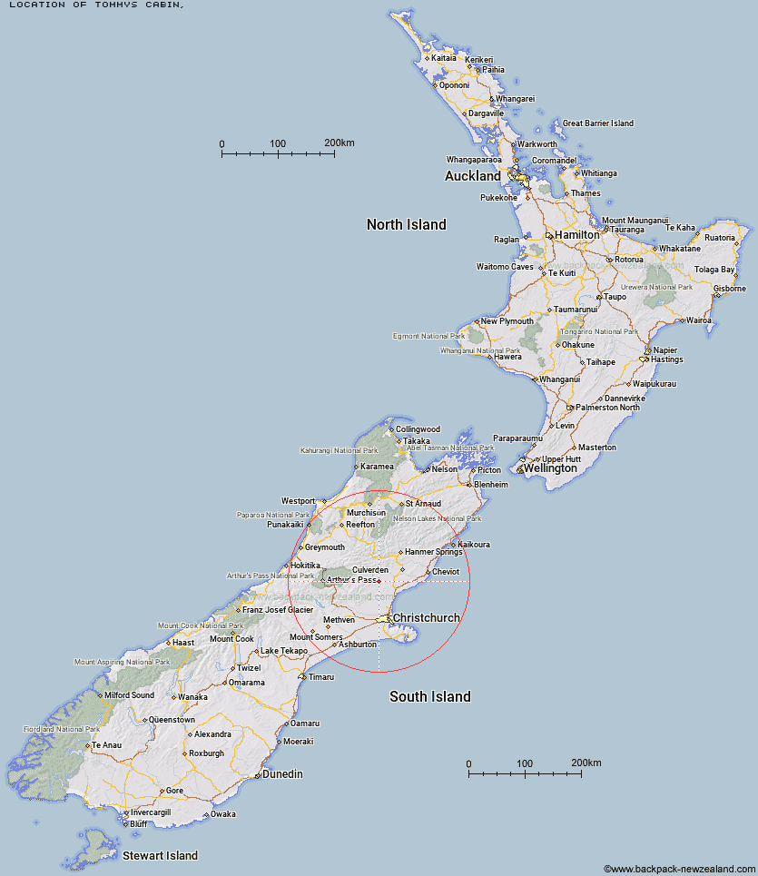
Topo Map showing location of Tommys Cabin
This information is sourced from DoC, LINZ and Openstreetmap. Some of the hut photos are mine and the rest are from DoC. I will be adding an upload feature soon so people can photos of .Tommys Cabin.
Latitude: -42.9565414522
Longitude: 172.48135281
Location:
Type of Hut:
Map: Topo Map | Road Map
Does this hut still exist? Have any more information? Contact
Latitude: -42.9565414522
Longitude: 172.48135281
Location:
Type of Hut:
Map: Topo Map | Road Map
Does this hut still exist? Have any more information? Contact
Scroll down to see a topographical map and road map showing the location of Tommys Cabin
[ A ] [ B ] [ C ] [ D ] [ E ] [ F ] [ G ] [ H ] [ I ] [ J ] [ K ] [ L ] [ M ] [ N ] [ O ] [ P ] [ Q ] [ R ] [ S ] [ T ] [ U ] [ V ] [ W ] [ Y ] [ Z ]
Closest 20 Huts to Tommys Cabin
These are as the crow fliesTommys Cabin 0km Seldom Inn Hut 16.01km Glenrae Hut 21.7km Esk Bivouac 22.15km Pinchgut Hut 22.5km Cattle Creek Hut 22.82km Cold Stream Hut 24.98km Youngman Stream Hut 25.44km Bob's Camp Bivouac 25.77km Bush Hut 26.57km Deep Creek Hut 26.7km Anderson's Hut 27.14km Tarn Hut 28.52km Jollie Brook Hut 28.93km Glenrae Bivouac 29.28km Lilburne Hut 30.31km Gabriel Hut 30.47km Anna Hut 30.56km Bush Camp Hut 30.98km Valley Camp Hut 31.67km Ant Stream Hut 32.63km Ant Stream Bivouac 32.9km Evangeline Bivouac 34.67km Lake Mason Hut 35.33km Stony Stream Hut 37.62km North Esk Hut 37.77km Lochinvar Hut 38.66km Lake Sumner Hut 38.85km Candlesticks Bivouac 39.89km South Branch Research Hut 40.26km Museum Hut 40.63km Hope Halfway Hut 40.74km Bus Shelter 42.14km Hurunui Hut 42.16km Bull Creek Hut 42.36km Three Mile Stream Hut 42.61km Saint Jacob's Hut 43.92km Wharfedale Hut 44.74km Puketeraki Bivouac 44.77km Adams Hut 45.03km