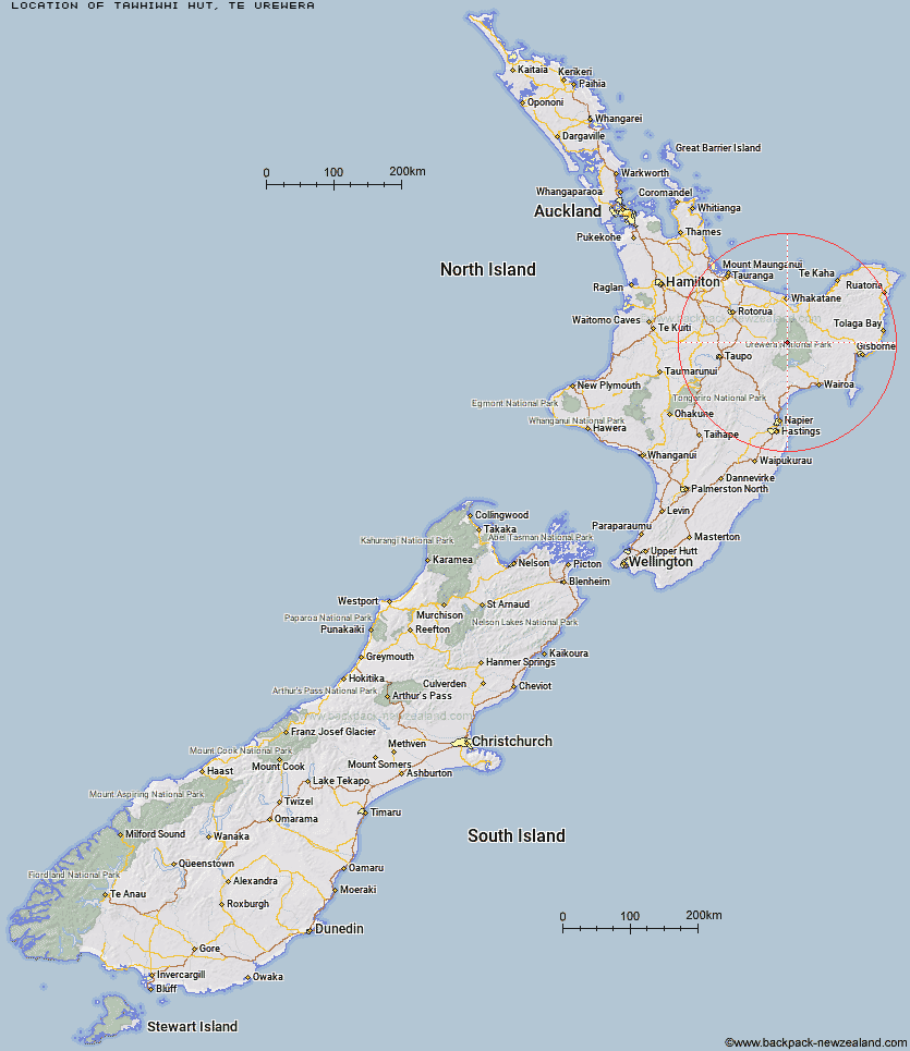
Topo Map showing location of Tawhiwhi Hut
This information is sourced from DoC, LINZ and Openstreetmap. Some of the hut photos are mine and the rest are from DoC. I will be adding an upload feature soon so people can photos of .Tawhiwhi Hut.
Basic info: standard 17-bunk hut in the Te Urewera area.
Latitude: -38.5122970946
Longitude: 176.989467992
Location: Te Urewera
Area: East Coast
Type of Hut: Standard
Map: BF39 Topo Map | Road Map
Does this hut still exist? Have any more information? Contact
Basic info: standard 17-bunk hut in the Te Urewera area.
Latitude: -38.5122970946
Longitude: 176.989467992
Location: Te Urewera
Area: East Coast
Type of Hut: Standard
Map: BF39 Topo Map | Road Map
Does this hut still exist? Have any more information? Contact
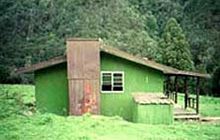
Image: DoC
Scroll down to see a topographical map and road map showing the location of Tawhiwhi Hut
[ A ] [ B ] [ C ] [ D ] [ E ] [ F ] [ G ] [ H ] [ I ] [ J ] [ K ] [ L ] [ M ] [ N ] [ O ] [ P ] [ Q ] [ R ] [ S ] [ T ] [ U ] [ V ] [ W ] [ Y ] [ Z ]
Closest 20 Huts to Tawhiwhi Hut
These are as the crow fliesTawhiwhi Hut 0km Ngahiramai Hut 2.44km Takurua Hut 3.85km Otanetea Hut 6.07km Waiawa Hut 7.73km Taurawharona Hut 8.79km Hanamahihi Hut 9.54km Kanohirua Hut 10.45km Te Panaa Hut 11.26km Makomako Hut 12.4km Manaohou Right Branch Hut 12.69km Ohane Hut 13.13km Waikare Junction Hut 13.53km Te Pua Hut 13.62km Mangapouri Hut 13.98km Te Pourewa Hut 14.53km Mangatoatoa Hut 15.57km Okui Hut 17.55km Otane Hut 17.61km Horomanga Base Camp 18.1km Te Rangaakapua Hut 18.7km Duckville Hut 19.22km Otapukawa Hut 19.25km Manuoha Hut 19.64km Whakatakaa Hut 20.06km Tataweka Hut 20.86km Onepu Hut 22.11km Ohora Hut 22.17km Makakoere Hut 22.88km Casino Hut 23.13km Whanganui Hut 23.6km Mangamako Hut 24.29km Koaunui Hut 25.11km Kahunui Hut 25.27km Tawa Hut 25.33km Apiti Hut 25.79km Waiharuru Hut 25.99km Te Totara Hut 26.34km Saddle (Mangaawai) Hut 26.77km Sandy Bay Hut 27.19km