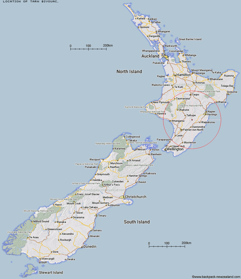
Topo Map showing location of Tarn Bivouac
This information is sourced from DoC, LINZ and Openstreetmap. Some of the hut photos are mine and the rest are from DoC. I will be adding an upload feature soon so people can photos of .Tarn Bivouac.
Latitude: -39.8835867245
Longitude: 176.144128573
Location:
Type of Hut:
Map: Topo Map | Road Map
Does this hut still exist? Have any more information? Contact
Latitude: -39.8835867245
Longitude: 176.144128573
Location:
Type of Hut:
Map: Topo Map | Road Map
Does this hut still exist? Have any more information? Contact
Scroll down to see a topographical map and road map showing the location of Tarn Bivouac
[ A ] [ B ] [ C ] [ D ] [ E ] [ F ] [ G ] [ H ] [ I ] [ J ] [ K ] [ L ] [ M ] [ N ] [ O ] [ P ] [ Q ] [ R ] [ S ] [ T ] [ U ] [ V ] [ W ] [ Y ] [ Z ]
Closest 20 Huts to Tarn Bivouac
These are as the crow fliesHowletts Hut 2.76km Hinerua Hut 3.26km Daphne Hut 3.29km Smiths Stream Hut 4.44km Pourangaki Hut 6.08km Triangle Hut 6.29km Waterfall Hut 6.59km Longview Hut 7.76km Waikamaka Hut 8.06km Kelly Knight Hut 8.61km Iron Gate Hut 8.85km Awatere Hut 9.71km Waipawa Forks Hut 9.8km Top Gorge Hut 9.91km Purity Hut 10.28km Rangiwahia Hut 10.76km Sunrise Hut 10.88km Triplex Hut 11.04km McKinnon Hut 12.09km Top Maropea Hut 12.19km Happy Daze Hut 12.63km Toka Bivouac 12.65km Alice Nash Memorial Heritage Lodge 13.38km Makaretu Hut 13.5km Crow Hut 13.91km Gold Creek Hut 14.28km Wakelings Hut 14.39km Leon Kinvig Hut 14.6km Norris Hut 15.1km Kawhatau Base 16.23km Sparrowhawk Bivouac 16.46km Maropea Forks Hut 17.11km Ngamoko Hut 18.58km Barlow Hut 19.68km Piripiri Hut 20.42km Otukota Hut 20.61km Mid Pohangina Hut 21.12km Cattle Creek Hut 21.41km Ellis Hut 22.22km Poutaki Hut 22.63km