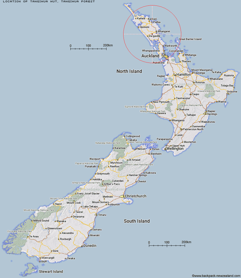
Topo Map showing location of Tangihua Hut
This information is sourced from DoC, LINZ and Openstreetmap. Some of the hut photos are mine and the rest are from DoC. I will be adding an upload feature soon so people can photos of .Tangihua Hut.
Basic info: Tangihua Hut is an eight-bunk standard hut.
Latitude: -35.8504526217
Longitude: 174.110459173
Location: Tangihua Forest
Area: Northland
Type of Hut: Standard
Tracks: Northern Tangihua Track|Te Haua Uru Track|Horokaka Track|Main Ridge Track
Map: AX29 Topo Map | Road Map
Does this hut still exist? Have any more information? Contact
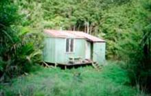
Image: DoC
Scroll down to see a topographical map and road map showing the location of Tangihua Hut
[ A ] [ B ] [ C ] [ D ] [ E ] [ F ] [ G ] [ H ] [ I ] [ J ] [ K ] [ L ] [ M ] [ N ] [ O ] [ P ] [ Q ] [ R ] [ S ] [ T ] [ U ] [ V ] [ W ] [ Y ] [ Z ]
Closest 20 Huts to Tangihua Hut
These are as the crow fliesTangihua Hut 0km Tangihua Lodge 4.85km Peach Cove Hut 41.07km Frampton's Hut 68.79km Puketi Forest Hut 76.59km Cape Brett Hut 77.97km Motukawanui Hut 95.09km Lane Cove Hut 99.34km Kaiaraara Hut 119.85km Mt Heale Hut 123.19km Ongaruanuku Hut 123.84km Piggotts Hut 166.21km Crosbies Hut 188.31km Pinnacles Hut 195.17km Daly's Clearing Hut 233.95km Mangakino Shelter 235.83km Waitawheta Hut 239.97km Wairoa Shelter 243.55km Te Rereatukahia Hut 246.47km Motutapere Hut 250.15km Pahautea Hut 253.76km Kauritatahi Hut 255.01km Mangamuka Hut 267.7km Ngamuwahine Shelter 267.8km Hurunui Hut 272.05km Hamilton Tomo Group Hut 281.46km Leitchs Hut 293.02km Wildlife Hut 305.03km Bog Inn Hut 332.27km Wairua Hut 335.71km Waihaha Hut 342.68km Hauhungaroa Hut 345.54km Rerekapa Hut 347.12km Waihua Hut 365.44km Ohuraiti Hut 365.71km Twain (Waipotiki) Hut 366.88km Mangamako Hut 367.56km Saddle (Mangaawai) Hut 368.33km Casino Hut 369.65km Apiti Hut 370.37km