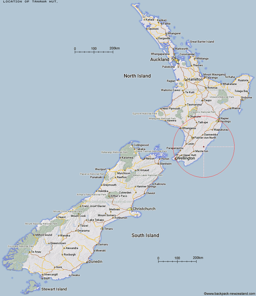
Topo Map showing location of Tanawa Hut
This information is sourced from DoC, LINZ and Openstreetmap. Some of the hut photos are mine and the rest are from DoC. I will be adding an upload feature soon so people can photos of .Tanawa Hut.
Latitude: -40.7490333864
Longitude: 176.135067056
Location:
Type of Hut:
Map: Topo Map | Road Map
Does this hut still exist? Have any more information? Contact
Latitude: -40.7490333864
Longitude: 176.135067056
Location:
Type of Hut:
Map: Topo Map | Road Map
Does this hut still exist? Have any more information? Contact
Scroll down to see a topographical map and road map showing the location of Tanawa Hut
[ A ] [ B ] [ C ] [ D ] [ E ] [ F ] [ G ] [ H ] [ I ] [ J ] [ K ] [ L ] [ M ] [ N ] [ O ] [ P ] [ Q ] [ R ] [ S ] [ T ] [ U ] [ V ] [ W ] [ Y ] [ Z ]
Closest 20 Huts to Tanawa Hut
These are as the crow fliesNorth Mangahao Bivouac 50.12km Roaring Stag Hut 51.47km Herepai Hut 51.95km Blue Range Hut 52.14km Burn Hut 53.1km Cattle Ridge Hut 53.26km Cow Creek Hut 54.33km Mitre Flats Hut 55.99km Dundas Hut 56.49km Arete Forks Hut 57.27km Mid King Bivouac 58.46km Arete Hut 58.8km Atiwhakatu Hut 58.83km Tarn Ridge Hut 59.06km Mangahao Flats Hut 59.26km Jumbo Hut 59.68km Dorset Ridge Hut 60.36km Mountain House Shelter 61.36km McGregor Bivouac 61.67km Powell Hut 61.7km North Ohau Hut 62km Te Matawai Hut 62.05km Carkeek Hut 62.38km Dracophyllum Hut 62.84km South Ohau Hut 62.88km Nichols Hut 64.28km Totara Flats Hut 64.87km Mid Waiohine Hut 64.92km Kiritaki Hut 64.92km Waiopehu Hut 65.61km Sayer Hut 66.07km Anderson Memorial Hut 66.47km Aokaparangi Hut 67.1km Neill Forks Hut 68.64km Waiohine Shelter 68.84km Maungahuka Hut 69.8km Waitewaewae Hut 70.37km Cone Hut 71.53km Traverse (A Frame) Hut 72.1km Forks Hut 72.53km