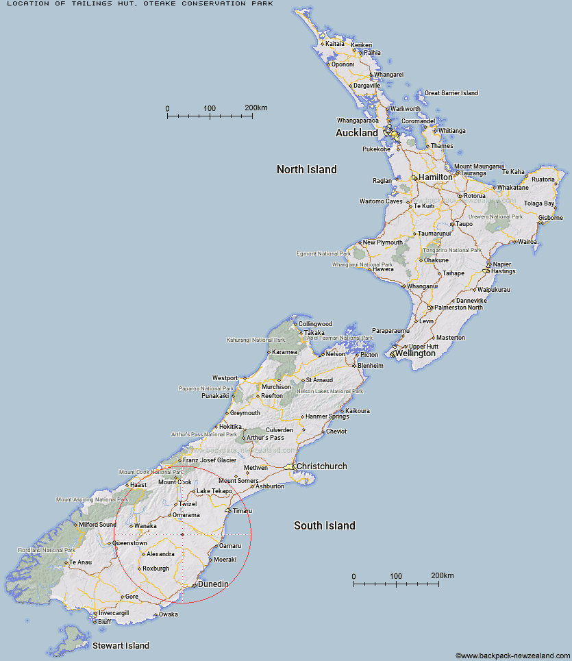
Topo Map showing location of Tailings Hut
This information is sourced from DoC, LINZ and Openstreetmap. Some of the hut photos are mine and the rest are from DoC. I will be adding an upload feature soon so people can photos of .Tailings Hut.
Basic info: Tailings Hut is 12-bunk hut in the Central Otago area.
Latitude: -44.855927321
Longitude: 170.241459568
Location: Oteake Conservation Park
Area: Otago
Type of Hut: Standard
Map: CB16 Topo Map | Road Map
Does this hut still exist? Have any more information? Contact
Basic info: Tailings Hut is 12-bunk hut in the Central Otago area.
Latitude: -44.855927321
Longitude: 170.241459568
Location: Oteake Conservation Park
Area: Otago
Type of Hut: Standard
Map: CB16 Topo Map | Road Map
Does this hut still exist? Have any more information? Contact
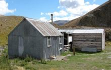
Image: DoC
Scroll down to see a topographical map and road map showing the location of Tailings Hut
[ A ] [ B ] [ C ] [ D ] [ E ] [ F ] [ G ] [ H ] [ I ] [ J ] [ K ] [ L ] [ M ] [ N ] [ O ] [ P ] [ Q ] [ R ] [ S ] [ T ] [ U ] [ V ] [ W ] [ Y ] [ Z ]
Closest 20 Huts to Tailings Hut
These are as the crow fliesTailings Hut 0km Hut Creek Hut 3.92km Brown Hut 4.06km Chimney Creek Hut 6.1km Ida Railway Hut 6.65km Buster Hut 7.54km Wire Yards Hut 9.84km Awakino Ski Field 10.17km Otamatapaio Hut 28.44km Balmoral Huts 29.77km Crumb Hut 31.52km Pearson Hut 31.8km Middle Hut 33.56km Boundary Creek Hut 33.63km Half Moon Hut 37.66km Top Hut 39.7km Mitchells Hut 41.28km Grays Hut 42.13km Mount Hut 43.92km Cayenne Hut 44.63km Richmond Hut 45.23km Lauder Basin Hut 45.86km Gentle Annie Hut 46.5km Bog Hut 50.18km Polson's Hut 53.39km Red Hut 55.13km Staircase Hut 59.6km Leaning Lodge 63.8km Big Hut 65.78km Burnt Bush Hut 67.48km Waitaki Huts 71.63km Hideaway Hut 72.01km Stodys Hut 72.52km Top Timaru Hut 72.55km Mae West Bivouac 75.86km Pakituhi Hut 76.27km Snowy Gorge Hut 76.91km Moonlight & Roses Hut 77.76km Junction Hut 78.25km Howells Hut 78.95km