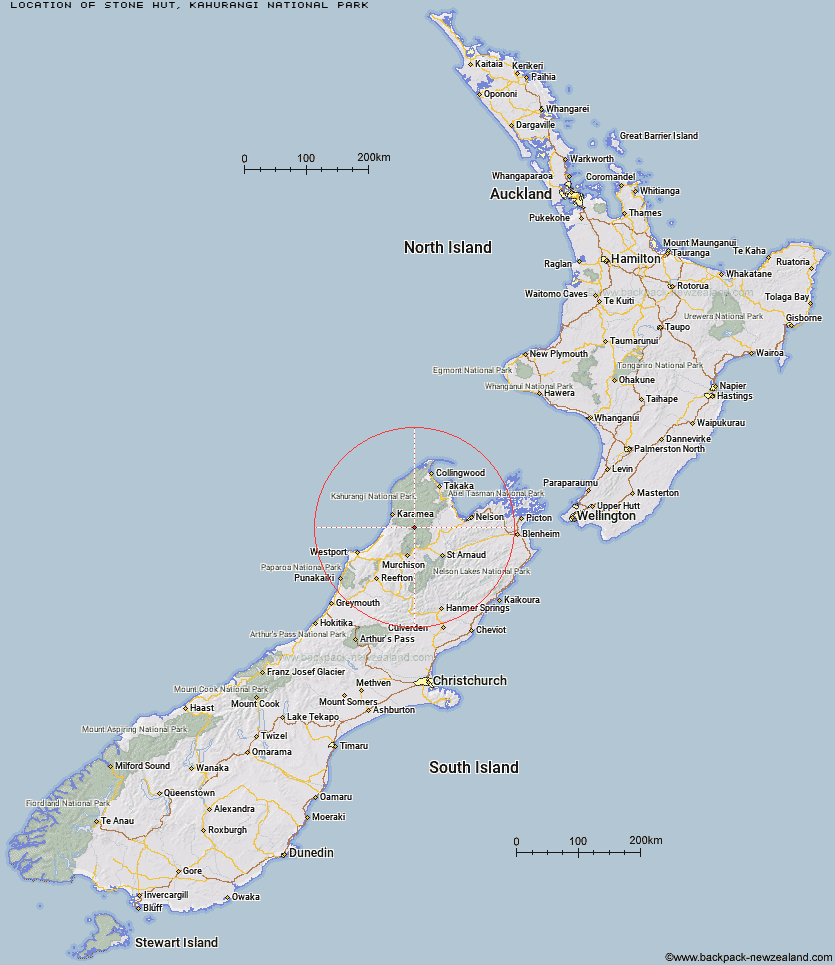
Topo Map showing location of Stone Hut
This information is sourced from DoC, LINZ and Openstreetmap. Some of the hut photos are mine and the rest are from DoC. I will be adding an upload feature soon so people can photos of .Stone Hut.
Basic info: standard 10-bunk hut in the Motueka area.
Latitude: -41.4206210631
Longitude: 172.43938529
Location: Kahurangi National Park
Area: Nelson/Tasman
Type of Hut: Standard
Tracks: Wangapeka Track
Map: BQ23 Topo Map | Road Map
Does this hut still exist? Have any more information? Contact
Basic info: standard 10-bunk hut in the Motueka area.
Latitude: -41.4206210631
Longitude: 172.43938529
Location: Kahurangi National Park
Area: Nelson/Tasman
Type of Hut: Standard
Tracks: Wangapeka Track
Map: BQ23 Topo Map | Road Map
Does this hut still exist? Have any more information? Contact
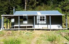
Image: DoC
Scroll down to see a topographical map and road map showing the location of Stone Hut
[ A ] [ B ] [ C ] [ D ] [ E ] [ F ] [ G ] [ H ] [ I ] [ J ] [ K ] [ L ] [ M ] [ N ] [ O ] [ P ] [ Q ] [ R ] [ S ] [ T ] [ U ] [ V ] [ W ] [ Y ] [ Z ]
Closest 20 Huts to Stone Hut
These are as the crow fliesTrevor Carter Hut 4.8km Kiwi Saddle Hut 4.84km Kings Creek Hut 6.09km Cecil Kings Hut 6.14km Helicopter Flat Hut 6.55km Thor Hut 7.53km John Reid Hut 9.42km Hurricane Hut 10.68km Taipo Hut 10.78km Venus Hut 11.54km Stag Flat Shelter 12.29km Branch Creek Hut 12.93km Wangapeka Bivouac 14.29km Crow Hut 14.35km Johnson Hut 14.57km Kākāpō Hut 14.98km Granity Pass Hut 15.25km Larrikin Creek Hut 18.58km Belltown Manunui Hut 18.63km McConchies Hut 19.58km Flanagans Hut 20.84km Karamea Bend Hut 21.69km Poor Pete's Hut 23.62km Greys Hut 24.37km Roaring Lion Hut 24.77km Mokihinui Forks Hut 25.94km Specimen Point Hut 27.62km Lake Matiri Hut 27.71km Splugeons Rock Shelter 27.8km Goat Creek Hut 28.74km Ellis Hut 28.93km Adams Flat Hut 31.21km Balloon Hut 31.88km Dry Rock Shelter 32.71km Stern Valley Hut 33.63km Mt Arthur Hut 33.87km Sunshine Flat Shelter 34.04km Growler Rock Shelter 34.39km Upper Gridiron Hut and Rock Shelters 35.14km Myttons Hut 35.14km