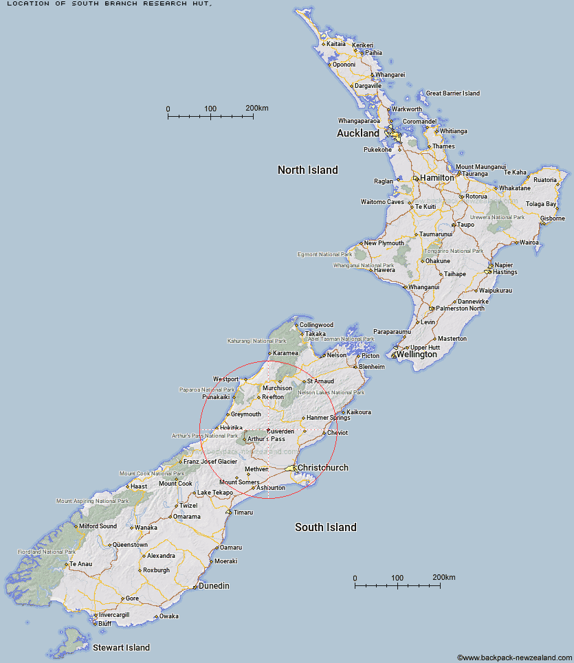
Topo Map showing location of South Branch Research Hut
This information is sourced from DoC, LINZ and Openstreetmap. Some of the hut photos are mine and the rest are from DoC. I will be adding an upload feature soon so people can photos of .South Branch Research Hut.
Latitude: -42.7457090328
Longitude: 172.079888415
Location:
Type of Hut:
Map: Topo Map | Road Map
Does this hut still exist? Have any more information? Contact
Latitude: -42.7457090328
Longitude: 172.079888415
Location:
Type of Hut:
Map: Topo Map | Road Map
Does this hut still exist? Have any more information? Contact
Scroll down to see a topographical map and road map showing the location of South Branch Research Hut
[ A ] [ B ] [ C ] [ D ] [ E ] [ F ] [ G ] [ H ] [ I ] [ J ] [ K ] [ L ] [ M ] [ N ] [ O ] [ P ] [ Q ] [ R ] [ S ] [ T ] [ U ] [ V ] [ W ] [ Y ] [ Z ]
Closest 20 Huts to South Branch Research Hut
These are as the crow fliesStony Stream Hut 2.64km Hurunui Hut 4.85km North Esk Hut 6.14km Lake Sumner Hut 6.94km Lake Mason Hut 7.04km Upper South Branch Hurunui Hut 7.84km Hurunui No 3 Hut 9.01km Bush Camp Hut 9.54km Candlesticks Bivouac 10.34km Mackenzie Bivouac 10.89km Camerons Hut 11.13km Three Mile Stream Hut 11.64km Mackenzie Hut 11.94km Ant Stream Bivouac 13.6km Deep Creek Hut 13.65km Harper Pass Bivouac 15.14km Mid Trent Hut 16.39km Ant Stream Hut 16.83km Tutaekuri Hut 17.08km Gabriel Hut 17.36km Evangeline Bivouac 17.7km Anderson's Hut 18.42km Bull Creek Hut 18.75km Top Hope Hut 19.02km Museum Hut 19.26km Ranger Bivouac 19.32km Saint Jacob's Hut 20.21km Esk Bivouac 20.31km Locke Stream Hut 20.4km Top Trent / Lagoon Hut 20.81km Jollie Brook Hut 20.94km Anna Hut 21.36km Lochinvar Hut 21.8km Slaty Creek Hut 22.31km Minchin Bivouac 22.68km Trust/Poulter Hut 22.83km Hope Halfway Hut 22.94km Waikiti Hut 23.54km Cattle Creek Hut 23.71km Cold Stream Hut 24.68km