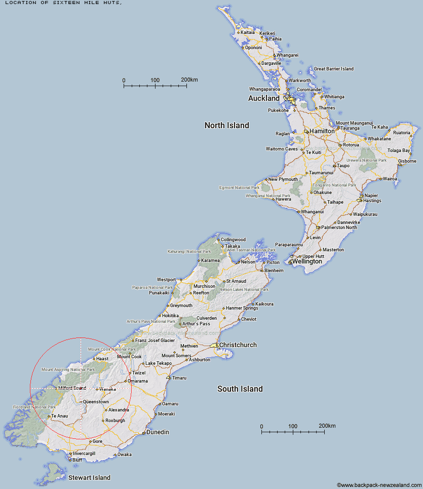
Topo Map showing location of Sixteen Mile Huts
This information is sourced from DoC, LINZ and Openstreetmap. Some of the hut photos are mine and the rest are from DoC. I will be adding an upload feature soon so people can photos of .Sixteen Mile Huts.
Latitude: -44.6726028333
Longitude: 168.65042608
Location:
Type of Hut:
Map: Topo Map | Road Map
Does this hut still exist? Have any more information? Contact
Latitude: -44.6726028333
Longitude: 168.65042608
Location:
Type of Hut:
Map: Topo Map | Road Map
Does this hut still exist? Have any more information? Contact
Scroll down to see a topographical map and road map showing the location of Sixteen Mile Huts
[ A ] [ B ] [ C ] [ D ] [ E ] [ F ] [ G ] [ H ] [ I ] [ J ] [ K ] [ L ] [ M ] [ N ] [ O ] [ P ] [ Q ] [ R ] [ S ] [ T ] [ U ] [ V ] [ W ] [ Y ] [ Z ]
Closest 20 Huts to Sixteen Mile Huts
These are as the crow fliesShiel Burn Hut 6.8km Hundred Mile Hut 7.21km Ballarat Hut - Flood Burn 8.73km Lochnagar Hut 8.89km Polnoon Hut 10.02km Cabin Hut 10.51km Tummel Burn Hut 11.67km Bullendale Hut 12.91km Archie's Hut - Copper Creek 13.77km Dynamo Hut 14.34km Twenty Five Mile Hut 14.67km Black Peak Hut 16.25km Shelter Rock Hut 16.91km Earnslaw Hut 17.02km Crystal Hut 17.63km Peats Hut 18.34km Dart Hut 18.43km Saddle Hut 18.97km Raspberry Creek Shelter 19.33km Sainsburys Huts 19.88km Cascade Hut 20.03km Stoney Creek Hut 20.19km Esquilant Bivvy Hut 20.28km Aspiring Hut 21.75km Roses Hut 22.27km McIntosh Hut 23.4km Wallers Hut 23.94km McIntyre's Hut 24.52km Green Gate Huts 25.36km Heather Jock Hut 25.39km Kelly's Hut 25.58km Highland Creek Hut 25.64km Jean Hut 25.82km Daleys Flat Hut 25.86km Bonnie Jean Hut 26.13km Liverpool Hut 26.87km French Ridge Hut 27.34km Fern Burn Hut 27.43km Eight Mile Hut 28.25km Scotts Rock Bivouac 28.28km