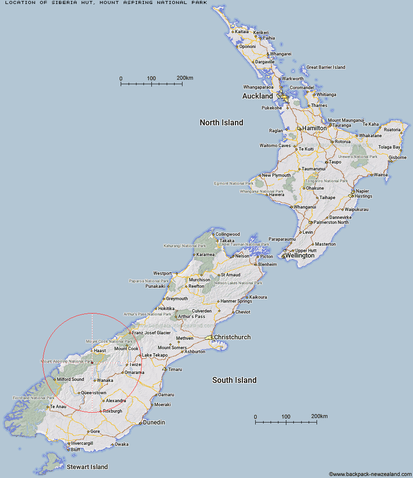
Topo Map showing location of Siberia Hut
This information is sourced from DoC, LINZ and Openstreetmap. Some of the hut photos are mine and the rest are from DoC. I will be adding an upload feature soon so people can photos of .Siberia Hut.
Basic info: This is an serviced 20-bunk hut in the Wanaka/Makarora area.
Latitude: -44.2047411606
Longitude: 169.061640267
Location: Mount Aspiring National Park
Area: Otago
Type of Hut: Serviced
Tracks: Gillespie Pass Circuit
Map: BZ12 Topo Map | Road Map
Does this hut still exist? Have any more information? Contact
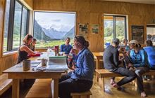
Image: DoC
Scroll down to see a topographical map and road map showing the location of Siberia Hut
[ A ] [ B ] [ C ] [ D ] [ E ] [ F ] [ G ] [ H ] [ I ] [ J ] [ K ] [ L ] [ M ] [ N ] [ O ] [ P ] [ Q ] [ R ] [ S ] [ T ] [ U ] [ V ] [ W ] [ Y ] [ Z ]
Closest 20 Huts to Siberia Hut
These are as the crow fliesYoung Hut 4.04km Kerin Forks Hut 4.34km Craigie Burn Hut 15.37km Albert Burn Hut 15.39km Top Forks Hut 15.63km Franklin Hut 19.73km Cameron Hut 20.27km Big Hopwood Burn Hut 23.58km Sawyer Burn Hut 28.15km Red Hut 29.65km High Burn Hut 30.83km Brewster Hut 30.85km Rock of Ages Bivouac 31.3km Makarora Hut 31.36km Little Boundary Hut 32.18km Boundary Hut 32.52km Green Bush Hut 33.23km Colin Todd Hut 34.64km Scrubby Hut 36.06km Thomas River Hut 36.19km Wills Hut 36.9km Wanaka Faces Hut 37.16km Bull Flat Hut 38.34km French Ridge Hut 38.42km Scotts Rock Bivouac 38.59km Bush Hut 39.11km Ferguson Hut 40.13km Roaring Billy Hut 40.25km Top Dingle Hut 40.29km Cotters Hut 40.29km Liverpool Hut 40.35km Ben Avon Hut 40.36km Moonlight & Roses Hut 41.93km Raspberry Creek Shelter 42.42km Mae West Bivouac 42.49km Arawhata Rock Bivouac 42.92km Junction Hut 43.25km Coppermine Creek Hut 43.35km Ahuriri Base Hut 43.48km Aspiring Hut 44.01km