Topo Map showing location of Shelter Rock Hut
This information is sourced from DoC, LINZ and Openstreetmap. Some of the hut photos are mine and the rest are from DoC. I will be adding an upload feature soon so people can photos of .Shelter Rock Hut.
Basic info: serviced 22-bunk hut in the Queenstown/Wakatipu area.
Latitude: -44.5587366889
Longitude: 168.508899507
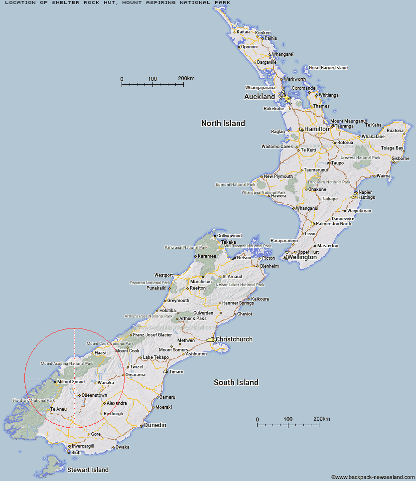
Location: Mount Aspiring National Park
Area: Otago
Type of Hut: Serviced
Tracks: Rees-Dart Track
Map: CA10 Topo Map | Road Map
Does this hut still exist? Have any more information? Contact
Basic info: serviced 22-bunk hut in the Queenstown/Wakatipu area.
Latitude: -44.5587366889
Longitude: 168.508899507
Location: Mount Aspiring National Park
Area: Otago
Type of Hut: Serviced
Tracks: Rees-Dart Track
Map: CA10 Topo Map | Road Map
Does this hut still exist? Have any more information? Contact
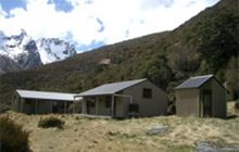
Image: DoC
Scroll down to see a topographical map and road map showing the location of Shelter Rock Hut
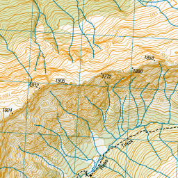
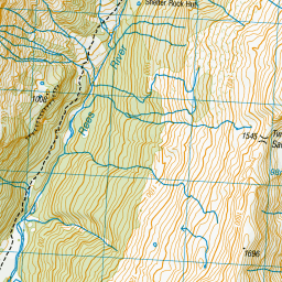
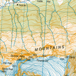
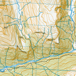
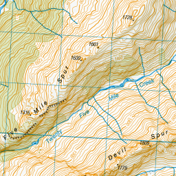
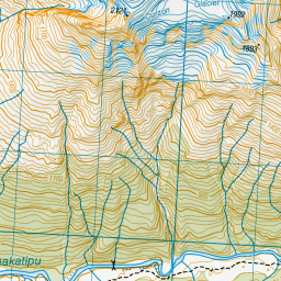
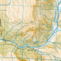
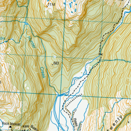
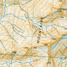
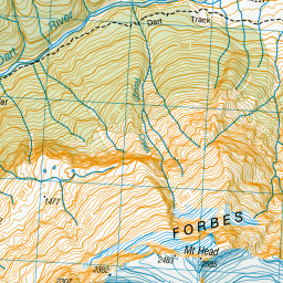
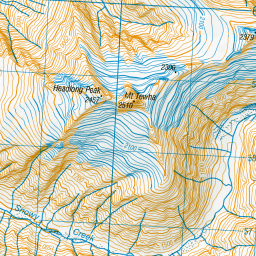
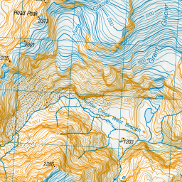
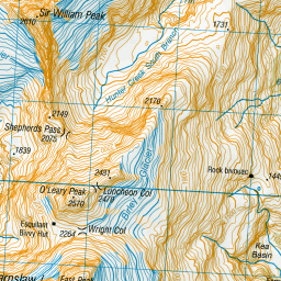
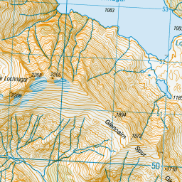

Leaflet | Sourced from LINZ. CC BY 4.0


Leaflet | Map data © OpenStreetMap contributors
[ A ] [ B ] [ C ] [ D ] [ E ] [ F ] [ G ] [ H ] [ I ] [ J ] [ K ] [ L ] [ M ] [ N ] [ O ] [ P ] [ Q ] [ R ] [ S ] [ T ] [ U ] [ V ] [ W ] [ Y ] [ Z ]
Closest 20 Huts to Shelter Rock Hut
These are as the crow fliesDart Hut 5.48km Earnslaw Hut 8.53km Twenty Five Mile Hut 9.6km Lochnagar Hut 9.7km Esquilant Bivvy Hut 10.24km Daleys Flat Hut 10.72km Tummel Burn Hut 12.79km Hundred Mile Hut 13.13km Cascade Hut 14.6km Aspiring Hut 15.04km Sixteen Mile Huts 16.91km Arawhata Rock Bivouac 17.95km Liverpool Hut 18.84km Raspberry Creek Shelter 19.58km French Ridge Hut 20.6km Scotts Rock Bivouac 20.63km Shiel Burn Hut 22.51km Polnoon Hut 23.82km Ballarat Hut - Flood Burn 24.38km Colin Todd Hut 25.46km Routeburn Shelter 25.5km Black Peak Hut 25.58km Cabin Hut 26.26km Olivine Hut 26.67km Rock of Ages Bivouac 27.97km Archie's Hut - Copper Creek 28.28km Bullendale Hut 28.58km Lake Alabaster Hut 28.94km Dynamo Hut 29.58km Routeburn Flats Hut 29.73km McIntosh Hut 30.63km Routeburn Falls Hut 30.74km Routeburn Falls Lodge 30.79km Saddle Hut 30.93km McIntyre's Hut 31.42km Sunshine Hut 31.94km Hidden Falls Hut 32.05km Wallers Hut 32.73km Crystal Hut 32.74km Stoney Creek Hut 32.83km