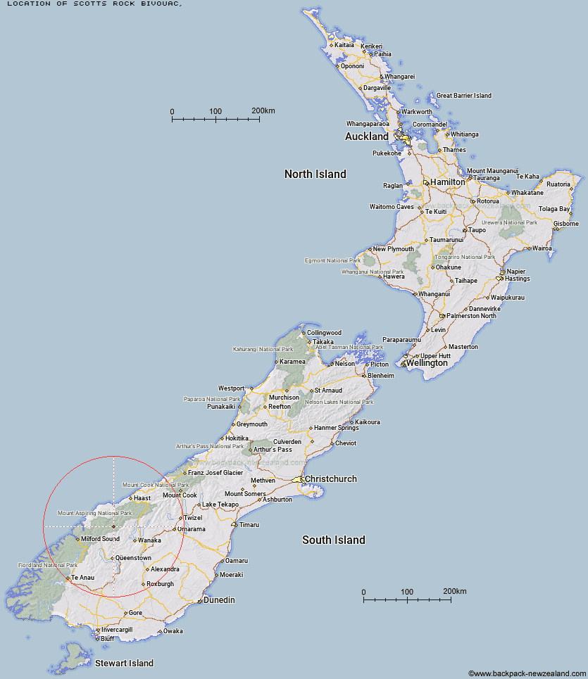
Topo Map showing location of Scotts Rock Bivouac
This information is sourced from DoC, LINZ and Openstreetmap. Some of the hut photos are mine and the rest are from DoC. I will be adding an upload feature soon so people can photos of .Scotts Rock Bivouac.
Latitude: -44.4192092284
Longitude: 168.680290995
Location:
Type of Hut:
Map: Topo Map | Road Map
Does this hut still exist? Have any more information? Contact
Latitude: -44.4192092284
Longitude: 168.680290995
Location:
Type of Hut:
Map: Topo Map | Road Map
Does this hut still exist? Have any more information? Contact
Scroll down to see a topographical map and road map showing the location of Scotts Rock Bivouac
[ A ] [ B ] [ C ] [ D ] [ E ] [ F ] [ G ] [ H ] [ I ] [ J ] [ K ] [ L ] [ M ] [ N ] [ O ] [ P ] [ Q ] [ R ] [ S ] [ T ] [ U ] [ V ] [ W ] [ Y ] [ Z ]
Closest 20 Huts to Scotts Rock Bivouac
These are as the crow fliesFrench Ridge Hut 1.51km Liverpool Hut 1.79km Colin Todd Hut 5.36km Arawhata Rock Bivouac 5.77km Aspiring Hut 6.64km Cascade Hut 8.25km Rock of Ages Bivouac 9.13km Raspberry Creek Shelter 11.72km Dart Hut 15.14km Tummel Burn Hut 16.63km Lochnagar Hut 20.21km Shelter Rock Hut 20.63km Hundred Mile Hut 21.06km Black Peak Hut 23.05km Top Forks Hut 23.25km Polnoon Hut 27.61km Daleys Flat Hut 28.19km Sixteen Mile Huts 28.28km Saddle Hut 28.97km Earnslaw Hut 29.12km Shiel Burn Hut 29.43km Albert Burn Hut 29.47km Twenty Five Mile Hut 29.71km Esquilant Bivvy Hut 30.75km Cabin Hut 31.72km Kerin Forks Hut 34.66km Ballarat Hut - Flood Burn 36.94km Olivine Hut 37.14km Siberia Hut 38.59km Wanaka Faces Hut 38.98km Craigie Burn Hut 39.84km Spoon Hut 40.72km Bullendale Hut 40.96km Archie's Hut - Copper Creek 42.05km Young Hut 42.46km Dynamo Hut 42.51km Fern Burn Hut 43.03km Highland Creek Hut 44.57km Lake Alabaster Hut 44.81km Roses Hut 45.21km