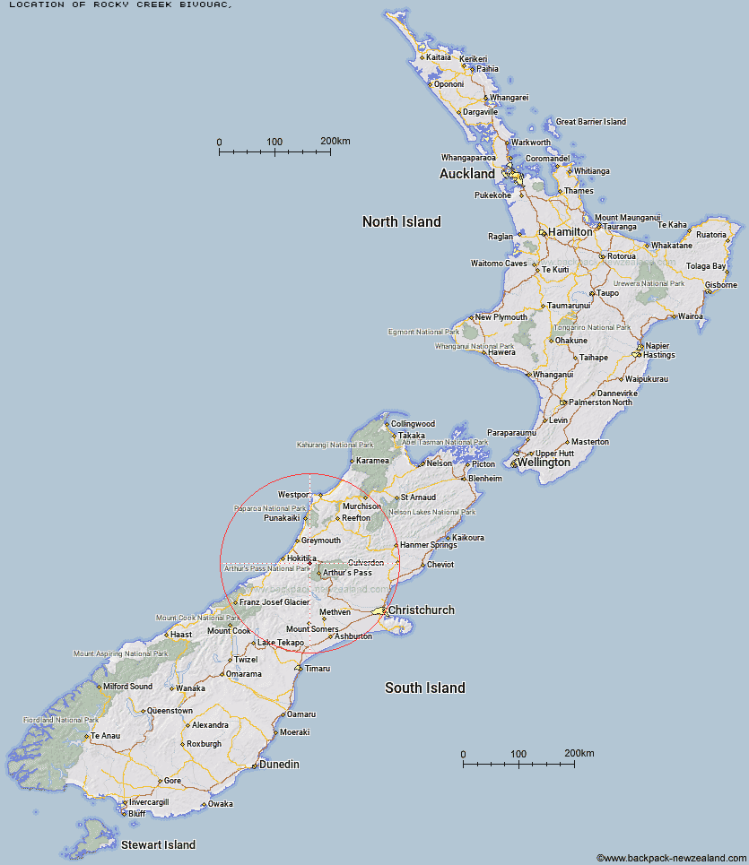
Topo Map showing location of Rocky Creek Bivouac
This information is sourced from DoC, LINZ and Openstreetmap. Some of the hut photos are mine and the rest are from DoC. I will be adding an upload feature soon so people can photos of .Rocky Creek Bivouac.
Latitude: -42.7865018384
Longitude: 171.409263844
Location:
Type of Hut:
Map: Topo Map | Road Map
Does this hut still exist? Have any more information? Contact
Latitude: -42.7865018384
Longitude: 171.409263844
Location:
Type of Hut:
Map: Topo Map | Road Map
Does this hut still exist? Have any more information? Contact
Scroll down to see a topographical map and road map showing the location of Rocky Creek Bivouac
[ A ] [ B ] [ C ] [ D ] [ E ] [ F ] [ G ] [ H ] [ I ] [ J ] [ K ] [ L ] [ M ] [ N ] [ O ] [ P ] [ Q ] [ R ] [ S ] [ T ] [ U ] [ V ] [ W ] [ Y ] [ Z ]
Closest 20 Huts to Rocky Creek Bivouac
These are as the crow fliesScottys Bivouac 2.3km Griffin Creek Hut 2.5km Dunns Creek Hut 5.59km Dillons Homestead Hut 6.19km Dillon Hut 6.33km Newton Creek Hut 6.61km Top Olderog Bivouac 6.89km Mid Taipo Hut 7.6km Hunts Creek Hut 9.65km Lower Olderog Bivouac 10.19km Mudflats Hut 10.35km Carroll Hut 11.67km Lower Arahura Hut 11.77km Julia Hut 12.42km Old Julia Hut 12.46km Campbell Bivouac 13.18km Grassy Flat Hut 15.15km Newton Range Bivouac 15.22km Camp Creek Hut 15.31km Waimakariri Falls Hut 15.92km Harman Hut 16.43km Browning Range Bivouac 17.17km Mid Styx Hut 18.06km Jacks Hut 19.17km Mt Brown Hut 19.37km Crow Hut 19.54km Carrington Hut 19.54km Top Crawford Hut 19.67km Jacko Flat Hut 20.09km Upper Deception Hut 20.12km Pfeifer Bivouac 20.98km Park Morpeth Hut 21.32km Goat Pass Hut 21.74km Barker Hut 22.53km Boo Boo Hut 23.32km Mingha Bivouac 23.52km Crawford Junction Hut 24.03km Top Crooked Hut 24.76km Anti Crow Hut 25.12km Pinnacle Bivouac 25.25km