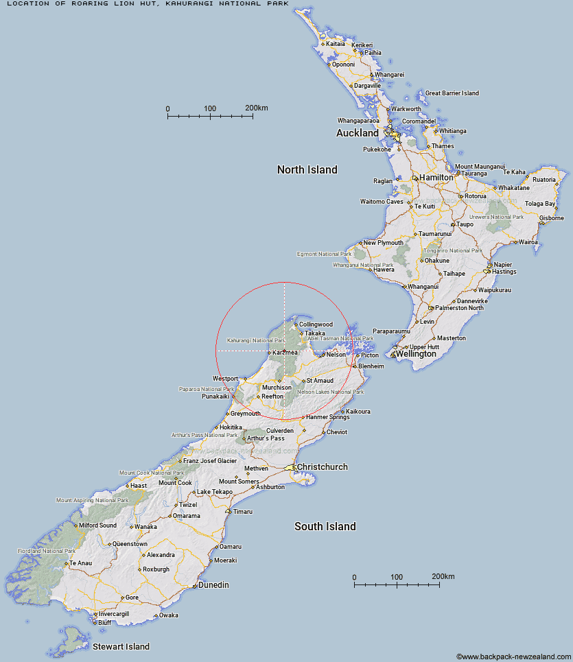
Topo Map showing location of Roaring Lion Hut
This information is sourced from DoC, LINZ and Openstreetmap. Some of the hut photos are mine and the rest are from DoC. I will be adding an upload feature soon so people can photos of .Roaring Lion Hut.
Basic info: basic 5-bunk hut in the Motueka area.
Latitude: -41.1979217272
Longitude: 172.433646408
Location: Kahurangi National Park
Area: Nelson/Tasman
Type of Hut: Basic/bivvies
Map: BQ23 Topo Map | Road Map
Does this hut still exist? Have any more information? Contact
Basic info: basic 5-bunk hut in the Motueka area.
Latitude: -41.1979217272
Longitude: 172.433646408
Location: Kahurangi National Park
Area: Nelson/Tasman
Type of Hut: Basic/bivvies
Map: BQ23 Topo Map | Road Map
Does this hut still exist? Have any more information? Contact
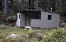
Image: DoC
Scroll down to see a topographical map and road map showing the location of Roaring Lion Hut
[ A ] [ B ] [ C ] [ D ] [ E ] [ F ] [ G ] [ H ] [ I ] [ J ] [ K ] [ L ] [ M ] [ N ] [ O ] [ P ] [ Q ] [ R ] [ S ] [ T ] [ U ] [ V ] [ W ] [ Y ] [ Z ]
Closest 20 Huts to Roaring Lion Hut
These are as the crow fliesKaramea Bend Hut 7.56km Crow Hut 11.02km Venus Hut 13.24km Greys Hut 13.98km Splugeons Rock Shelter 14.66km Flanagans Hut 15.52km Balloon Hut 16.12km Chaffey Hut 16.22km Trilobite Hut 16.51km Tent Camp 17km Myttons Hut 17.19km Thor Hut 17.24km Cobb Hut 17.55km Fenella Hut 18.19km Kākāpō Hut 18.49km Adams Flat Hut 18.49km Dry Rock Shelter 19.09km Sunshine Flat Shelter 19.69km Sylvester Hut 20.38km Growler Rock Shelter 20.48km Ellis Hut 21.55km Upper Gridiron Hut and Rock Shelters 22.22km Trevor Carter Hut 22.55km Asbestos Cottage 22.91km Belltown Manunui Hut 23.57km Mt Arthur Hut 23.6km Kiwi Saddle Hut 23.8km Wangapeka Bivouac 24.09km Taipo Hut 24.39km John Reid Hut 24.69km Stone Hut 24.77km Flora Hut 24.86km Stag Flat Shelter 24.91km Helicopter Flat Hut 25km Soper Shelter 25.32km Lonely Lake Hut 26.11km Waingaro Forks Hut 26.33km Kohaihai Shelter 29.39km Adelaide Tarn Hut 29.84km Kings Creek Hut 30.01km