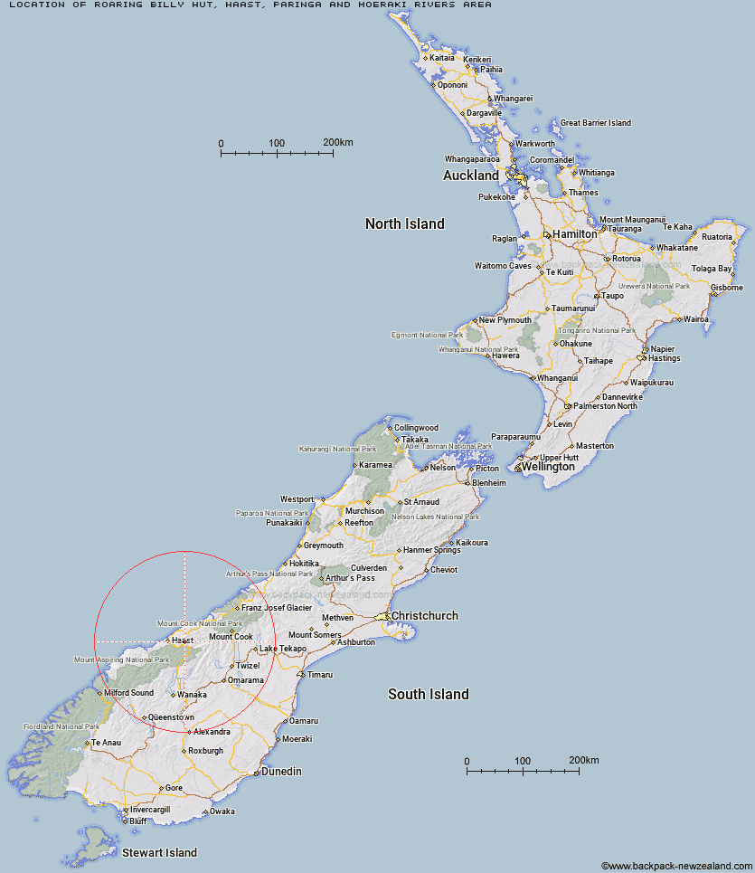
Topo Map showing location of Roaring Billy Hut
This information is sourced from DoC, LINZ and Openstreetmap. Some of the hut photos are mine and the rest are from DoC. I will be adding an upload feature soon so people can photos of .Roaring Billy Hut.
Basic info: basic six-bunk hut in the South Westland area.
Latitude: -43.8953240663
Longitude: 169.322988124
Location: Haast, Paringa and Moeraki rivers area
Area: West Coast
Type of Hut: Basic/bivvies
Map: By13 Topo Map | Road Map
Does this hut still exist? Have any more information? Contact
Basic info: basic six-bunk hut in the South Westland area.
Latitude: -43.8953240663
Longitude: 169.322988124
Location: Haast, Paringa and Moeraki rivers area
Area: West Coast
Type of Hut: Basic/bivvies
Map: By13 Topo Map | Road Map
Does this hut still exist? Have any more information? Contact
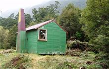
Image: DoC
Scroll down to see a topographical map and road map showing the location of Roaring Billy Hut
[ A ] [ B ] [ C ] [ D ] [ E ] [ F ] [ G ] [ H ] [ I ] [ J ] [ K ] [ L ] [ M ] [ N ] [ O ] [ P ] [ Q ] [ R ] [ S ] [ T ] [ U ] [ V ] [ W ] [ Y ] [ Z ]
Closest 20 Huts to Roaring Billy Hut
These are as the crow fliesMaori Saddle Hut 9.83km Thomas River Hut 10.25km Blue River (Blowfly) Hut 11.56km Horseshoe Flat Hut 12.02km Middle Head Hut 13.24km Coppermine Creek Hut 14.87km Tunnel Creek Hut 19.17km Wills Hut 19.41km Brewster Hut 22.56km Franklin Hut 23.54km Red Hut 27.41km Makarora Hut 27.66km Forbes Hut 29.24km Creswicke Flat Hut 29.48km Ferguson Hut 30.86km Brodrick Hut 33.68km Cameron Hut 33.78km Bull Flat Hut 33.89km Scrubby Hut 34.98km Main Huxley Forks Hut 35.91km Young Hut 36.22km Top Hut 37.21km South Huxley Bivouac 37.48km Hagens Hut 38.44km Boundary Hut 40.09km Siberia Hut 40.25km Little Boundary Hut 40.76km Elcho Hut 40.83km Cullers Hut 41.24km Monument Hut 41.67km Green Bush Hut 41.93km Shamrock Hut 42.14km Dasler Bivouac 42.43km Red Hut 42.48km South Temple Hut 43.25km Dodger Hut 44.56km Kerin Forks Hut 44.59km Big Hopwood Burn Hut 45.3km High Burn Hut 45.72km Top Dingle Hut 46.71km