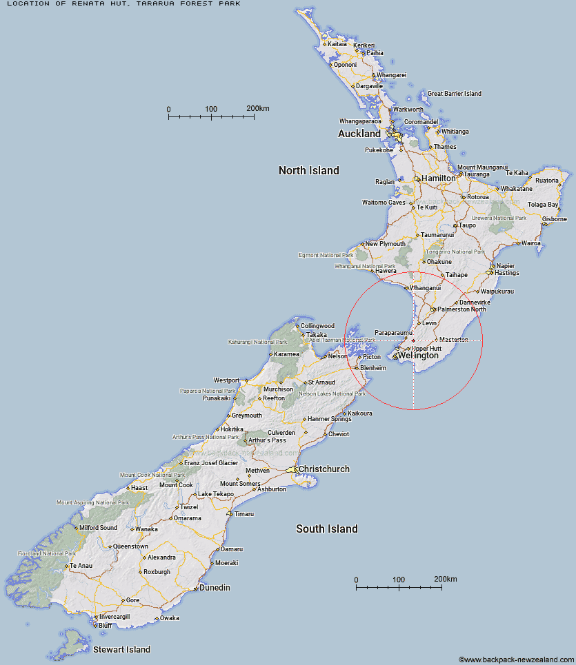
Topo Map showing location of Renata Hut
This information is sourced from DoC, LINZ and Openstreetmap. Some of the hut photos are mine and the rest are from DoC. I will be adding an upload feature soon so people can photos of .Renata Hut.
Basic info: basic six-bunk hut in the Kapiti region.
Latitude: -40.9683156252
Longitude: 175.172608579
Location: Tararua Forest Park
Area: Wellington/Kapiti
Type of Hut: Basic/bivvies
Map: BP33 Topo Map | Road Map
Does this hut still exist? Have any more information? Contact
Basic info: basic six-bunk hut in the Kapiti region.
Latitude: -40.9683156252
Longitude: 175.172608579
Location: Tararua Forest Park
Area: Wellington/Kapiti
Type of Hut: Basic/bivvies
Map: BP33 Topo Map | Road Map
Does this hut still exist? Have any more information? Contact
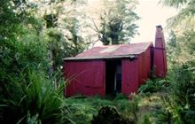
Image: DoC
Scroll down to see a topographical map and road map showing the location of Renata Hut
[ A ] [ B ] [ C ] [ D ] [ E ] [ F ] [ G ] [ H ] [ I ] [ J ] [ K ] [ L ] [ M ] [ N ] [ O ] [ P ] [ Q ] [ R ] [ S ] [ T ] [ U ] [ V ] [ W ] [ Y ] [ Z ]
Closest 20 Huts to Renata Hut
These are as the crow fliesWaiotauru Hut 3.42km Elder Hut 5.04km Kapakapanui Hut 5.89km Kime Hut 8.79km Eastern Hutt Hut 9.11km Alpha Hut 9.38km Field Hut 9.73km Penn Creek Hut 12.1km Smith Creek Shelter 13.01km Tutuwai Hut 13.62km Cone Hut 14.61km Maungahuka Hut 14.92km Neill Forks Hut 15.91km Aokaparangi Hut 17.92km Sayer Hut 18.76km Waiohine Shelter 18.86km Waitewaewae Hut 18.96km Totara Flats Hut 19.76km Mid Waiohine Hut 20.45km Anderson Memorial Hut 20.52km Powell Hut 23.08km Mountain House Shelter 23.25km Nichols Hut 24.52km McGregor Bivouac 25.07km Jumbo Hut 25.78km Atiwhakatu Hut 26.14km Carkeek Hut 27.31km Dorset Ridge Hut 27.58km Mid King Bivouac 27.98km Waikawa Shelter 28.22km Dracophyllum Hut 28.64km Tarn Ridge Hut 29.66km Mitre Flats Hut 29.95km Waiopehu Hut 31.05km Te Matawai Hut 31.94km Waiorongomai Hut 32.53km Arete Forks Hut 32.81km Arete Hut 33.04km South Ohau Hut 33.3km Cow Creek Hut 34.21km