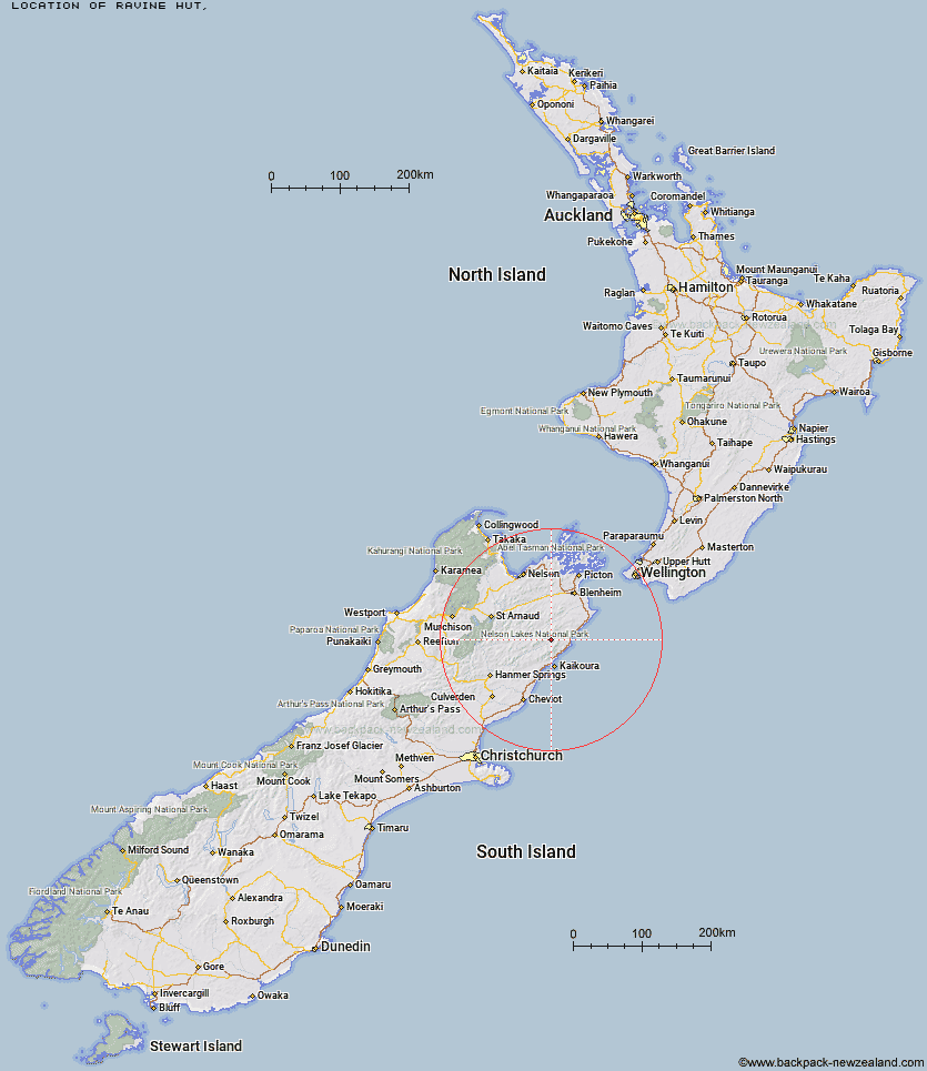
Topo Map showing location of Ravine Hut
This information is sourced from DoC, LINZ and Openstreetmap. Some of the hut photos are mine and the rest are from DoC. I will be adding an upload feature soon so people can photos of .Ravine Hut.
Latitude: -42.0803953138
Longitude: 173.650160036
Location:
Type of Hut:
Map: Topo Map | Road Map
Does this hut still exist? Have any more information? Contact
Latitude: -42.0803953138
Longitude: 173.650160036
Location:
Type of Hut:
Map: Topo Map | Road Map
Does this hut still exist? Have any more information? Contact
Scroll down to see a topographical map and road map showing the location of Ravine Hut
[ A ] [ B ] [ C ] [ D ] [ E ] [ F ] [ G ] [ H ] [ I ] [ J ] [ K ] [ L ] [ M ] [ N ] [ O ] [ P ] [ Q ] [ R ] [ S ] [ T ] [ U ] [ V ] [ W ] [ Y ] [ Z ]
Closest 20 Huts to Ravine Hut
These are as the crow fliesJam Hut 5.62km Haycocks Bivouac 6.17km Snowgrass Hut 8km Hornby Bivvy 8.15km Fidgit Bivouac 10.84km Goose Flat Hut 11.35km Dee Hut 12.16km Gibson Hut 15.69km Old Middlehurst Hut 16.36km Dubious Bivouac 16.81km Mead Hut 17.69km Barratts Bivouac 18.23km Barratts Hut 18.35km Cabbage Tree Hut 18.96km Cam Hut 19.58km Hapuku Hut 21.37km Limestone Hut 21.44km Flynns 22.88km Swale Hut 24.46km Kowhai Hut 24.66km Beechs Hut 25.29km Seymour Hut 26.03km Whernside Hut 27.23km Mt Fyffe Hut 27.49km Warden Hut 28.11km Black Spur Historic Hut 28.53km Zoo Hut 28.81km Tent Poles Hut 29.16km Lake McRae Hut 30.2km Burnt Yards Hut 31.68km Top Whare 32.04km Penk Hut 32.75km Kahutara Bivouac 33.5km Munroe Hut 33.6km Isolation Hut 34.22km Blue Mountain Hut 36.23km Lake Alexander Hut 36.82km Alfred Hut 36.83km Junction Hut 37.16km Carters Yards Hut 37.78km