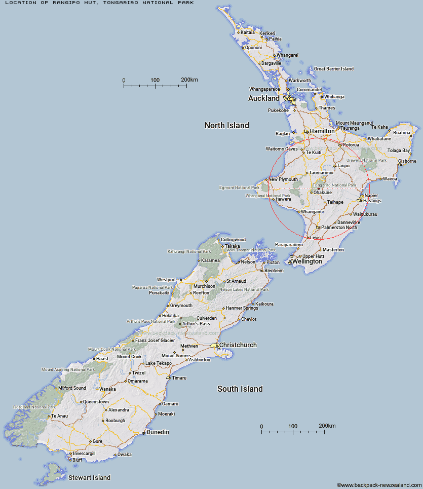
Topo Map showing location of Rangipo Hut
This information is sourced from DoC, LINZ and Openstreetmap. Some of the hut photos are mine and the rest are from DoC. I will be adding an upload feature soon so people can photos of .Rangipo Hut.
Basic info: serviced 20-bunk hut in the Turangi/Taupo area.
Latitude: -39.3000923541
Longitude: 175.623844678
Location: Tongariro National Park
Area: Central North Island
Type of Hut: Serviced
Tracks: Round the Mountain Track
Map: BJ34 Topo Map | Road Map
Does this hut still exist? Have any more information? Contact
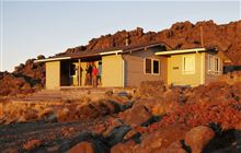
Image: DoC
Scroll down to see a topographical map and road map showing the location of Rangipo Hut
[ A ] [ B ] [ C ] [ D ] [ E ] [ F ] [ G ] [ H ] [ I ] [ J ] [ K ] [ L ] [ M ] [ N ] [ O ] [ P ] [ Q ] [ R ] [ S ] [ T ] [ U ] [ V ] [ W ] [ Y ] [ Z ]
Closest 20 Huts to Rangipo Hut
These are as the crow fliesWhangaehu Hut 3.61km Mangaehuehu Hut 7.95km Blyth Hut 9.2km Lupton Hut 9.47km Mangaturuturu Hut 10.51km Old Waihohonu Hut 10.93km Waihohonu Hut 11.17km Whakapapaiti Hut 11.48km Oturere Hut 16.7km Mangatepopo Hut 17.44km Ketetahi Shelter 21.51km Westlawn Hut 26.21km Zekes Hut 28.77km Bob's Hut 31.72km Waipakihi Hut 34.84km Ten Man Hut 34.98km Te Apunga Hut 40.05km Golden Hills Hut 46.73km WTFRW Hut 47.52km Cascade Hut 50.03km Otutu Island Hut 50.89km Cedars Hut (Blowfly) 51.75km Otutu Hut 52.51km Rock Camp Bivouac 52.67km Tussock Hut 53.09km Harkness Hut 54.25km Ngaawapurua Hut 54.32km Tieke Kainga 54.41km Manson Hut 54.74km Old Manson Hut 54.99km Puketotara Hut 55.95km Kiwi Mouth Hut 56.48km Makirikiri Hut 56.58km Manson Bivouac 57.2km Ohuraiti Hut 57.35km Te Puke (Te Pukeohikarua) Hut 57.44km Omarukokere Bivouac 57.77km Rocks Ahead Bivouac 57.85km Cameron Hut 57.88km Rocks Ahead Hut 57.97km