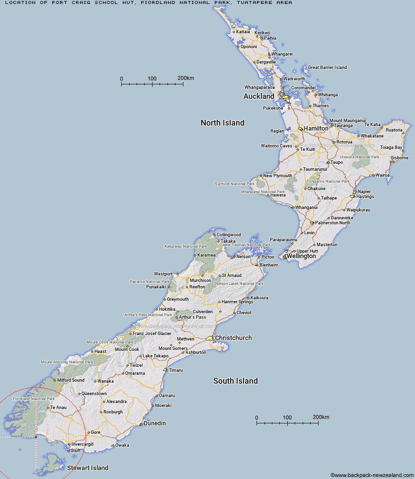
Topo Map showing location of Port Craig School Hut
This information is sourced from DoC, LINZ and Openstreetmap. Some of the hut photos are mine and the rest are from DoC. I will be adding an upload feature soon so people can photos of .Port Craig School Hut.
Basic info: serviced 20-bunk hut in southern Fiordland.
Latitude: -46.2225754911
Longitude: 167.361440117
Location: Fiordland National Park, Tuatapere area
Area: Fiordland
Type of Hut: Serviced
Tracks: South Coast Track
Map: CG07 Topo Map | Road Map
Does this hut still exist? Have any more information? Contact
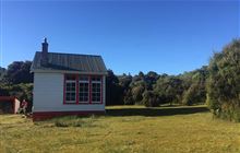
Image: DoC
Scroll down to see a topographical map and road map showing the location of Port Craig School Hut
[ A ] [ B ] [ C ] [ D ] [ E ] [ F ] [ G ] [ H ] [ I ] [ J ] [ K ] [ L ] [ M ] [ N ] [ O ] [ P ] [ Q ] [ R ] [ S ] [ T ] [ U ] [ V ] [ W ] [ Y ] [ Z ]
Closest 20 Huts to Port Craig School Hut
These are as the crow fliesPort Craig Lodge 0.08km Percy Burn Hut 4.81km Okaka Lodge 8.08km Wairaurahiri Hut 11.62km Teal Bay Hut 18.09km Lake Poteriteri Hut 20.28km Slaughterburn Hut 22.97km Waitutu Hut 23km Westies Hut 31km Caroline Hut 31.85km Eel Creek Hut 37.85km Turnbull's (Big Dam) Hut 38.52km Martin's Hut 38.62km Rodger Inlet Huts 41.08km Monowai Hut 43.18km Hauroko Burn Hut 46.66km Clark Hut - A Frame 47.89km Green Lake Hut 48.69km Historic Clark Hut 48.82km Borland Bivouac 53.67km Halfway Hut 54.15km Te Oneroa Hut 54.21km Barcoo Hut 55.73km Rock Hut 59.01km Lake Roe Hut 60.12km North Borland Hut 60.45km Long Harry Hut 62.61km East Ruggedy Hut 63.01km Loch Maree Hut 64.01km Telford Hut 64.31km Smoky Hunters Hut 64.55km Yankee River Hut 66.21km Supper Cove Hut 66.23km Redcliff Hut 66.39km Lower Wairaki Hut 66.55km Upper Wairaki Hut 67.85km Spence Hut 70.04km Kintail Hut 70.22km Percy Shelter 70.49km Back Valley Hut 71.24km