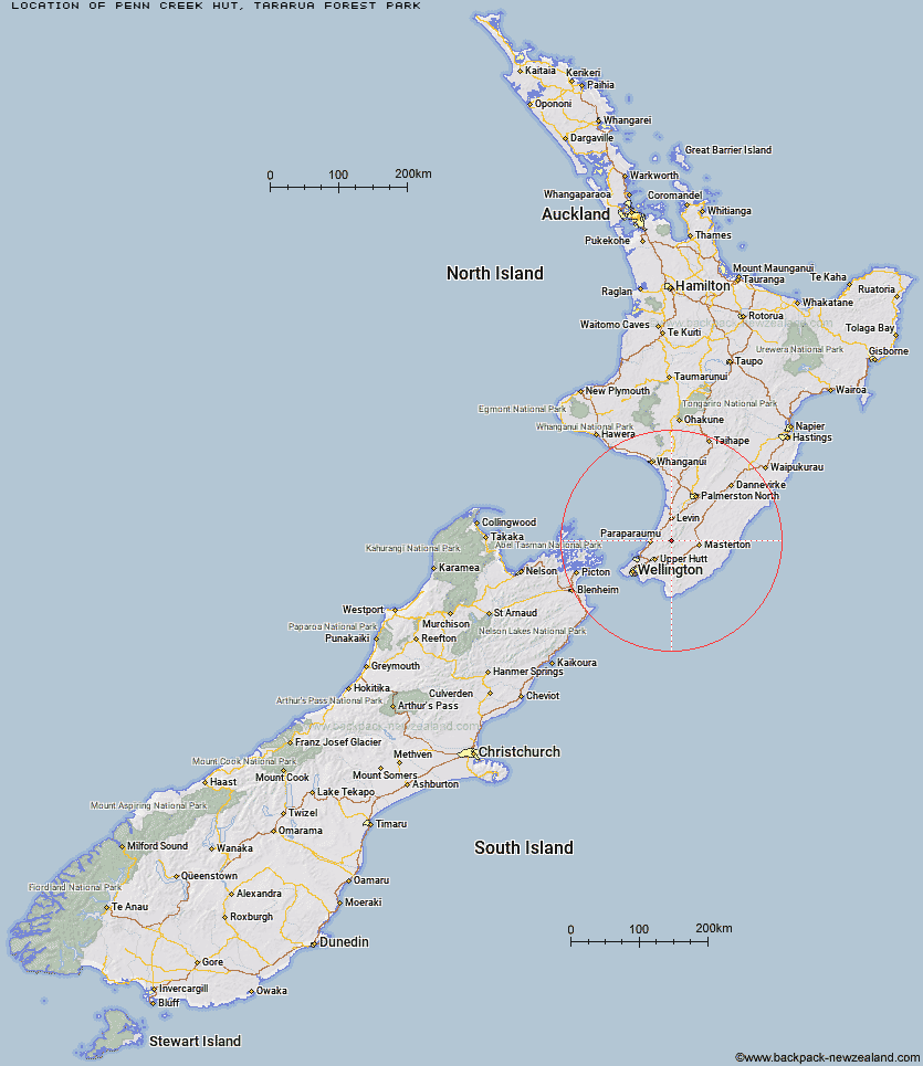
Topo Map showing location of Penn Creek Hut
This information is sourced from DoC, LINZ and Openstreetmap. Some of the hut photos are mine and the rest are from DoC. I will be adding an upload feature soon so people can photos of .Penn Creek Hut.
Basic info: standard six-bunk hut in the Kapiti region.
Latitude: -40.9015556346
Longitude: 175.286381551
Location: Tararua Forest Park
Area: Wellington/Kapiti
Type of Hut: Standard
Map: BP33 Topo Map | Road Map
Does this hut still exist? Have any more information? Contact
Basic info: standard six-bunk hut in the Kapiti region.
Latitude: -40.9015556346
Longitude: 175.286381551
Location: Tararua Forest Park
Area: Wellington/Kapiti
Type of Hut: Standard
Map: BP33 Topo Map | Road Map
Does this hut still exist? Have any more information? Contact
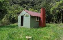
Image: DoC
Scroll down to see a topographical map and road map showing the location of Penn Creek Hut
[ A ] [ B ] [ C ] [ D ] [ E ] [ F ] [ G ] [ H ] [ I ] [ J ] [ K ] [ L ] [ M ] [ N ] [ O ] [ P ] [ Q ] [ R ] [ S ] [ T ] [ U ] [ V ] [ W ] [ Y ] [ Z ]
Closest 20 Huts to Penn Creek Hut
These are as the crow fliesField Hut 2.63km Maungahuka Hut 4.17km Kime Hut 4.75km Aokaparangi Hut 6.31km Neill Forks Hut 6.8km Waitewaewae Hut 8.02km Anderson Memorial Hut 8.47km Mid Waiohine Hut 8.57km Elder Hut 9.04km Alpha Hut 9.37km Waiotauru Hut 9.47km Sayer Hut 10.34km Totara Flats Hut 10.4km Cone Hut 10.72km Kapakapanui Hut 11.13km Powell Hut 11.73km Renata Hut 12.1km Mountain House Shelter 12.23km Tutuwai Hut 12.5km Nichols Hut 12.64km Eastern Hutt Hut 12.89km McGregor Bivouac 12.97km Jumbo Hut 13.93km Atiwhakatu Hut 14.58km Waiohine Shelter 14.71km Carkeek Hut 15.45km Dorset Ridge Hut 15.5km Mid King Bivouac 15.92km Smith Creek Shelter 16.99km Dracophyllum Hut 17.04km Tarn Ridge Hut 17.61km Mitre Flats Hut 18km Waikawa Shelter 20.36km Waiopehu Hut 20.37km Te Matawai Hut 20.54km Arete Forks Hut 20.8km Arete Hut 21.22km Cow Creek Hut 22.11km South Ohau Hut 22.19km Blue Range Hut 22.95km