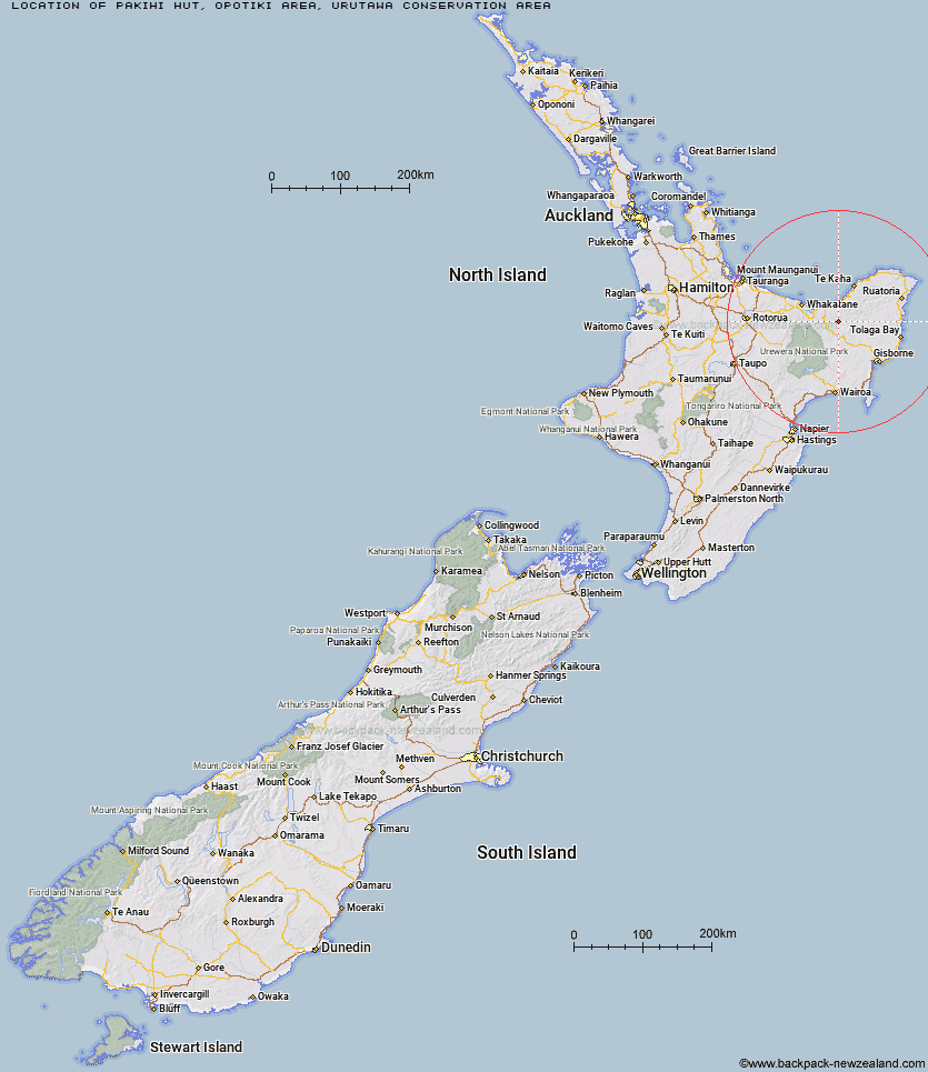
Topo Map showing location of Pakihi Hut
This information is sourced from DoC, LINZ and Openstreetmap. Some of the hut photos are mine and the rest are from DoC. I will be adding an upload feature soon so people can photos of .Pakihi Hut.
Basic info: Stay in the heart of Barry Crump country in this classic backcountry hut.
Latitude: -38.1701716805
Longitude: 177.467583371
Location: Opotiki area, Urutawa Conservation Area
Area: East Coast
Type of Hut: Standard
Tracks: Pakihi Track
Map: BF41 Topo Map | Road Map
Does this hut still exist? Have any more information? Contact
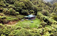
Image: DoC
Scroll down to see a topographical map and road map showing the location of Pakihi Hut
[ A ] [ B ] [ C ] [ D ] [ E ] [ F ] [ G ] [ H ] [ I ] [ J ] [ K ] [ L ] [ M ] [ N ] [ O ] [ P ] [ Q ] [ R ] [ S ] [ T ] [ U ] [ V ] [ W ] [ Y ] [ Z ]
Closest 20 Huts to Pakihi Hut
These are as the crow fliesWahaatua Hut 5.1km Te Waiti Hut 5.65km Pakihi Heads Hut 6.74km Lagoon Hut 9.16km Hastings Hut 9.58km Savlon Hut 9.65km Tokenui Hut 9.9km Manganuku Hut 11.65km Brills Bivouac 12.08km Kotepato Hut 21.93km Mangakirikiri Hut 25.38km Nikau Flat Hut 25.76km Mangaotane Hut (McMillans) 27.98km Koranga Forks Hut 29.74km Koaunui Hut 31.61km Tawa Hut 34.34km Otapukawa Hut 37.2km Kahunui Hut 38.23km Tataweka Hut 38.65km Wharekahika Hut 38.83km Onepu Hut 39.03km Makakoere Hut 39.21km Otane Hut 39.89km Te Pourewa Hut 41.92km Ohora Hut 42.41km Te Pua Hut 43.99km Te Rangaakapua Hut 45.29km Te Panaa Hut 45.44km Apiti Hut 45.6km Ohane Hut 45.66km Twain (Waipotiki) Hut 46.06km Waikare Junction Hut 47.42km Saddle (Mangaawai) Hut 47.54km Mangatoatoa Hut 47.61km Makomako Hut 50.31km Taurawharona Hut 50.54km Otanetea Hut 50.73km Casino Hut 51.36km Waihua Hut 51.98km Hanamahihi Hut 52.95km