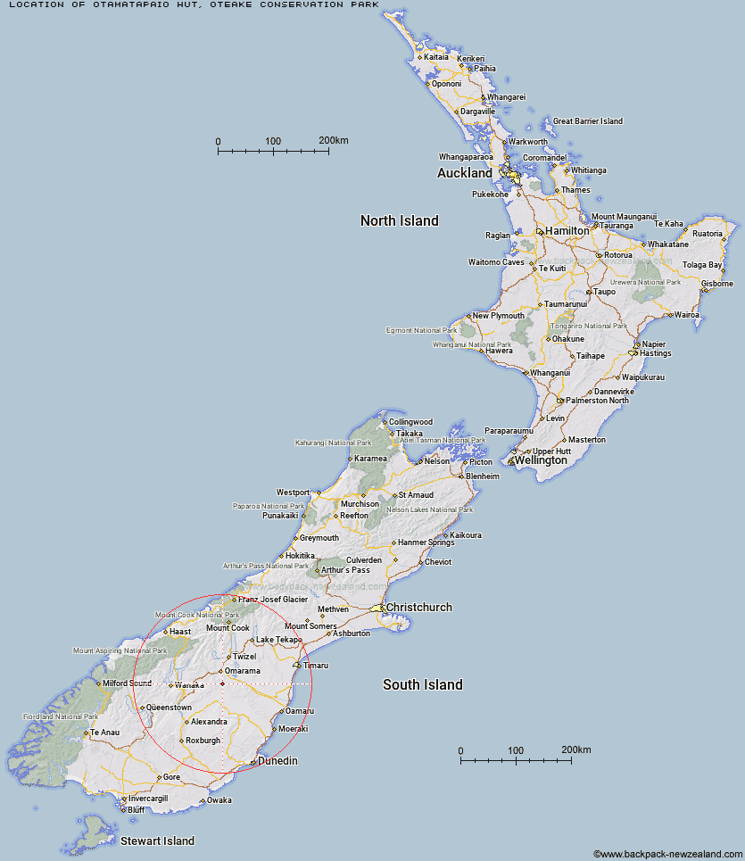
Topo Map showing location of Otamatapaio Hut
This information is sourced from DoC, LINZ and Openstreetmap. Some of the hut photos are mine and the rest are from DoC. I will be adding an upload feature soon so people can photos of .Otamatapaio Hut.
Basic info: standard four-bunk hut in the Mackenzie Country and Waitaki area.
Latitude: -44.6730903138
Longitude: 169.989552467
Location: Oteake Conservation Park
Area: Canterbury
Type of Hut: Standard
Tracks: Oteake Conservation Park tramping tracks
Map: CA15 Topo Map | Road Map
Does this hut still exist? Have any more information? Contact
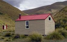
Image: DoC
Scroll down to see a topographical map and road map showing the location of Otamatapaio Hut
[ A ] [ B ] [ C ] [ D ] [ E ] [ F ] [ G ] [ H ] [ I ] [ J ] [ K ] [ L ] [ M ] [ N ] [ O ] [ P ] [ Q ] [ R ] [ S ] [ T ] [ U ] [ V ] [ W ] [ Y ] [ Z ]
Closest 20 Huts to Otamatapaio Hut
These are as the crow fliesBoundary Creek Hut 12.31km Top Hut 14.33km Wire Yards Hut 22.05km Chimney Creek Hut 22.35km Ida Railway Hut 23.56km Richmond Hut 26.74km Awakino Ski Field 27.79km Tailings Hut 28.44km Hut Creek Hut 29.02km Polson's Hut 30.47km Lauder Basin Hut 32.32km Brown Hut 32.34km Buster Hut 35.12km Pearson Hut 35.64km Burnt Bush Hut 39.73km Hideaway Hut 43.85km Top Timaru Hut 44.75km Stodys Hut 46.14km Mae West Bivouac 48.06km Snowy Gorge Hut 49.17km Moonlight & Roses Hut 50.75km Cotters Hut 50.95km Bush Hut 51.1km Pakituhi Hut 51.12km Junction Hut 51.94km Ben Avon Hut 51.98km Ahuriri Base Hut 54.29km Maitland Hut 54.4km Top Dingle Hut 55.56km Balmoral Huts 58.09km Shamrock Hut 59.44km Crumb Hut 59.51km High Burn Hut 61.04km Green Bush Hut 61.86km Middle Hut 62km South Temple Hut 62.96km Baikie Hut 63.12km Little Boundary Hut 63.18km Boundary Hut 63.51km Hagens Hut 63.92km