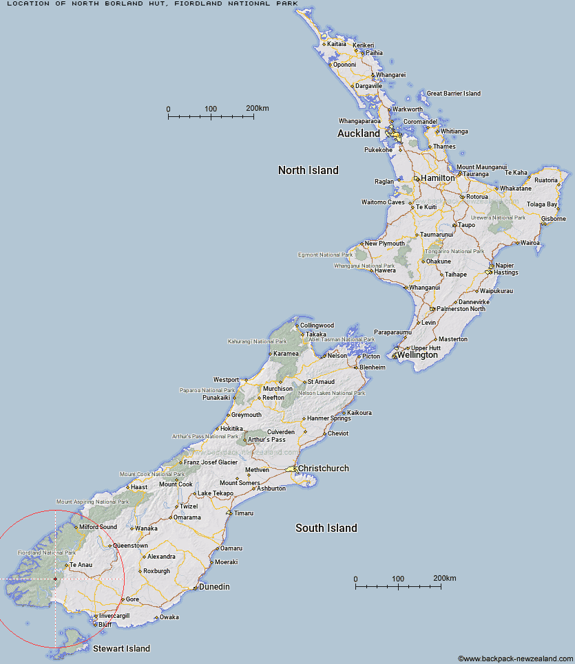
Topo Map showing location of North Borland Hut
This information is sourced from DoC, LINZ and Openstreetmap. Some of the hut photos are mine and the rest are from DoC. I will be adding an upload feature soon so people can photos of .North Borland Hut.
Basic info: basic two-bunk hut in southern Fiordland.
Latitude: -45.6858883174
Longitude: 167.486107604
Location: Fiordland National Park
Area: Fiordland
Type of Hut: Basic/bivvies
Map: Topo Map | Road Map
Does this hut still exist? Have any more information? Contact
Basic info: basic two-bunk hut in southern Fiordland.
Latitude: -45.6858883174
Longitude: 167.486107604
Location: Fiordland National Park
Area: Fiordland
Type of Hut: Basic/bivvies
Map: Topo Map | Road Map
Does this hut still exist? Have any more information? Contact
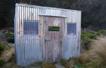
Image: DoC
Scroll down to see a topographical map and road map showing the location of North Borland Hut
[ A ] [ B ] [ C ] [ D ] [ E ] [ F ] [ G ] [ H ] [ I ] [ J ] [ K ] [ L ] [ M ] [ N ] [ O ] [ P ] [ Q ] [ R ] [ S ] [ T ] [ U ] [ V ] [ W ] [ Y ] [ Z ]
Closest 20 Huts to North Borland Hut
These are as the crow fliesBorland Bivouac 10.74km Hope Arm Hut 11.51km Back Valley Hut 12.05km Green Lake Hut 12.94km Percy Shelter 16.59km Clark Hut - A Frame 16.86km Historic Clark Hut 17.01km Rodger Inlet Huts 19.37km Monowai Hut 19.62km Shallow Bay Hut 23.56km Eel Creek Hut 23.87km Cheviot Downs Hut 24.03km Moturau Hut 24.68km West Arm Hut 24.87km Whare Creek Hut 26.5km Lake Roe Hut 26.67km Redcliff Hut 26.76km Upper Spey Hut 27.71km Halfway Hut 27.87km Freeman Burn Hut 28.49km Telford Hut 28.9km Kintail Hut 29.85km Spence Hut 30.58km Hauroko Burn Hut 30.94km Upper Wairaki Hut 31.78km Iris Burn Hut 31.95km Caroline Hut 32.46km Loch Maree Hut 32.66km Forest Burn Shelter 33.63km Hanging Valley Shelter 33.92km Upper Princhester Hut 33.99km Aparima Forks Hut 34.52km Brod Bay Shelter and Campsite 34.54km Barcoo Hut 34.63km Luxmore Hut 35km Rock Hut 35.36km Lower Wairaki Hut 36.79km Lower Princhester Hut 37.61km Aparima Huts 39.92km Becketts Hut 40.3km